Powered by WUFT
Temporarily change filter
Finding your station


The strongest cold front yet this season could produce a round or two of strong thunderstorms ahead of it in the Florida Panhandle Sunday Night, then across parts of North Florida Monday.
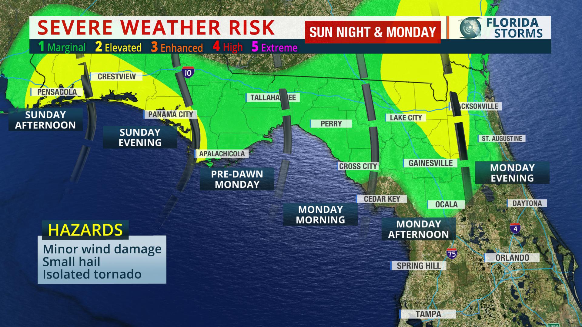
The strongest storms might produce damaging wind gusts to 60 mph, small hail, and even an isolated tornado. Chances of this occurring are highest along the Gulf Coast from Pensacola to Panama City Sunday Night and early Monday morning. A second, but potentially equally as strong round of thunderstorm activity is expected to develop and move along the I-10 corridor roughly from Lake City to Jacksonville Monday afternoon. The strong storms may extend as far south as Gainesville and Ocala by early Monday evening.
As the front sweeps across the rest of the peninsula, the intensity and coverage of the thunderstorm activity is likely to diminish. However, gusty winds and a few showers may ride along the front all the way to South Florida during the day Tuesday.
This week’s front will usher in the coldest air mass experienced by most Floridians since April. It will also by a remarkably drier air mass, signaling the end to the 2017 rainy season for the entire state.
1885 Stadium Road
PO Box 118405
Gainesville, FL 32611
(352) 392-5551
A service of WUFT at the University of Florida College of Journalism and Communications


Partners of the Florida Public Radio Emergency Network include: Florida's Division of Emergency Management, WDNA (Miami), WFIT (Melbourne), WMFE (Orlando), WFSU (Tallahassee), WGCU (Fort Myers), WJCT (Jacksonville), WKGC (Panama City), WLRN (Miami), WMNF (Tampa-Sarasota), WQCS (Fort Pierce), WUFT (Gainesville-Ocala), WUSF (Tampa), WUWF (Pensacola) and Florida Public Media.
This page uses the Google Privacy Policy and UF's Privacy Policy
