Warmer weather is back, but so too is the chance for rain.
Chance of showers in forecast due to upper level low in Gulf of Mexico for #Florida peninsula. #FLforecast pic.twitter.com/YH1yFP1Bdv
— Florida Storms (@FloridaStorms) January 9, 2018
Moisture is on the move back into the Sunshine State, thanks in large part to an onshore wind from the Atlantic. This
easterly flow is in response to an area of high pressure moving offshore of the Mid-Atlantic states and an area of lower pressure developing in the Gulf of Mexico. The two will work in tandem to keep the moisture around through Friday, when a stronger cold front will be moving through the state.
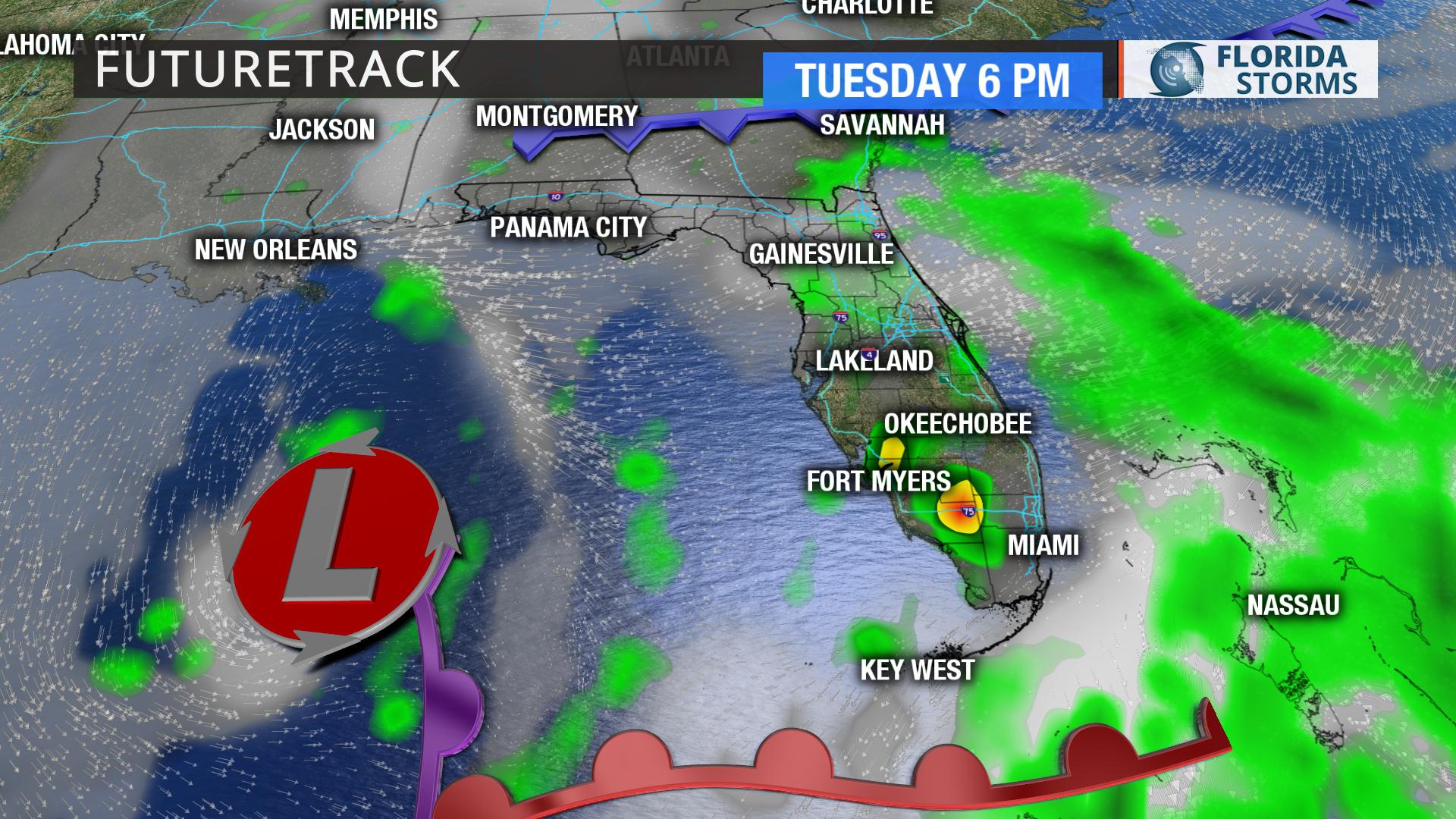
Tuesday: Rain chances will be highest along the panhandle and south Florida during the morning hours, then push into north and north-central Florida that afternoon.
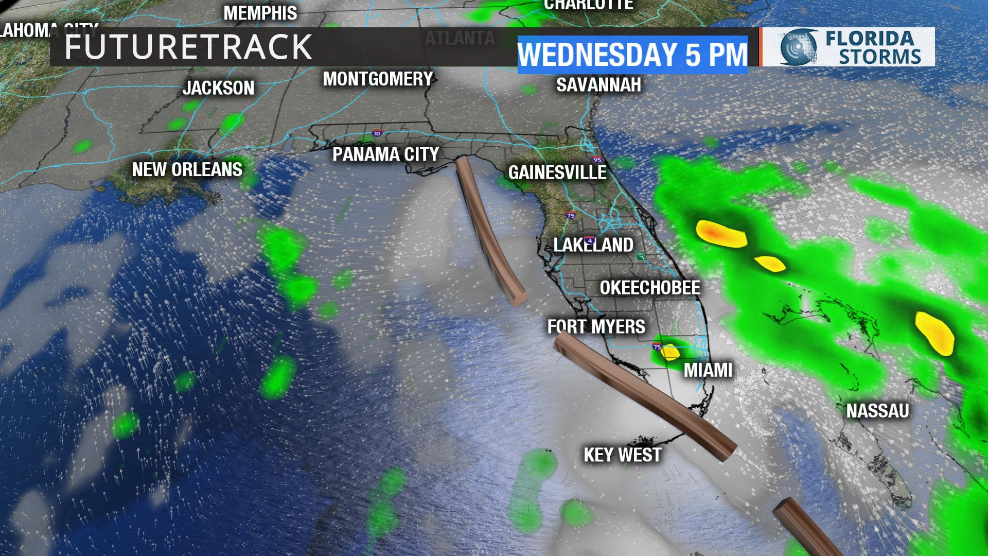
Wednesday: Onshore flow will keep rain chances higher along the Atlantic coast during the day and then showers will develop late in the day from the Big Bend down to Tampa Bay.
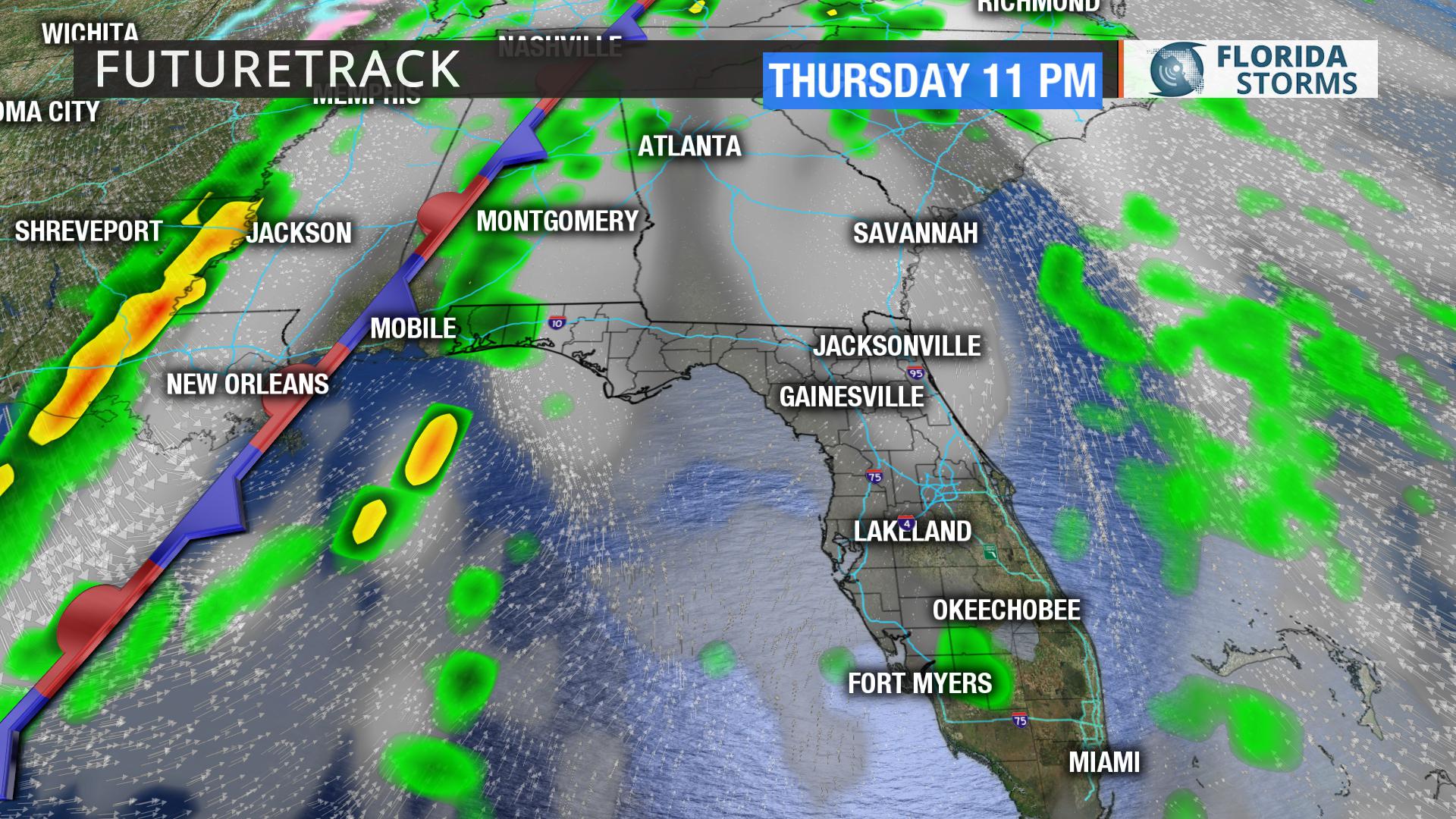
Thursday: A few spotty showers will develop in the onshore flow along the Atlantic coast.
Friday: Rain showers spread from the panhandle ahead of the front to the rest of the state by the afternoon.


