Powered by WUFT
Temporarily change filter
Finding your station


A Severe Thunderstorm Watch is in effect for Central and West Central Florida until 10 p.m. Friday.
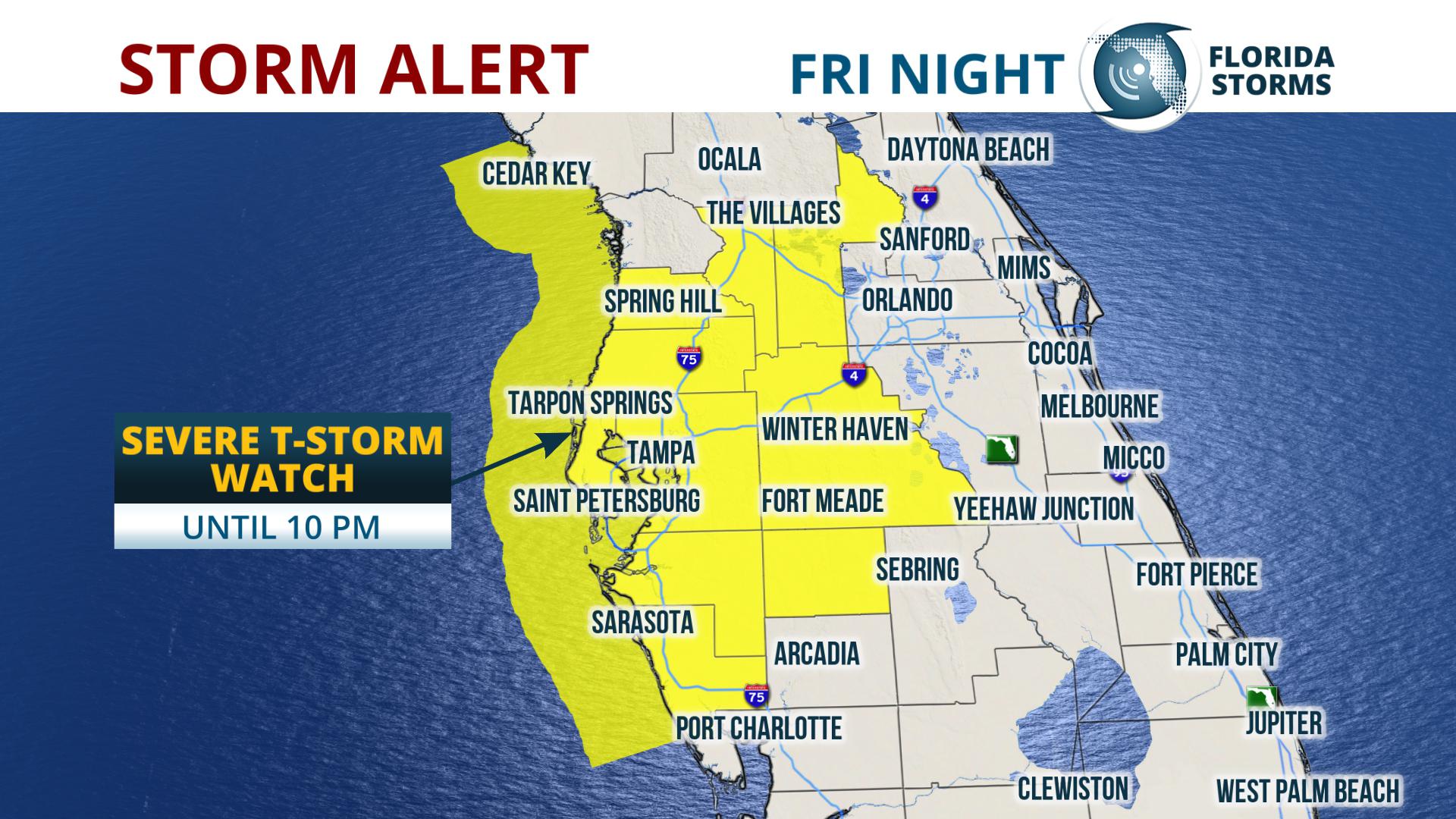
A band of strong storms will continue to push through Florida through this evening. These storms could bring with them a risk for heavy downpours, wind, lightning and even isolated tornadoes.
The biggest threat to most areas will be heavy winds with gusts up to 70 mph. Stronger cells could begin to rotate and produce isolated tornadoes. However, the risk of severe weather to North Central Florida has dropped over the last few hours.
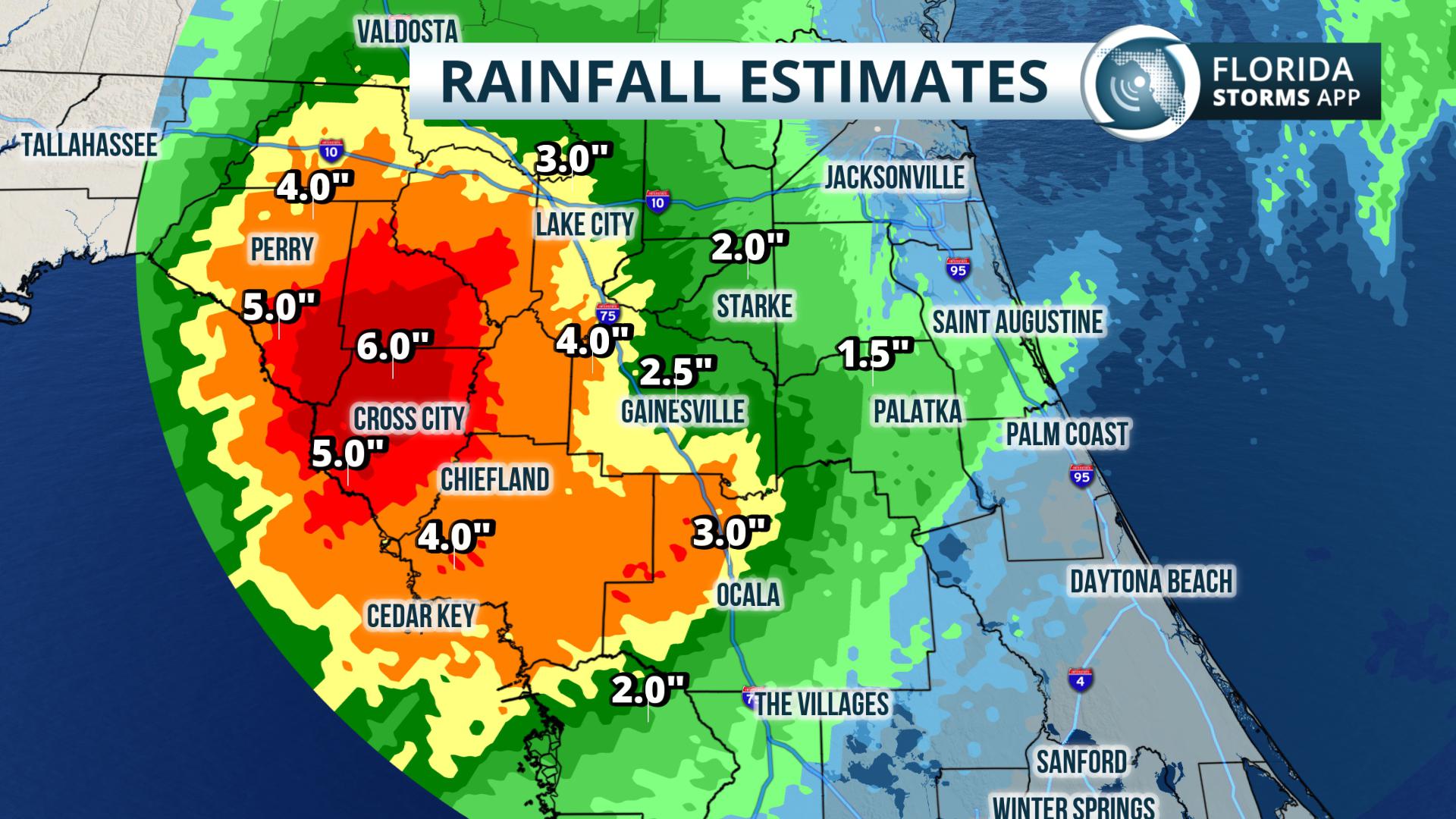
An Areal Flood Watch has been issued for portions of North Florida from Jacksonville to north of Tampa through early Saturday morning. Rainfall totals will be between 2 and 4 inches with isolated areas of 6 to 8 inches. River flooding is possible due to significant amounts of rainfall.
Several rivers are in minor or moderate flood stage, and forecasters at the National Weather Service in Jacksonville and Tallahassee have advised that Friday’s heavy rain will likely produce additional flooding along their banks. Sections of the Nature Coast have already seen 6 inches of rain as of 3 p.m. Friday.
The band of storms will push out of North Florida tonight, but showers will linger behind the front through Saturday morning. Strong storms will move through Tampa Bay tonight between 6 p.m. and and 11 p.m. Orlando could see storms between 10 p.m. and 3 a.m. South Florida will see the chance of thunderstorms after midnight into Saturday morning.
After the storms push through, slightly below average temperatures will return to Florida. The approaching air mass won't be as cool as previous cold fronts this year because air will filter in more so from the West than from the Northwest.
1885 Stadium Road
PO Box 118405
Gainesville, FL 32611
(352) 392-5551
A service of WUFT at the University of Florida College of Journalism and Communications


Partners of the Florida Public Radio Emergency Network include: Florida's Division of Emergency Management, WDNA (Miami), WFIT (Melbourne), WMFE (Orlando), WFSU (Tallahassee), WGCU (Fort Myers), WJCT (Jacksonville), WKGC (Panama City), WLRN (Miami), WMNF (Tampa-Sarasota), WQCS (Fort Pierce), WUFT (Gainesville-Ocala), WUSF (Tampa), WUWF (Pensacola) and Florida Public Media.
This page uses the Google Privacy Policy and UF's Privacy Policy
