The front is forecast to first reach the Florida Panhandle Saturday afternoon, then completely clear the southern tip of the peninsula by Sunday morning.
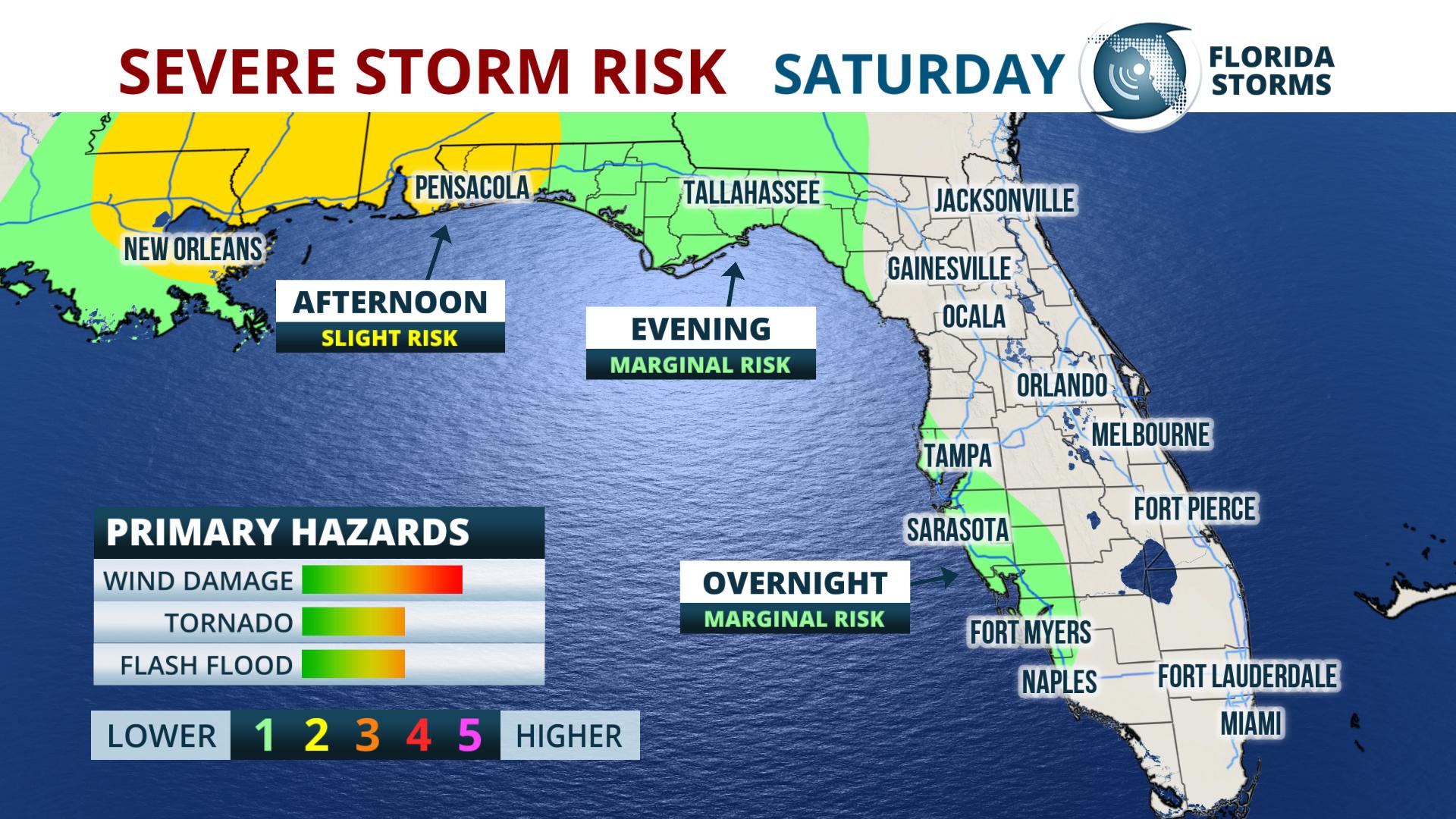
A line of downpours, gusty winds, and even a few thunderstorms, will mark the arrival of the boundary in most areas. Some of them might even be strong enough to produce wind damage or an isolated tornado, thanks to the strong winds aloft associated with this storm system. The greatest threat of severe storms is over the Florida panhandle Saturday afternoon and evening.
[table id=6 /]
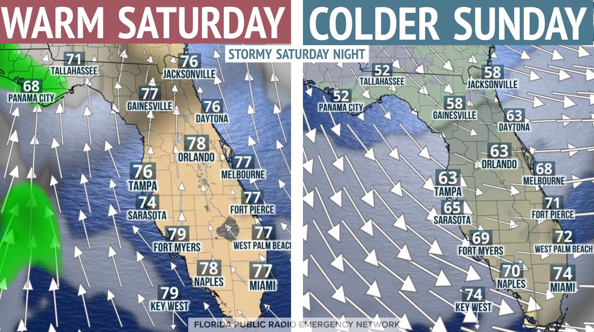
Gusty south to southwest winds ahead of the front will cause temperatures to soar well into the 70s over north Florida and close to 80 degrees for the southern half of the peninsula on Saturday afternoon. After the front clears, the winds will abruptly veer to the northwest, sending much colder air through the state by Sunday. In fact, temperatures are expected to be upwards of 20 degrees colder on Sunday. Afternoon highs will range from the 50’s in areas north of I-4, to the 60s across most of South Florida.


