A line of strong thunderstorms could produce wind damage in a few areas of the Florida Panhandle early Sunday. The activity is then expected to move east and weaken through sections of North Florida by early evening.
The National Weather Service has highlighted areas west of Tallahassee as having a “slight risk” for the severe weather Sunday morning and midday. Locations further east, such as in the Big Bend region and Suwannee River valley, have a marginal risk of severe storms in the afternoon and evening hours Sunday.
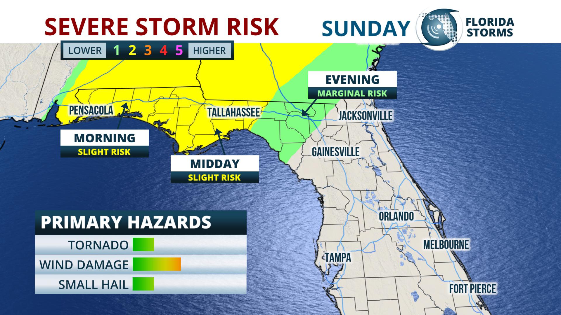
The primary hazard from this thunderstorm event is damaging wind gusts up to 60 mph, although hail and and isolated tornado both can not be ruled out. The storms will most likely congeal into a squall line as they move through the panhandle in the morning and midday hours. The cells will then become a bit more scattered in nature as they approach northeastern sections of Florida.
The severe weather will diminish across the entire state by late Sunday evening, although a line of showers with gusty winds will still be possible as the front presses south across the rest of the peninsula Monday.


