Several more rounds of thunderstorms – some of which could be strong – are expected in Florida this weekend, but it won’t be a complete washout in any given area.
We’ve detailed the timing and potential hazards from the thunderstorms north to south below.
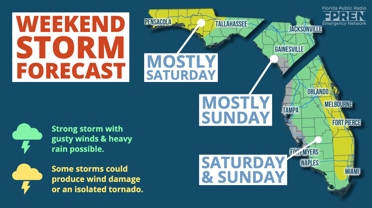
FLORIDA PANHANDLE
A cold front is expected to approach the Florida Panhandle late Saturday afternoon. Thunderstorms ahead of this front could become strong to produce wind damage or an isolated tornado, according to the National Weather Service. Quarter-size hail is also possible with the storms as they move into Escambia, Santa Rosa, and Okaloosa counties between 4 and 8 pm CDT Saturday evening. Showers may continue off and on in these areas through early Sunday, but the severe weather risk will be over.
Further east, from Panama City to Pensacola, the same complex of thunderstorms will be moving in Saturday night. The risk of damaging wind gusts will continue with some of the stronger cells, although they will be more scattered in nature.
NORTH FLORIDA
Most of Saturday will be dry in North Florida, outside of a few stray showers that develop by early evening. Sunday, however, could be quite stormy. Thunderstorms will either be moving into North Florida by the late morning hours, or redeveloping across the region by early afternoon. Confidence is lower than normal on the evolution of Sunday’s activity in this region related to the front. Regardless, any stronger cells that develop will have the ability to produce heavy rain, frequent lightning, and minor wind damage. Chances of showers will decrease through the evening hours, as dry air moves in behind the front.
CENTRAL AND SOUTH FLORIDA
Sea breeze thunderstorms, similar to what is experienced in the summer, are expected Saturday afternoon across most inland areas east of I-75 by late afternoon. They will move toward the I-95 corridor and the Atlantic Coast by early evening, Some of the storms could be locally strong, capable of producing minor wind damage and frequent lightning.
The front that produces thunderstorms further north on Saturday will be weakening as it approaches areas south of I-4 Sunday. Nonetheless, scattered thunderstorms are still likely to develop Sunday during the warmest part of the day, and some of them could yet again be locally strong. The greatest concentration of Sunday storms will be across the eastern half of the peninsula, generally along the Florida Turnpike and I-95 corridors.
Meteorologist Megan Borowski contributed to this story.


