The historic heat wave and developing drought experienced recently across parts of Florida is coming to an abrupt end.
Not only has the state’s rainy season begun, a significant change in the weather pattern across the Southeast will lead to unusually high rain chances, longer lasting periods of rain, and downpours that could occur at any time of day. This is most likely to occur across the northern third of Florida Friday through Tuesday.
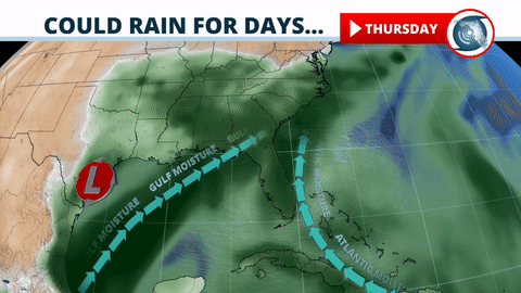
The strong ridge of high pressure that supplied the abnormally hot, dry weather is breaking down. Replacing it will be a slow-moving area of low pressure that is on track to reach the eastern Gulf of Mexico this weekend. A deep feed of tropical moisture ahead of the system will create an environment that’s favorable for repeating rounds of showers and thunderstorms across the state.
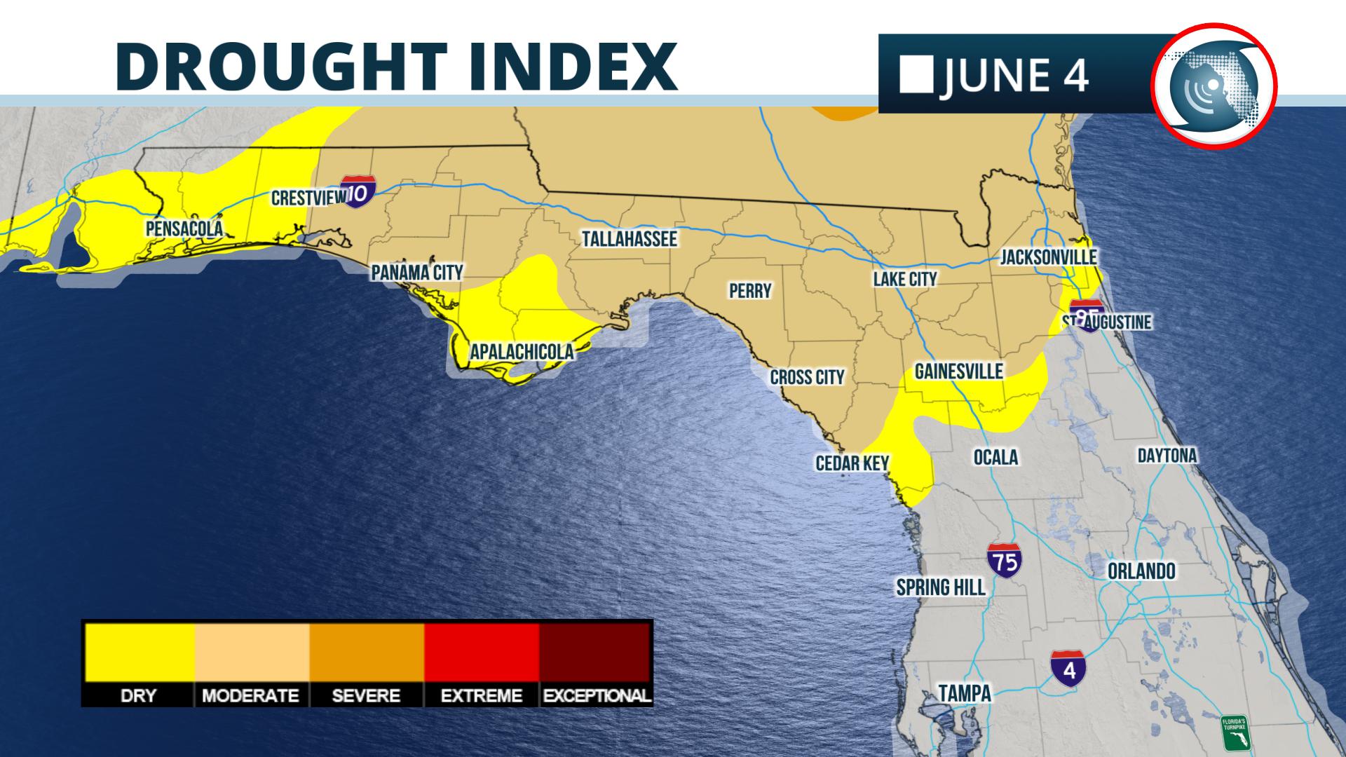
The rain will be beneficial to the northern parts of the state, where moderate drought conditions have developed from Jacksonville to Panama City according to NOAA’s latest Drought Monitor released Thursday.
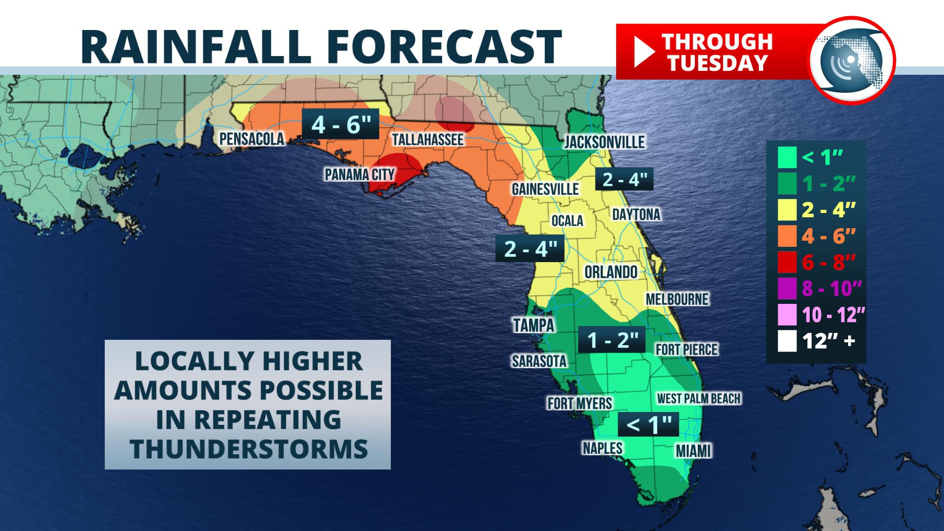
Forecasters at NOAA’s Weather Prediction Center say 5 to 7 inches of rain may fall through Tuesday in parts of the Florida Panhandle and Big Bend. The National Weather Service even hoisted Flash Flood Watches for the Pensacola area Thursday night where thunderstorms with heavy rain may move over some of the same areas multiple times.
The central and southern parts of Florida, including Tampa, Orlando, Miami, and Fort Myers, will have an increased risk of mainly afternoon and evening thunderstorms into the weekend. The National Weather Service is forecasting rainfall amounts between one-half inch and 1.5 inches in these areas, but locally higher amounts are possible with heavier, persistent thunderstorms.
Meteorologist Jeff Huffman contributed to this report.


