The National Hurricane Center says the tropical system in the Gulf of Mexico is now Tropical Storm Barry, and it could become a hurricane before hitting Louisiana this weekend.
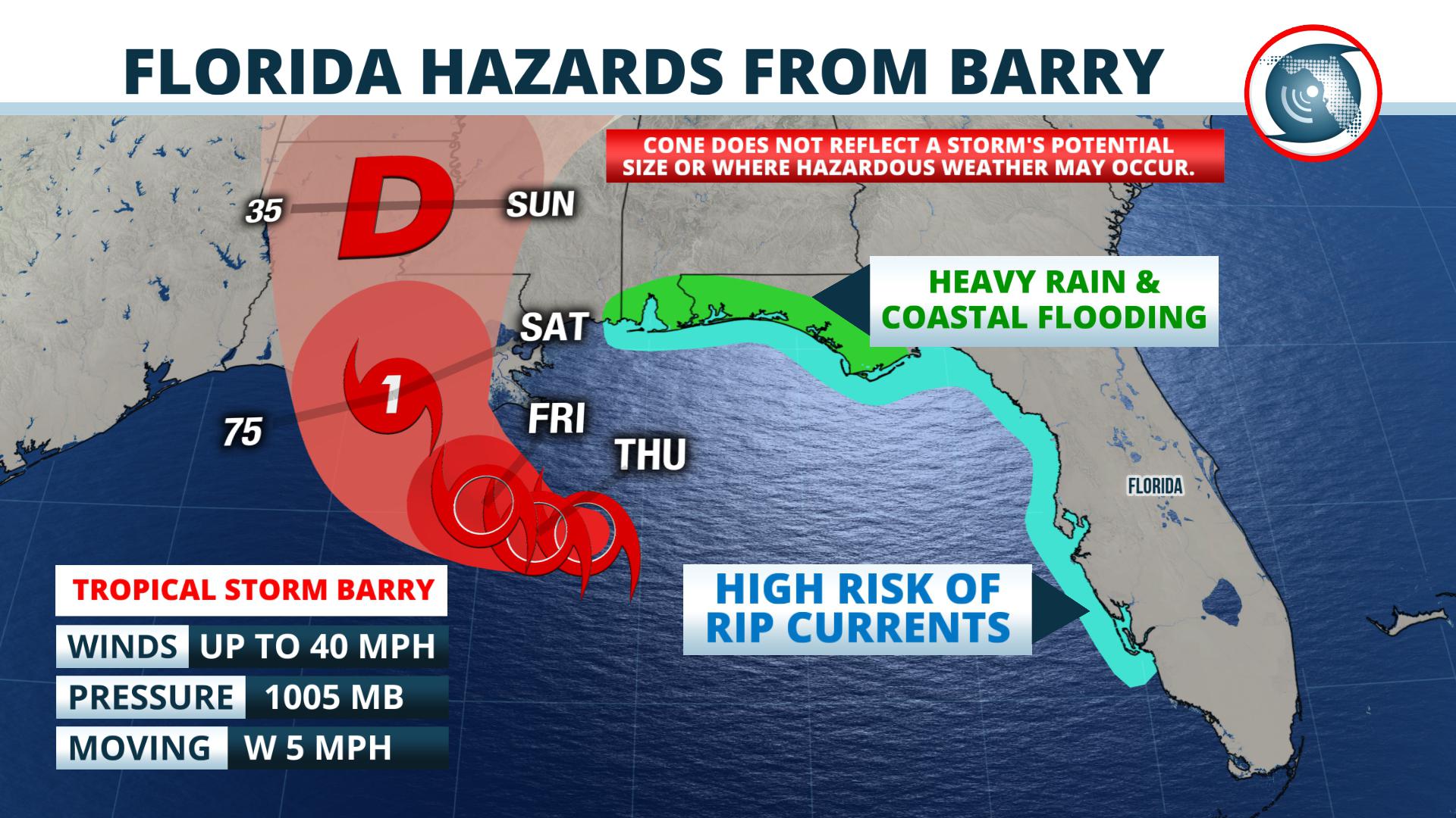 The storm was located 95 miles south-southeast of the mouth of the Mississippi River, according to the advisory issued by the National Hurricane Center at 11 am Thursday. The warm waters of the Gulf of Mexico should encourage the system to intensify slowly at first, but a little more rapidly on Friday. Forecasters expect the depression to become a hurricane and track toward Louisiana late Friday night or Saturday morning. Based on the current forecast path, the most likely areas to receive significant storm surge is over coastal Louisiana, where Storm Surge Warnings are posted.
The main effects from Barry in Florida will be limited to locally heavy rain and coastal flooding, mainly west of the Apalachicola River, along with an increasing risk of rip currents.
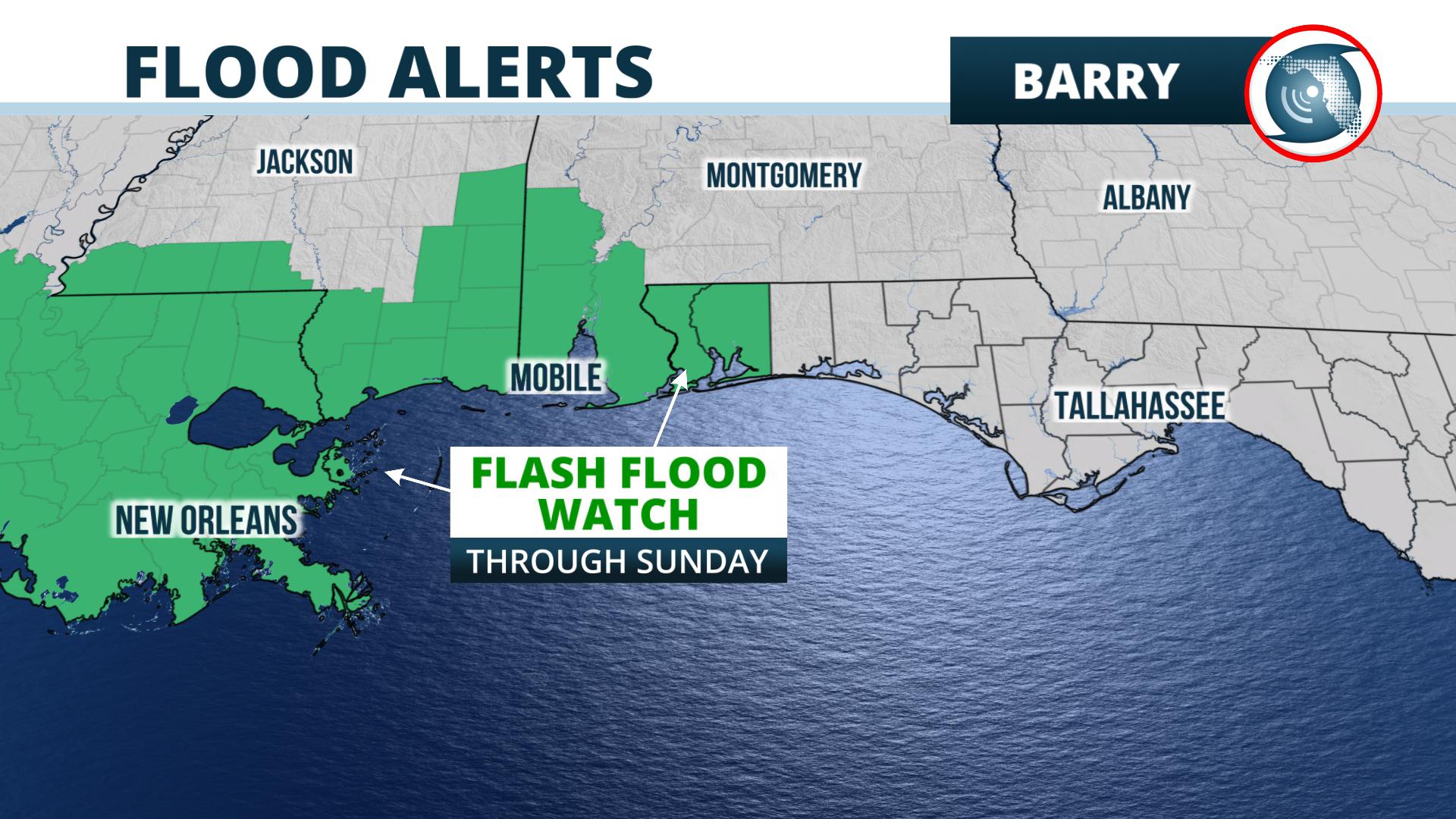 NOAA’s Weather Prediction Center says 1 to 3 inches of rain are most likely to occur from near Panama City to Pensacola through the weekend. The National Weather Service has hoisted Flash Flood Watches through Sunday for the Pensacola area in anticipation of outer rain bands from the storm.
The Storm Prediction Center says there’s a marginal risk of severe thunderstorms near and offshore of Pensacola on Friday and Saturday. These storms would be on the east side of Barry and may produce tornadoes, the center said.
The National Weather Service has issued a Coastal Flood Watch from Destin to Pensacola, where up to 3 feet of inundation is possible from Thursday night through Sunday. The most likely times of inundation, the weather service says, is near the time of high tides during the mid-morning hours of Friday, Saturday, and Sunday.
As the storm strengthens, rip currents will be a danger to swimmers. The National Weather Service offices in Tallahassee and Mobile say there’s a high rip current risk from the Forgotten coast westward to Pensacola. They say the rip currents will be frequent and are dangerous for all levels of swimmers through at least Saturday evening.
In addition, the National Weather Service in Tampa has issued a high rip current risk from Pinellas county southward to Bonita Springs, including St. Petersburg, Sarasota, and Fort Myers. Southerly winds around the organizing tropical storm will make the seas dangerous in these areas through Friday evening.
The rest of Florida will see little change from the typical, mainly afternoon thunderstorms inland, with a few morning thunderstorms, especially near the Gulf coast on Thursday and Friday. As a ridge of high pressure builds over the state from the Bahamas this weekend, the number of afternoon thunderstorms should decrease, particularly over the Peninsula and Big Bend areas.


