A strong cold front will sweep through the Sunshine State by midweek, bringing the coldest temperatures of the season with it.
The start of meteorological winter is just over one week away, but the entire state may get a head start on cold weather by Thanksgiving. A cold front that moved into the Panhandle Monday morning will gradually move eastward by Tuesday before clearing the entire state. Blustery northerly winds follow the passage of the cold front, which will help to usher in an early preview of winter-like temperatures by Wednesday morning.
Temperatures begin the downward trend Monday night and Tuesday. Temperatures early Tuesday dip into the 30s across the Panhandle, while lows between I-10 and I-4 fall into the 40s. Cooler temperatures even make it to South Florida, with 50s and lower 60s expected Tuesday morning. Sunshine will not give temperatures much of a boost Tuesday as highs only climb into the 50s to near 60-degrees over the northern half of the state. Highs for the central and southern part of the state get into the 60s and 70s, which is between 5 and 10-degrees below average.
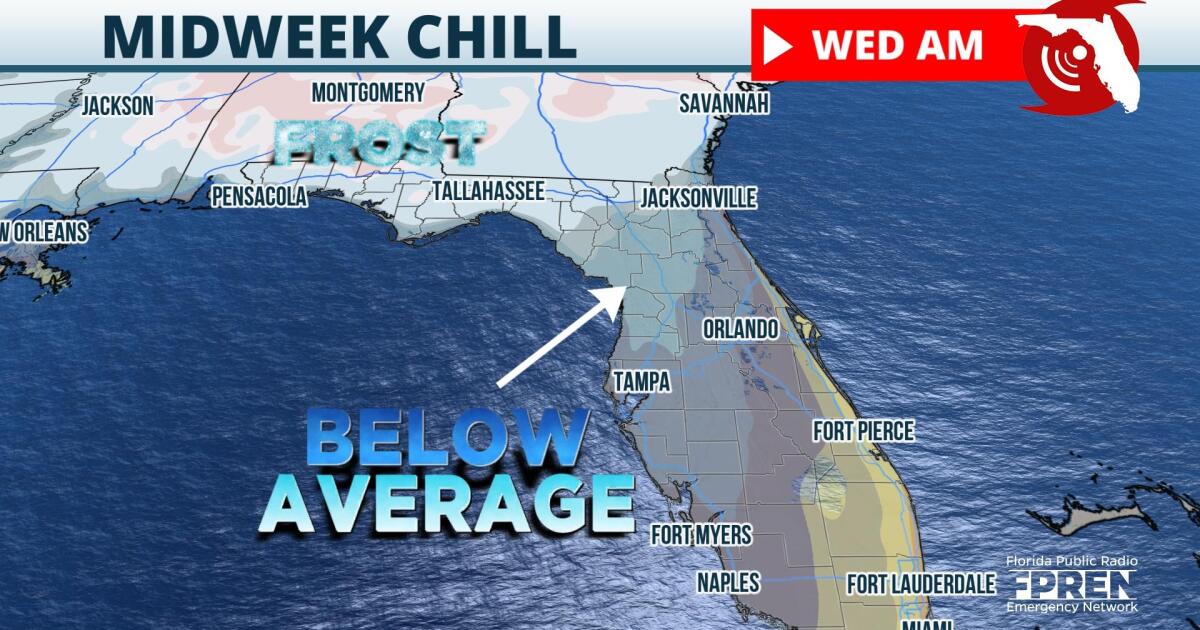
High pressure will move across the Southeast Tuesday night, clearing skies and calming winds. This will result in optimal conditions for radiational cooling, resulting in the coldest temperatures since spring in the Sunshine State by Wednesday morning. Temperatures along the I-10 corridor fall into the 30s, leading to the potential for frost development. Residents of Central and Southwest Florida will wake up to temperatures in the mid-40s to mid-50s early Wednesday. The winter-like chill does escape the Treasure and Gold Coasts, as temperatures will only fall into the 60s thanks to its proximity of relatively warm ocean water.
Temperatures will gradually moderate by Thanksgiving, with highs across most of Florida warming into the 70s. Another cold front is expected to move through late in the week, dropping temperatures by the weekend. Forecast trends over the next six to ten days suggest below-average temperatures may last through the remainder of November.
9(MDA5NDY0MjA5MDEzMzcwMjQ4MTUxZWMwMg004))


