Heavy Rain, Flash Flooding Possible in North Florida Wednesday
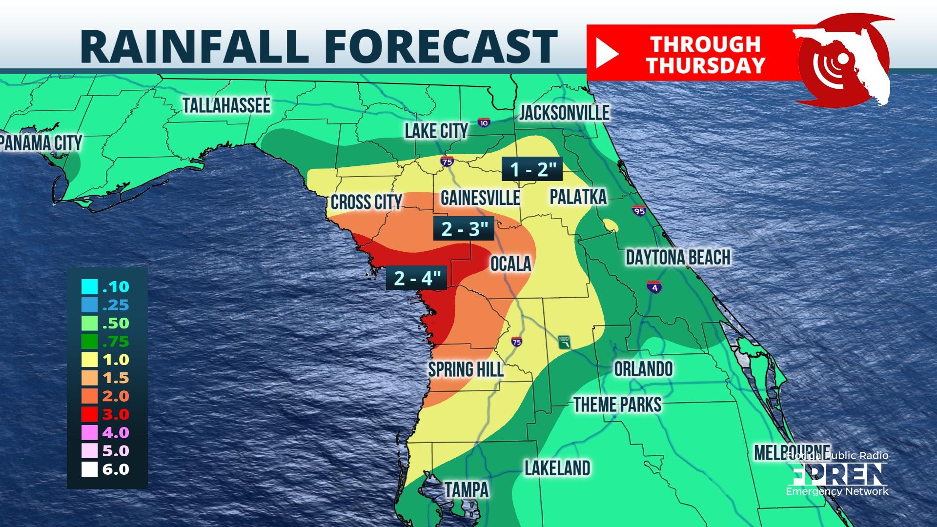
Ida’s remnant moisture is set to move into North Central Florida Wednesday, and flash flooding could occur in some locations west of I-75 from repeating rounds of heavy rain.
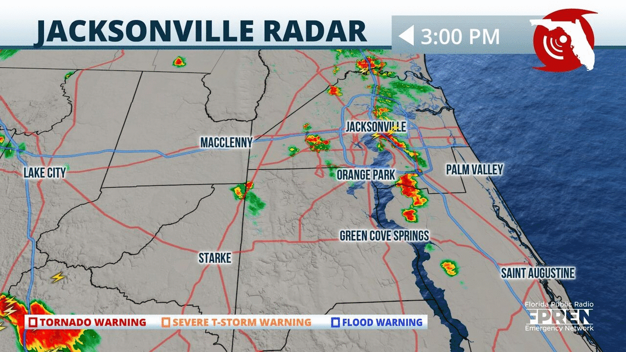
Strong storms are lining up along the #StJohns River and moving north into #Jax. Heavy rain, gusty winds and frequent lightning possible.
📍WJCT | 🕒Now on Twitter | ❌Expires passively`
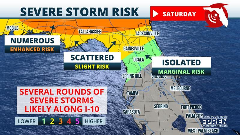
Weekend Update: The risk of wind damage, hail, and even a tornado has gone up for areas along and north of I-10 corridor in #FLPanhandle and #NFla Saturday. Rest of state will be rather quiet.
📍WUWF WKGC WFSU WJCT WUFT | 🕒Now on Twitter | ❌Expires passively`
Heavy showers are continuing to move out of #NoFL. Heavy rainfall in #Daytona with showers approaching the #Orlando region. Overnight, skies will clear gradually with cooler temperatures. #flwx

📍WJCT WUFT | 🕒Now on Twitter | ❌Expires passively`
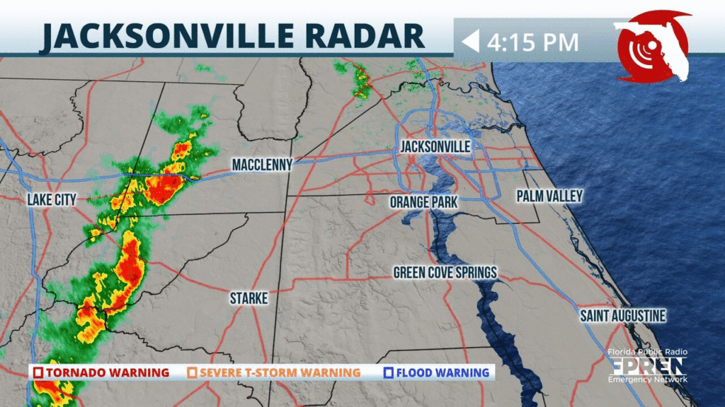
A line of showers, ahead of a strong cold front, is approaching the city of #Jacksonville from the west. Brief heavy rainfall and some gusty winds will be possible. Cooler weather is on the way. #flwx
📍WJCT | 🕒Now on Twitter | ❌Expires passively`
A line of showers & isolated t-storms is approaching parts of #Jacksonville & #OrangePark from the Atlantic. Some gusty winds & brief heavy rainfall possible. This line will continue eastward. #flwx
📍WJCT | 🕒Now on Twitter | ❌Expires passively`
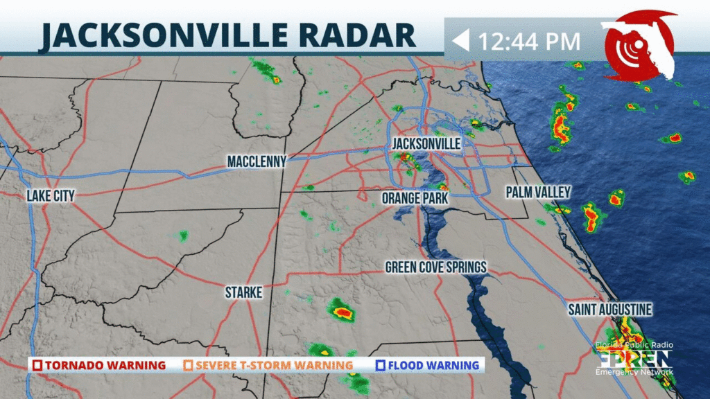
Only scattered activity so far around the #FirstCoast. Storms are moving through northern parts of #Jacksonville producing some brief heavy rainfall. Additional storms expected this afternoon. #flwx
📍WJCT | 🕒Now on Twitter | ❌Expires passively`
A Flood Watch has been issued for St. Johns and Putnam Co. through Tuesday evening, where the NWS says 4 to 6 in. of rain has already fallen and an addition 1 to 3 in. could cause flooding.
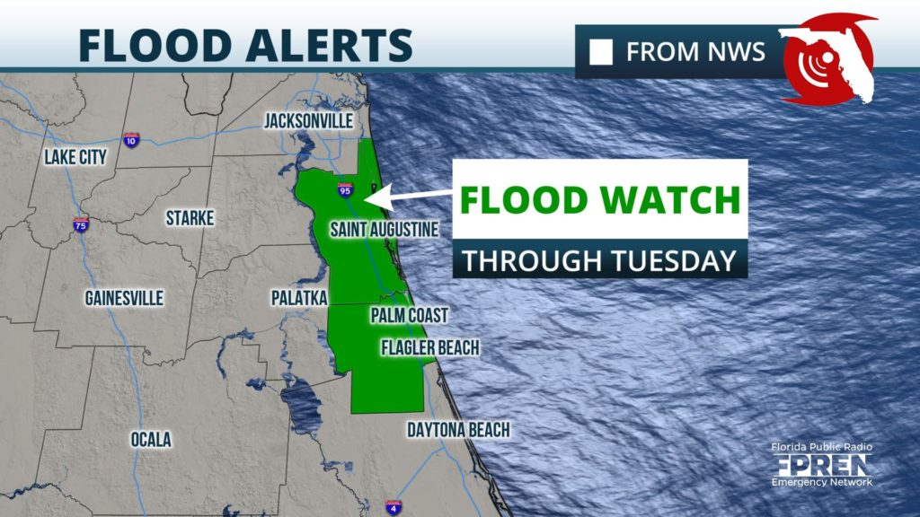
📍WJCT | 🕒Now on Twitter | ❌Expires passively`


