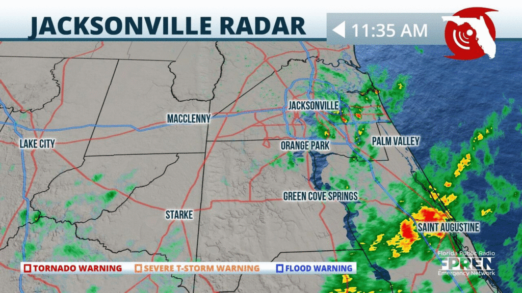
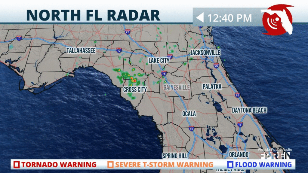
Showers and t-storms are quickly flaring up near #Jacksonville and down towards #StAugustine. Heavy rainfall, gusty winds and frequent lightning expected with these storms. Time to head indoors! #flwx
📍WJCT | 🕒Now on Twitter | ❌Expires passively`
Pockets of heavy rain continue to push inland across #NEFla to about the St. John’s River, thanks to a strong northeast wind. Coastal Flood Warnings also continue for the area. #flwx
📍WJCT | 🕒Now on Twitter | ❌Expires passively`
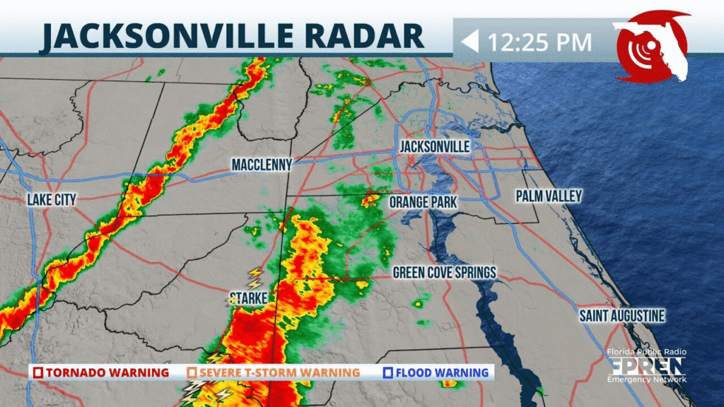
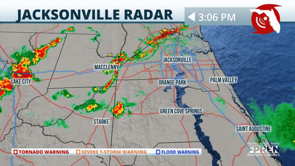
Heavy showers and a few t-storms are approaching parts of #Jacksonville and the #FirstCoast this afternoon. Heavy rainfall and gusty winds will be the main hazards with this line. #flwx
📍WJCT | 🕒Now on Twitter | ❌Expires passively`
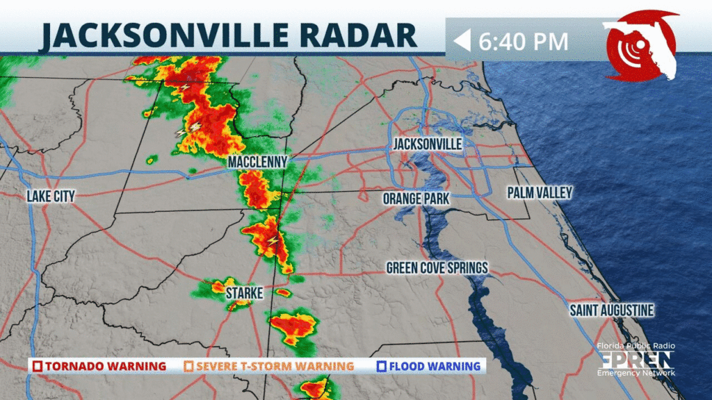
An outer band from #Sally is approaching the #Jacksonville area delivering heavy rainfall and gusty winds. This line of storms is moving to the NNE at 20 mph. Take it slow on I-10 and I-95. #flwx
📍WJCT | 🕒Now on Twitter | ❌Expires passively`
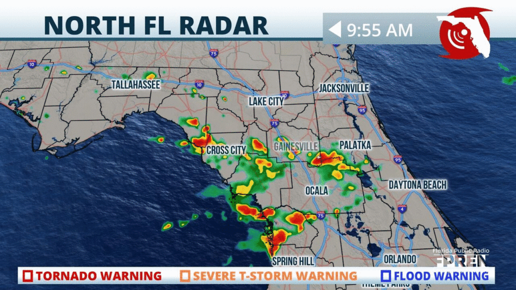
A Flash Flood Warning continues until 10:45 am for NE #Clay and south-central #Duval counties, where an additional 1 to 2 inches of rain has fallen this morning. #flwx
📍WJCT | 🕒Now on Twitter | ❌Expires passively`
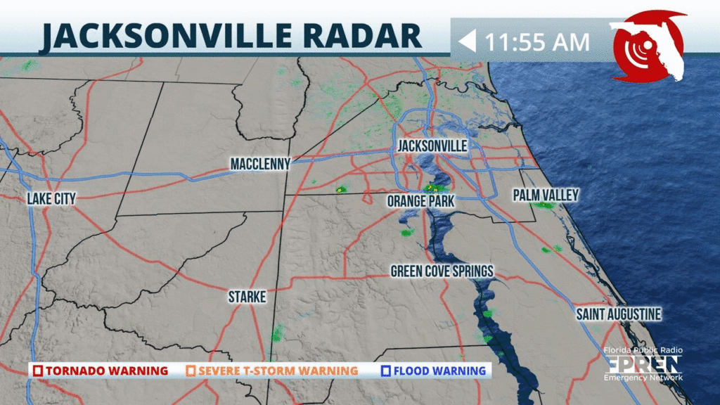
Only a few scattered showers so far for the early afternoon stretching from the #NatureCoast over towards the #FirstCoast. Storms are expected to develop further throughout the afternoon. #flwx
📍WJCT WUFT | 🕒Now on Twitter | ❌Expires passively`
Showers are starting early again across portions of #NFL. Storms will continue to develop around the #NatureCoast and push eastward through the rest of the morning and into the afternoon. #flwx #NCFL
📍WJCT WUFT | 🕒Now on Twitter | ❌Expires passively`
A line of strong showers and t-storms is approaching the #Jacksonville area from the north. Frequent lightning, gusty winds, and heavy rainfall possible with these storms. Time to head indoors! #flwx
📍WJCT | 🕒Now on Twitter | ❌Expires passively`


