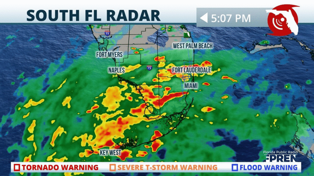
The rain is becoming heavier and steadier across portions of #SoFla, well ahead of Tropical Storm #Eta’s approach. The flood risk will be increasing with time in these areas Sunday.
📍WQCS WGCU WXEL WLRN | 🕒Now on Twitter | ❌Expires passively`
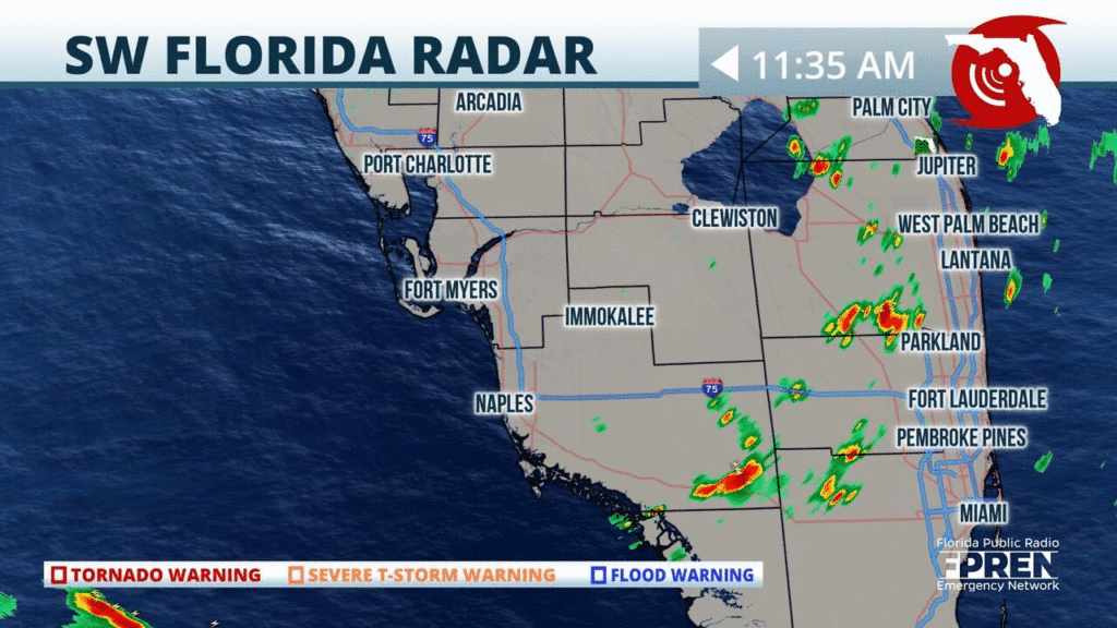
As we head into the weekend, moisture will continue to increase across #SoFL ahead of #Eta. Scattered showers are currently making their way through parts of #Miami, #FtLauderdale and #Naples. #flwx
📍WQCS WGCU WXEL WLRN | 🕒Now on Twitter | ❌Expires passively`
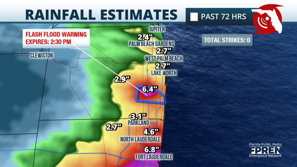
Even though the rain has temporarily tapered off in most areas, a Flash Flood Warning continues for SE #PalmBeach Co until 2:30 pm, where 4 to 6 inches has already fallen in the past 3 days. #flwx
📍WQCS WXEL WLRN | 🕒Now on Twitter | ❌Expires passively`
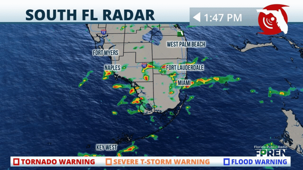
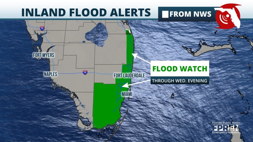
Heavy rain squall moving into #Miami and #FortLauderdale over next hour could cause localized flooding. Flood Watch continues through this evening for the area >>
📍WQCS WGCU WXEL WLRN | 🕒Now on Twitter | ❌Expires passively`
Flood Risk Continues in Portion of South Florida through Thursday
Localized flooding will continue to be possible across portions of South Florida through Thursday, thanks to tropical moisture being funneled in by a disturbance south of Cuba.
Strong storms continue to drift west, toward the beaches of #SWFla near #FortMyers and #Naples. It will be a much nicer (drier) evening near #Miami and #WestPalmBeach. #flwx
📍WQCS WGCU WXEL WLRN | 🕒Now on Twitter | ❌Expires passively`
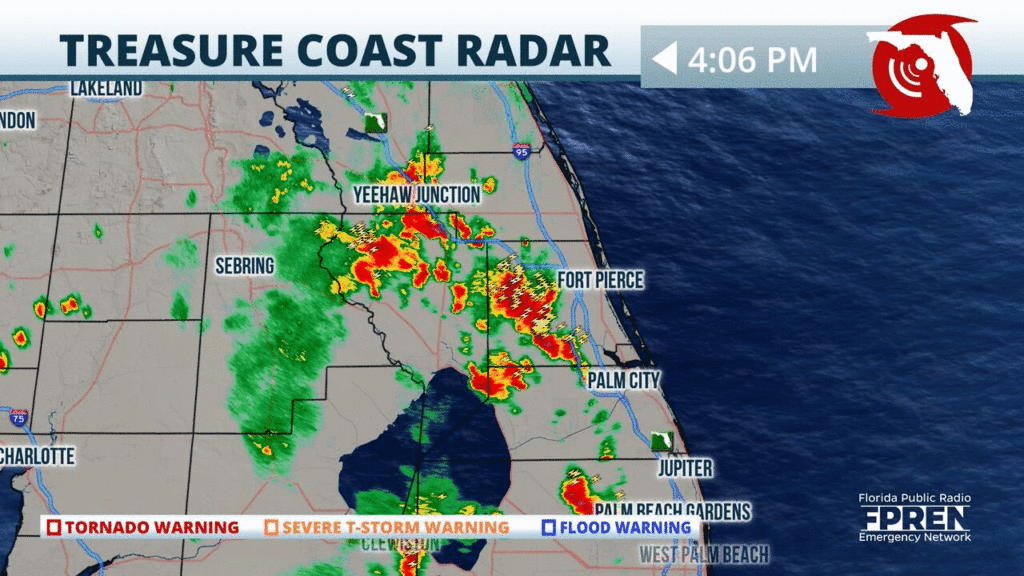
Strong showers and t-storms continue to develop close to the #TreasureCoast this evening. Heavy rainfall, gusty winds, and frequent lightning possible. Flash flooding remains a possibility. #flwx
📍WQCS | 🕒Now on Twitter | ❌Expires passively`
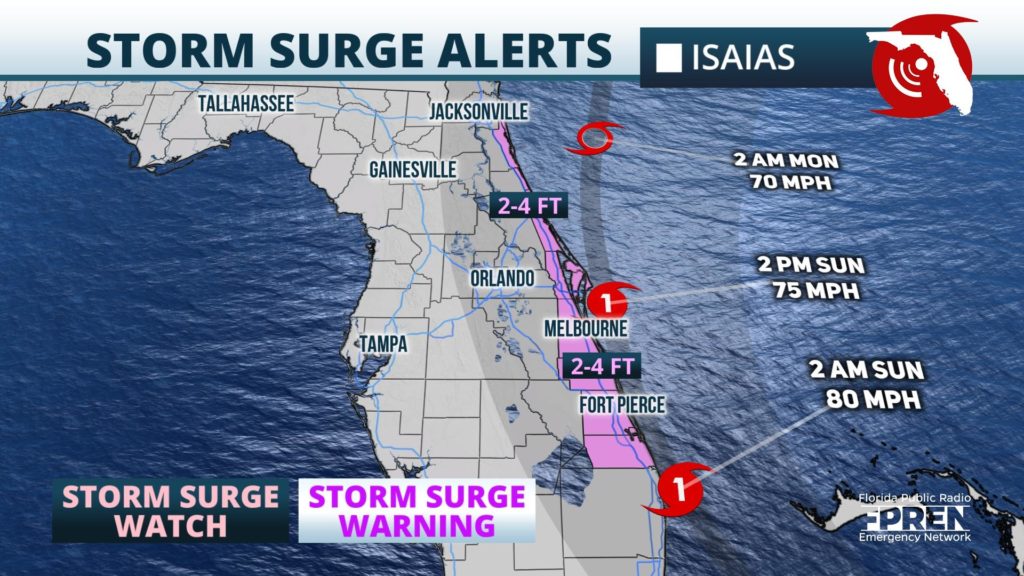
Surge alerts from #Isaias: A Storm Surge Watch is in effect for the east coast of Florida from Jupiter Inlet to Ponte Vedre Beach, where 2 to 4 feet of inundation is possible.
📍WJCT WMFE WFIT WQCS WXEL | 🕒Now on Twitter | ❌Expires passively`


