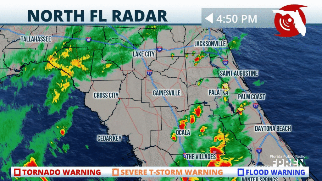
Lines of heavy rain, gusty winds, and some lightning approaching #Ocala #HighSprings and #LakeCity over the next hour, moving northwest (lower right to upper left in the app). #flwx
📍WJCT WUFT | 🕒Now on Twitter | ❌Expires passively`
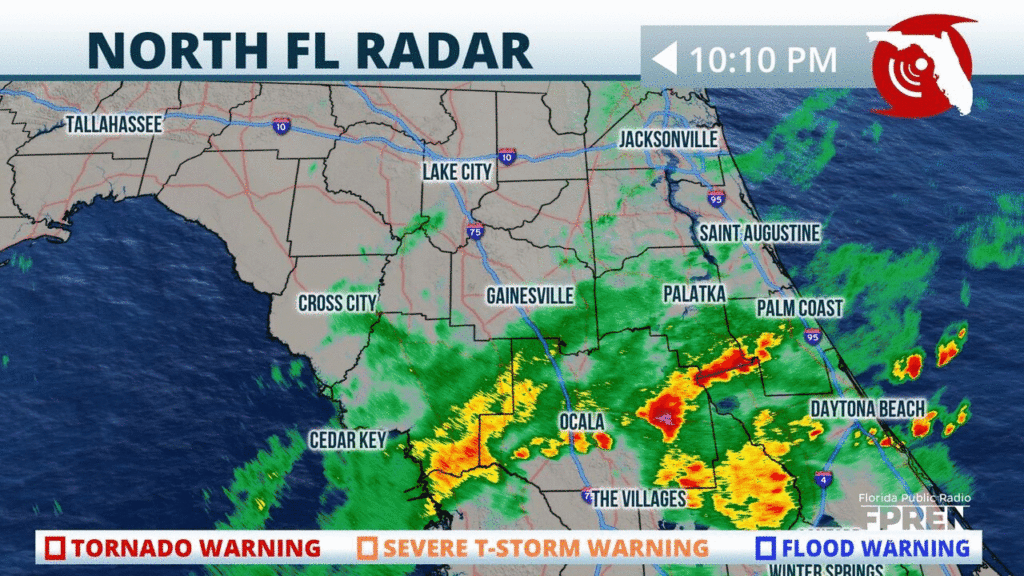
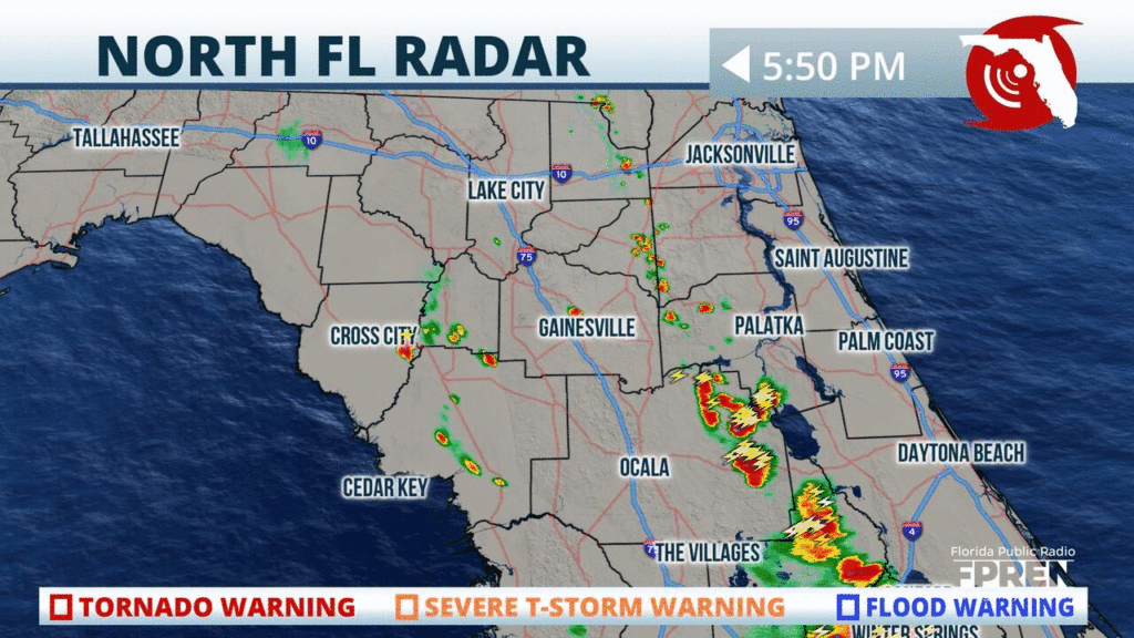
More steady rain rotating back into #NFla from #Gainesville to #StAugustine. It’s been a soggy day in #Alachua and #Marion counties, where 1 to 2 in has fallen in some spots. #flwx
📍WJCT WUFT | 🕒Now on Twitter | ❌Expires passively`
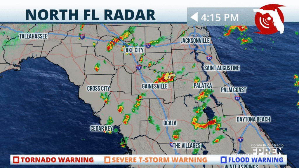
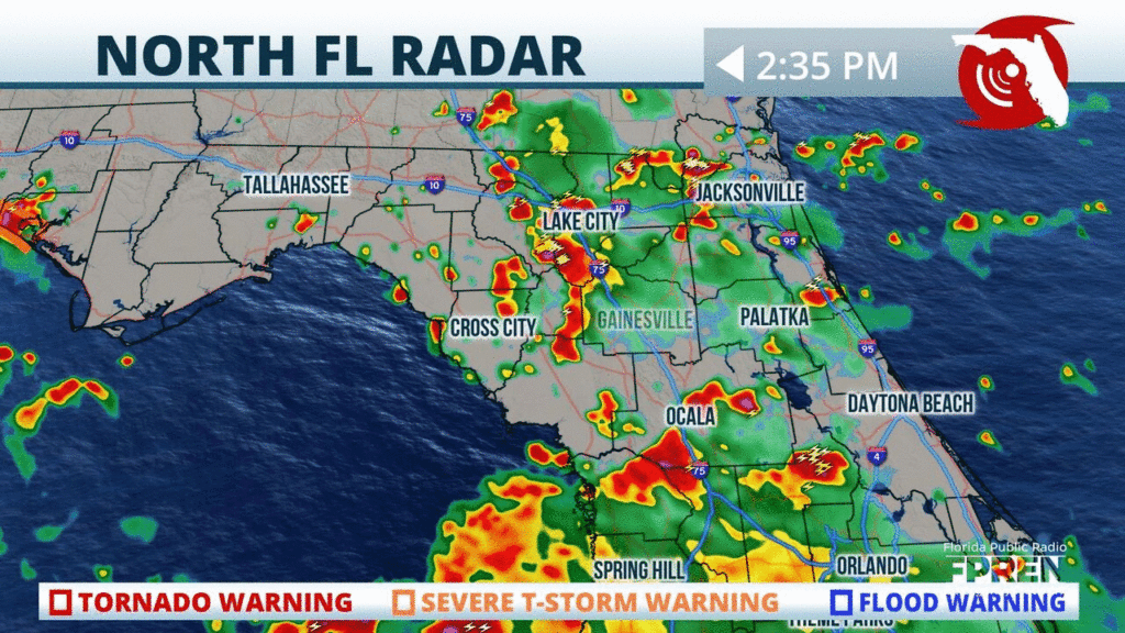
Strong thunderstorms with heavy rain have developed in #Marion County, and they are drifting into #Ocala and #Gainesville over the next couple of hours. Localized flooding possible. #flwx
📍WJCT WUFT | 🕒Now on Twitter | ❌Expires passively`
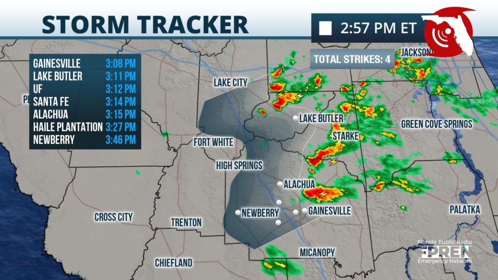
Rain squalls from #Isaias with gusty winds and lightning are approaching #Gainesville #HighSprings rapidly from the northeast. Time to head indoors in these areas. #flw
📍WUFT | 🕒Now on Twitter | ❌Expires passively`
Thunderstorms are blossoming over the southeastern parts of #NFla. Activity will likely intensify and become more widespread inland and west this afternoon. #FLwx
📍WJCT WUFT | 🕒Now on Twitter | ❌Expires 07/23/2020 1:00 PM`
Showers and thunderstorms are becoming widespread toward southeastern parts of #NFla. Activity will likely intensify as it tracks northwestward this afternoon. #FLwx
📍WJCT WUFT | 🕒Now on Twitter | ❌Expires 07/23/2020 12:30 PM`
Showers and storms likely especially inland and west today. Activity should arrive earlier than normal (early afternoon) and dissipate before sunset.
📍WJCT WUFT | 🕒Now on Web only | ❌Expires 07/22/2020 5:00 PM`
Sea breeze collision likely in #Alachua #Marion counties over next few hours.
Sea breeze collision likely in #Alachua #Marion counties over next few hours.


