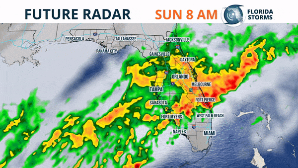
SUNDAY 7 AM UPDATE: Rain had overspread nearly the entire peninsula in the pre-dawn hours Sunday. The heaviest was noted on radar in portions of central and southwest Florida.
Latest Future Radar still suggests a very soggy Sunday across most of the state.
It was a cool and dry start to the weekend in Florida, but for many it won't be a dry finish.
A storm system was seen organizing in the Gulf of Mexico Saturday, already spreading showers on radar over portions of South Florida.
A heavier and steadier rain is likely to spread across the rest of the Florida peninsula Sunday, which could be seen on our Future Radar shared with our Twitter followers early Saturday afternoon.
Longer lasting periods of rain, which at times will be heavy, is forecast to move into the southern third of Florida Saturday night, as a low pressure system develops along a stalled front in the southeastern Gulf of Mexico. Widespread rain will then move into central Florida Sunday morning as the boundary lifts north. Much of north Florida will likely experience the wet weather by Sunday afternoon, before the system exits the state early Monday. A strong thunderstorm or two can't be ruled out with this storm system in portions of South Florida Sunday, but severe weather is not expected to be widespread with this storm system.
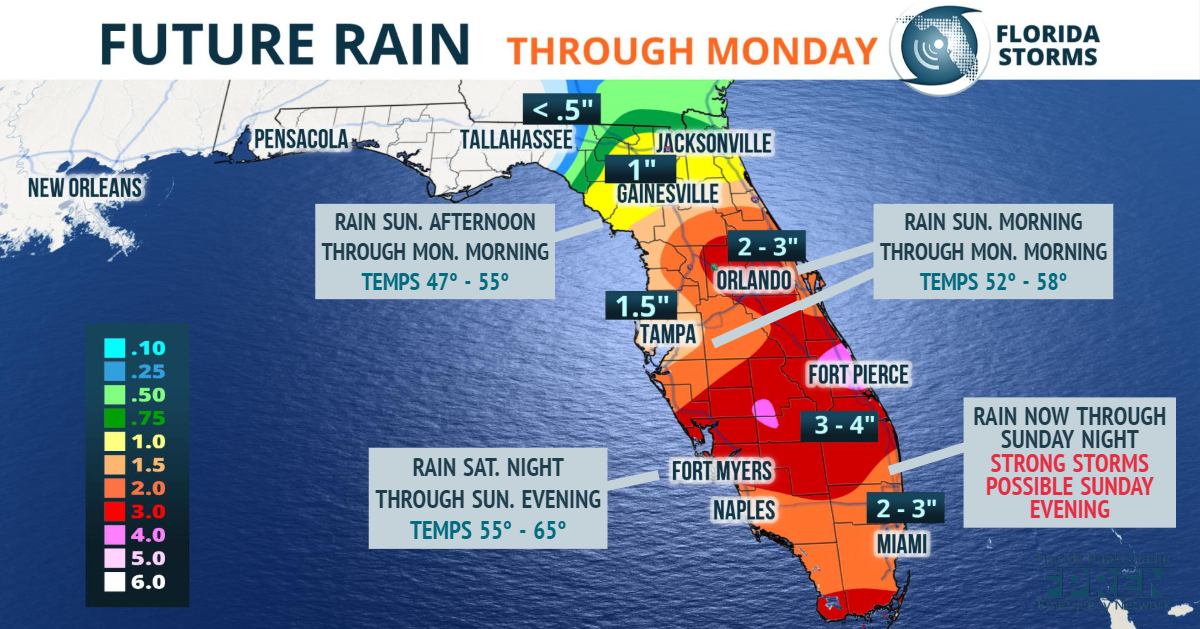
Rainfall totals over the 36-hour period ending Monday morning could be as high as two or three inches over a large area of central and south Florida, tapering off to an inch or two north of the I-4 corridor and up to about I-10.
This is welcome news for much south and east-central Florida, where drought conditions have developed this winter.
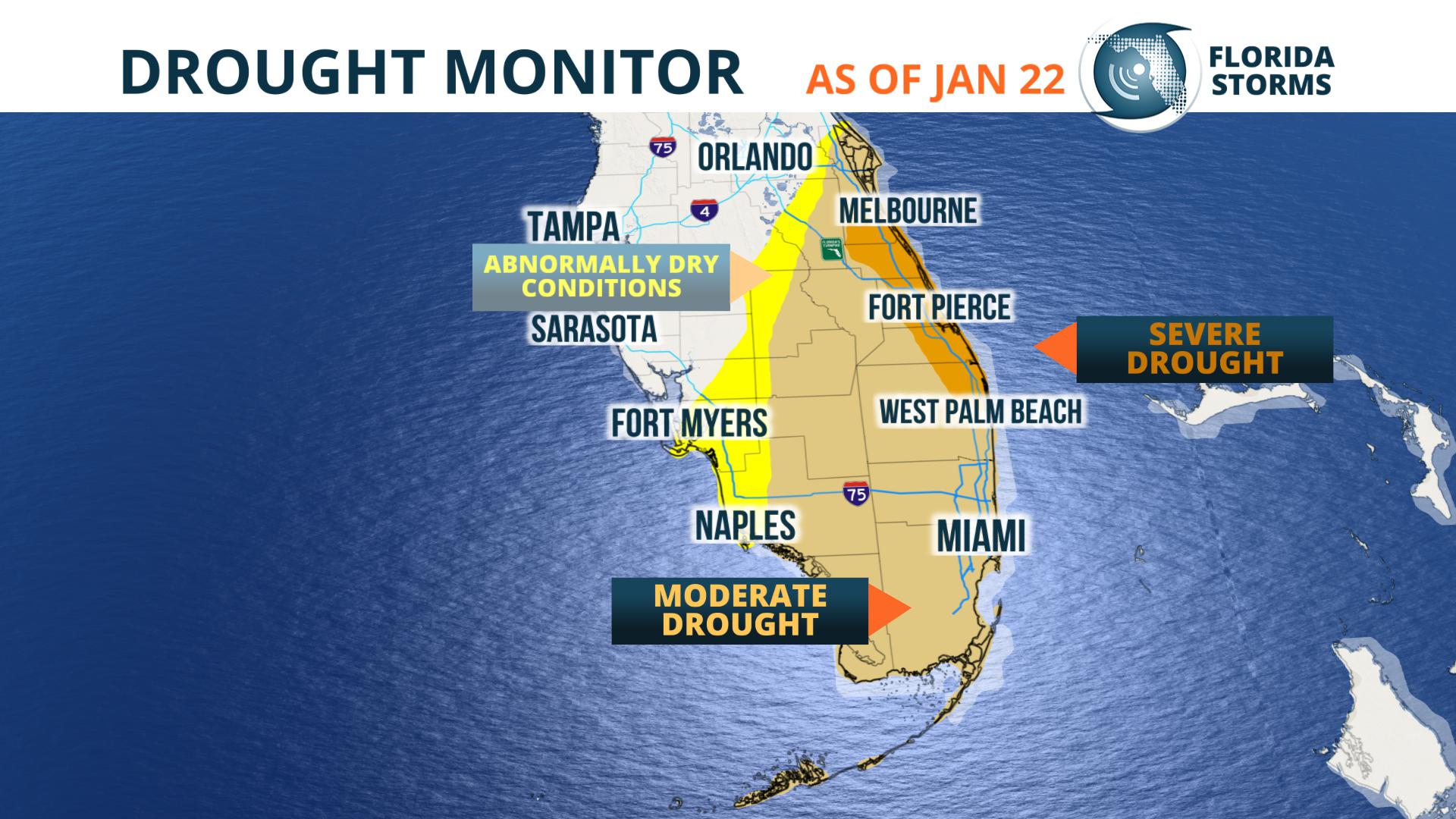
A severe drought was noted by the U.S. Drought Mitigation Center in areas from West Palm Beach to Melbourne, while a moderate drought was ongoing in Miami, the Everglades and portions of the Space Coast. And as of January 22, Fort Myers and Naples were entering into a slight drought.
Sunday's rain will fall into an unusually cool air mass across Florida. Temperatures, while it's raining, are expected to hold in the upper 40's in portions of North Florida. The numbers will likely only be in the 50's for much of Central Florida, and lower 60's in South Florida.
The soggy storm system will exit the state early Monday, but unlike several prior fronts this winter, the air mass behind it will not be as cold. Temperatures will return to normal winter values in most areas by Tuesday.


