A few tornadoes are possible Thursday along a squall line of thunderstorms approaching the Florida peninsula. Some of the storms will also be capable of producing wind damage as a powerful cold front moves through.
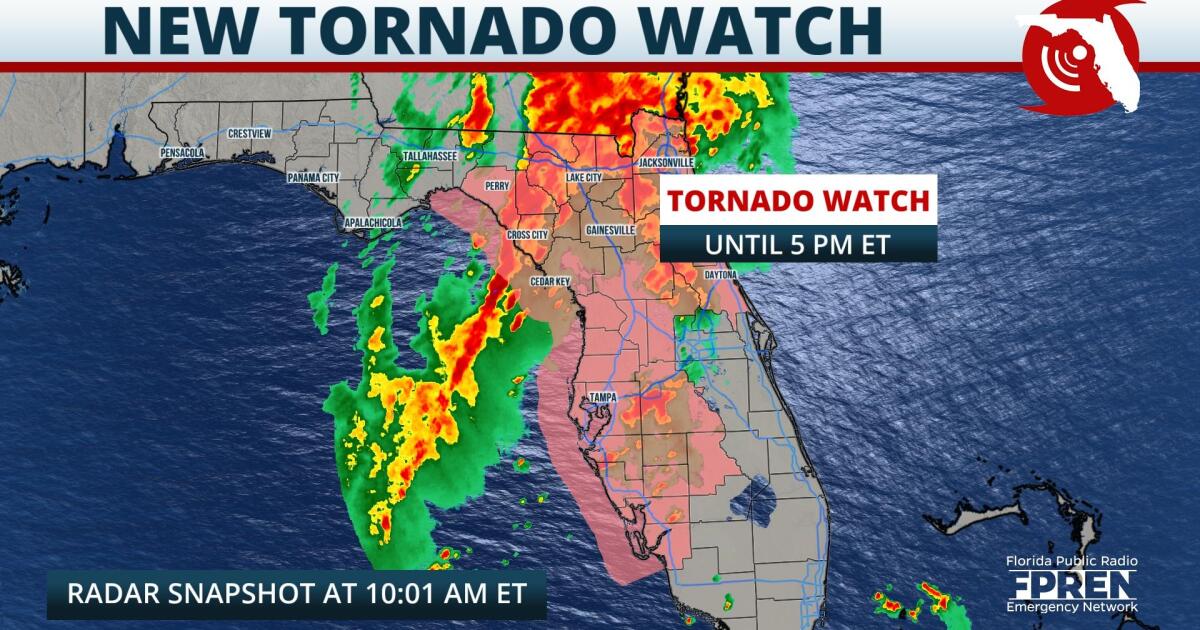
A Tornado Watch was issued for all of north and west-central Florida through 5 pm. The watch includes the cities of Jacksonville, Lake City, Gainesville, Ocala, Cedar Key, The Villages, Tampa, Sarasota and Fort Myers. The watch also stretches as far south as Lake County in Central Florida, and it might be expanded farther south and east later in the day depending on the progression of the storms.
Here are the latest most likely arrival times of the dangerous storms in the following corridors across Florida:
At 10:00 am Wednesday, radar data showed a line of storms stretching from Live Oak to just offshore of the Nature Coast. Atmospheric parameters are expected to become increasingly favorable for rotating cells along or just ahead of this line as it moves inland through north and central Florida Wednesday afternoon. Line segments embedded within the line may also tap into strong winds aloft, transferring those winds to the surface and producing damaging gusts up to 60 mph.
Strong thunderstorms are also expected across South Florida Thursday evening and overnight along the front. Damaging winds will remain the biggest hazard with any of the stronger cells, but heavy rainfall could also lead to localized flooding along the Gold Coast through the pre-dawn hours Friday morning.
The cold front responsible for the unsettled weather Thursday should be out of here on Friday, allowing for more northwesterly winds and much cooler, nicer weather to settle in across Florida for the weekend.
9(MDA5NDY0MjA5MDEzMzcwMjQ4MTUxZWMwMg004))


