FLORIDA
STORMS

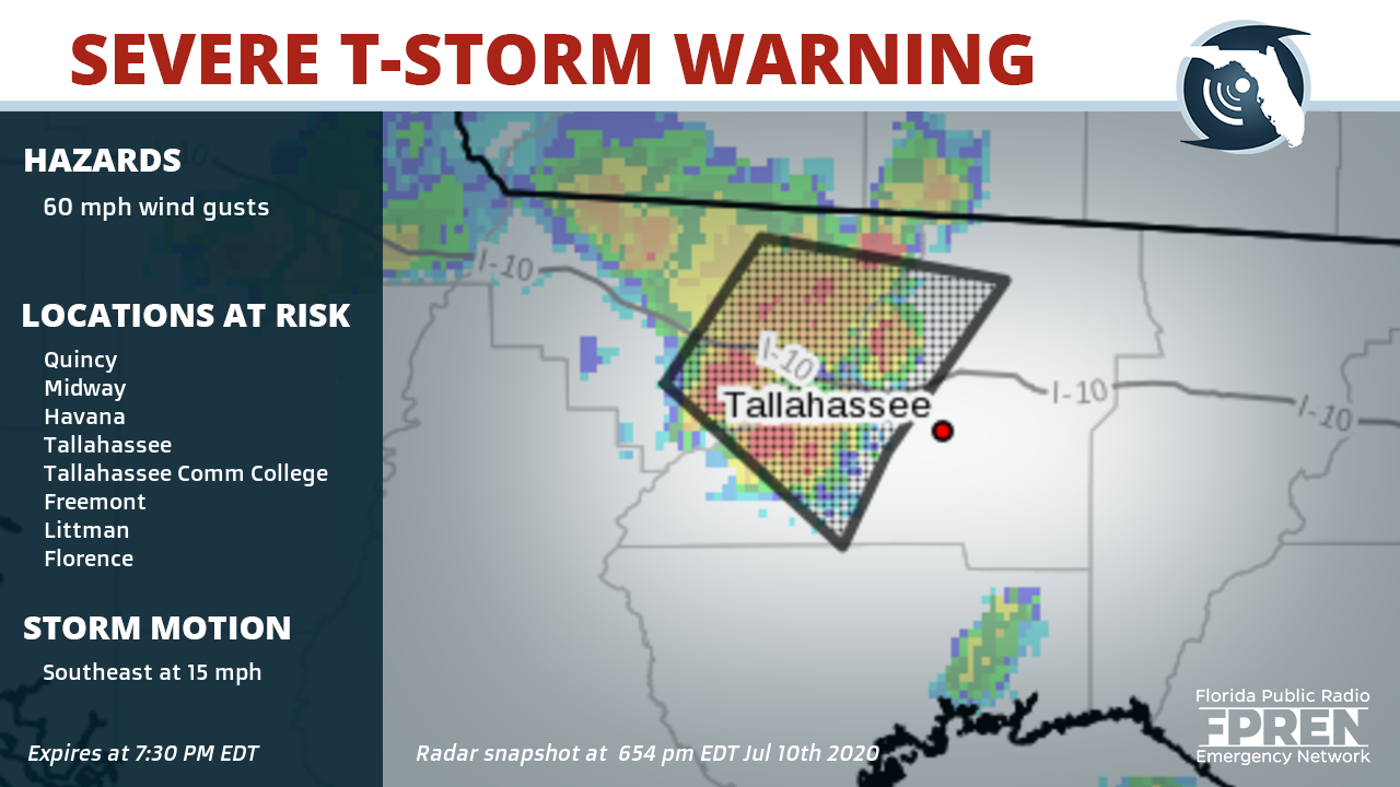
Counties: Eastern Gadsden County in Big Bend of Florida, Central Leon County in Big Bend of Florida,
Cities: Quincy, Midway, Havana, Tallahassee, Tallahassee Comm College, Freemont, Littman, Florence, Scotland, Santa Clara, Shady Rest, Quincy Airport, Wetumpka, Branchville, Forest Meadows Park, Lake Talquin, Andrew, Orchard Pond, Gibson and Killearn Lakes Florida
Potential impacts: Expect damage to roofs, siding, and trees.
Suggested action(s): To report severe weather, contact your nearest law enforcement agency. They will send your report to the National Weather Service office in Tallahassee.
Summary: At 654 PM EDT, a severe thunderstorm was located over Midway, moving southeast at 15 mph.
This alert expires July 10, 2020 at 7:30 PM EDT
Partners of the Florida Public Radio Emergency Network include: WDNA (Miami), WFIT (Melbourne), WMFE (Orlando), WFSU (Tallahassee), WGCU (Fort Myers), WJCT (Jacksonville), WKGC (Panama City), WLRN (Miami), WMNF (Tampa-Sarasota), WQCS (Fort Pierce), WUFT (Gainesville-Ocala), WUSF (Tampa), WUWF (Pensacola) and Florida Public Media.
1885 Stadium Road
PO Box 118400
Gainesville, FL 32611
(352) 392-5551
This page uses the Google Privacy Policy and UF's Privacy Policy
