FLORIDA
STORMS

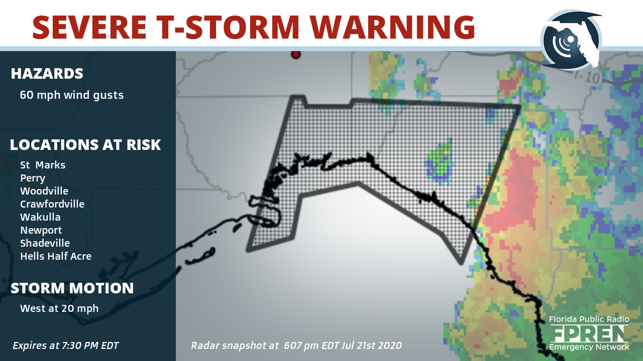
Counties: Eastern Wakulla County in Big Bend of Florida, Northwestern Taylor County in Big Bend of Florida, Southwestern Jefferson County in Big Bend of Florida, Eastern Franklin County in Big Bend of Florida,
Cities: St Marks, Perry, Woodville, Crawfordville, Wakulla, Newport, Shadeville, Hells Half Acre, Wakulla Springs, Cabbage Grove, Scanlon, Perry-Foley Airport, Hampton Springs, Liveoak Island, Alligator Point, Goose Pasture, Iddo, Bald Point, Hyde Park and Secotan Florida
Potential impacts: Expect damage to roofs, siding, and trees.
Suggested action(s): To report severe weather, contact your nearest law enforcement agency. They will send your report to the National Weather Service office in Tallahassee.
Summary: At 605 PM EDT, severe thunderstorms were located along a line extending from 7 miles east of Perry to 17 miles west of Steinhatchee, moving west at 20 mph.
This alert expires July 21, 2020 at 7:30 PM EDT
Partners of the Florida Public Radio Emergency Network include: WDNA (Miami), WFIT (Melbourne), WMFE (Orlando), WFSU (Tallahassee), WGCU (Fort Myers), WJCT (Jacksonville), WKGC (Panama City), WLRN (Miami), WMNF (Tampa-Sarasota), WQCS (Fort Pierce), WUFT (Gainesville-Ocala), WUSF (Tampa), WUWF (Pensacola) and Florida Public Media.
1885 Stadium Road
PO Box 118400
Gainesville, FL 32611
(352) 392-5551
This page uses the Google Privacy Policy and UF's Privacy Policy
