FLORIDA
STORMS

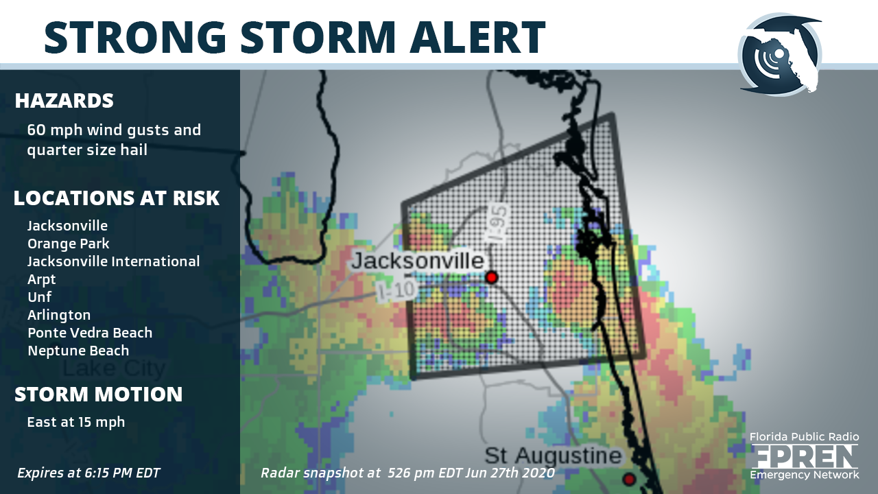
Counties: East central Nassau County in northeastern Florida, Northern St. Johns County in northeastern Florida, North central Clay County in northeastern Florida, Duval County in northeastern Florida,
Cities: Jacksonville, Orange Park, Jacksonville International Arpt, Unf, Arlington, Ponte Vedra Beach, Neptune Beach, Baymeadows, Cisco Gardens and Ortega Florida
Potential impacts: Hail damage to vehicles is expected. Expect wind damage to roofs, siding, and trees.
Suggested action(s): Prepare immediately for large hail and damaging winds. People outside should move immediately to shelter inside a strong building. Stay away from windows. Large hail and damaging winds and continuous cloud to ground lightning is occurring with this storm. Move indoors immediately. Lightning is one of nature's leading killers. Remember, if you can hear thunder, you are close enough to be struck by lightning. Torrential rainfall is occurring with this storm, and may lead to flash flooding. Do not drive your vehicle through flooded roadways.
Summary: At 525 PM EDT, a severe thunderstorm was located over Ortega, or near Jacksonville, moving east at 15 mph.
This alert expires June 27, 2020 at 6:15 PM EDT
Partners of the Florida Public Radio Emergency Network include: WDNA (Miami), WFIT (Melbourne), WMFE (Orlando), WFSU (Tallahassee), WGCU (Fort Myers), WJCT (Jacksonville), WKGC (Panama City), WLRN (Miami), WMNF (Tampa-Sarasota), WQCS (Fort Pierce), WUFT (Gainesville-Ocala), WUSF (Tampa), WUWF (Pensacola) and Florida Public Media.
1885 Stadium Road
PO Box 118400
Gainesville, FL 32611
(352) 392-5551
This page uses the Google Privacy Policy and UF's Privacy Policy
