Downpours are returning to Central and South Florida over the next few days, following a brief period of unusually dry conditions.
Numerous showers and thunderstorms are expected over the Florida peninsula for locations near I-4 and points southward through the weekend. Some of the cells could produce excessive rain, which could cause localized flooding. As of Thursday afternoon, a Flood Watch was in effect for the Treasure Coast, where the National Weather Service says up to six inches of rain is possible through Saturday. In addition to the pockets of heavy rain, a few strong thunderstorms could develop and produce damaging wind gusts across portions of south and central Florida.
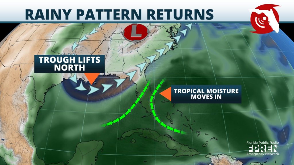
An upper level disturbance was lifting out of the Mid-Atlantic states on Thursday, after remaining parked over the region for the past several days. The system’s steering winds guided drier air into the Sunshine State earlier in the week, providing a brief stretch of cooler than normal mornings, and primarily rain-free afternoons.
Subtropical moisture was noted to be replacing the drier air Thursday, thanks to a pulse of energy moving out of the Caribbean Sea toward Florida. Southerly winds in response to this system will encourage tropical moisture to move northward into Central and South Florida.
Afternoon downpours and thunderstorms should become numerous as sea breezes progress inland, thanks to the elevated humidity levels. This could result in torrential rainfall rates, and with weak low-level winds, the storms will be slow-moving and flooding will be a formidable concern.
A brief dry period is expected in Florida over the weekend, as a high pressure system moves in and suppresses afternoon storm development. In addition, a slight warming trend is expected. High temperatures should climb to the low 90s along the coast, and mid-90s inland.


