If the warmer weather sends you outdoors this weekend, your plans will be spoiled if you choose the wrong day.
A low pressure system is expected to develop in the Gulf of Mexico Saturday Night. It will bring heavy rain to most of the state Sunday.
If you are making outdoor plans this weekend, see why @MetCyndee says you'll definitely want to pick Saturday. #flwx pic.twitter.com/Dw1q0txEGb
— Florida Storms (@FloridaStorms) January 26, 2018
Widespread rain will move into the Florida Panhandle Sunday morning. The wet weather will then move east toward Jacksonville and Gainesville by midday, before eventually overspreading the rest of the peninsula late Sunday afternoon. In most cities, the rain will likely last for several hours and could be heavy at times.
Thunderstorms are also possible as the storm system nears Sunday evening, especially embedded in some of the heavier rain bands. However, at this time, thunderstorms capable of producing wind damage or hail are not anticipated.
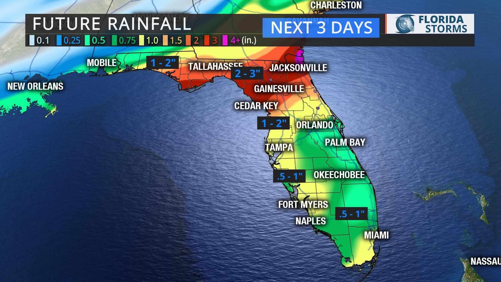
Rainfall totals will generally be between 1 to 2 inches in most areas, with locations near the I-10 corridor possibly receiving as much as 3 inches of rain before the storm system exits Monday.


