Tuesday 10 am EDT Update: Tropical Storm Bertha made landfall Wednesday morning at 9:30AM EDT about 20 miles east of Charleston, SC. Maximum sustained winds were at 50 mph, according to a special statement from the National Hurricane Center.
Bertha will continue to move north-northwest through the Lowcountry and Pee Dee regions Wednesday afternoon before turning more northward and moving through the Midlands through the overnight Wednesday and into Thursday.
Tropical Storm Bertha is expected to produce heavy rainfall across portions of eastern and central South Carolina along with Tropical Storm force winds to the coastline.
Tropical Storm Bertha formed Wednesday morning about 30 miles east-southeast of Charleston, SC. Maximum sustained winds were 45 mph at the time, and the storm is expected to make landfall in the South Carolina Lowcountry by midday.
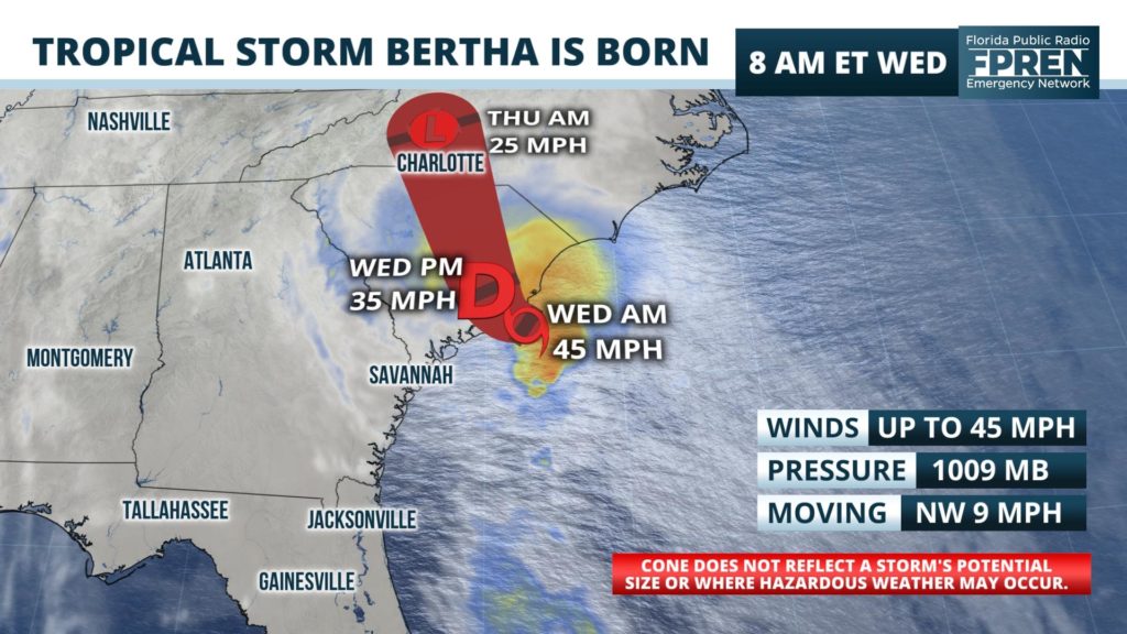
The second named storm of the season began organizing off the east coast of Florida Monday, and it began strengthening as it moved over the warmer waters of the western Atlantic Ocean. As of 8:30 am EDT, the center was 30 miles east-southeast of Charleston and is moving northwest at about 9 mph.
The National Hurricane Center issued a Tropical Storm Warning from Edisto Beach to South Santee River in anticipation of Bertha's landfall late this morning or early this afternoon. Tropical storm force winds in squalls are likely near the coast in the warning area.
Heavy rain and flash flooding is expected over portions of the Lowcountry, primarily from Charleston north and east, and over the Pee Dee, and Grand Strand. Rainfall amounts of 2 to 4 inches are forecast over eastern and central South Carolina, with local amounts up to 8 inches according to the National Hurricane Center.
Rain is expected to continue after the storm moves inland and continue into tonight before diminishing early Thursday morning.


