Tropical Storm Cristobal is expected to make landfall in Louisiana Sunday evening, spreading heavy rain, potential flooding, and the risk of tornadoes across the Florida Panhandle and as far east as Jacksonville.
A Tropical Storm Warning remains in effect for coastal Escambia, Santa Rosa, and Okaloosa counties, or roughly all coastal areas west of Eglin Air Force Base in the Florida Panhandle. Tropical storm force wind gusts (greater than 39 mph) are likely in these areas now through Sunday night.
A Flash Flood Watch remains in effect for all coastal and inland areas from Florida’s Big Bend to Pensacola through Sunday night and Monday morning, respectively. Flooding has been ongoing or was imminent in and around the Suwannee River Valley, where Flash Flood Warnings were issued and parts of I-10 had to be closed from flooding. Radar estimates in this area suggest that nearly a foot of rain has fallen over the past 48 hours.
An additional 2 to 4 inches of rain is possible across the advised area through Monday, with locally higher amounts possible.
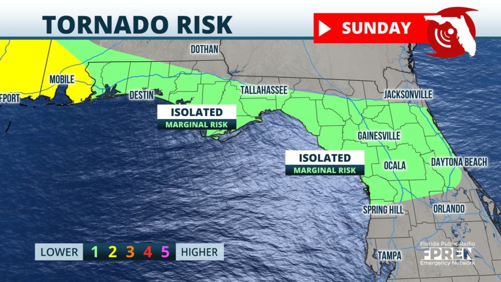
A few brief tornadoes and waterspouts are also possible as the large circulation from Tropical Storm Cristobal rotates through the Florida Panhandle and North Florida.
A Coastal Flood Advisory is in effect from the Florida-Alabama state line to Horseshoe Beach along Florida’s Nature Coast. Water inundation of 1 to 3 feet above normally dry ground will remain possible in these areas, especially at times of high tide through Monday.
Cristobal is expected to continue northward, losing strength and likely degrade into a Tropical Depression on Monday, when the storm moves across the lower Mississippi River Valley.
The widespread hazards from Tropical Storm Cristobal will subside across Florida Sunday night, but ample amounts of moisture will likely stay stay in place through at least midweek. A summer-like pattern will take over beginning Monday, with the majority of showers and thunderstorms being scattered and developing mostly in the afternoon hours along sea breeze interactions.


