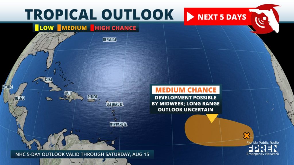

The tropics have been quiet since Hurricane Isaias hit the East Coast a week ago, but a new tropical wave could develop this week in the central Atlantic.

The disturbance, identified by meteorologists as Invest 95, was located about 600 miles west-southwest of the Cabo Verde Islands Monday, where it was producing a broad area of showers and thunderstorms. Organization of the system has changed very little over the last few days, but environmental conditions are expected to become more favorable for development by midweek. The National Hurricane Center says that Invest 95 could become a tropical depression in the next day or two as it continues to track generally westward at roughly 10 to 15 mph across the tropical Atlantic.
If this tropical wave manages to reach tropical storm status (winds over 39 mph), it will acquire the name "Josephine". Six records for earliest named storms have already been broken this year, which include Cristobal, Edouard, Fay, Gonzalo, Hanna, and Isaias. The earliest "J" named storm on record was Jose, which formed on August 22, 2005.
1885 Stadium Road
PO Box 118405
Gainesville, FL 32611
(352) 392-5551
A service of WUFT at the University of Florida College of Journalism and Communications
Partners of the Florida Public Radio Emergency Network include: Florida's Division of Emergency Management, WDNA (Miami), WFIT (Melbourne), WMFE (Orlando), WFSU (Tallahassee), WGCU (Fort Myers), WJCT (Jacksonville), WKGC (Panama City), WLRN (Miami), WMNF (Tampa-Sarasota), WQCS (Fort Pierce), WUFT (Gainesville-Ocala), WUSF (Tampa), WUWF (Pensacola) and Florida Public Media.
This page uses the Google Privacy Policy and UF's Privacy Policy
