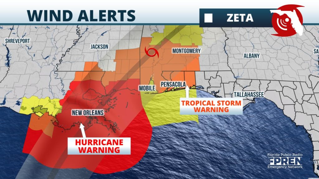
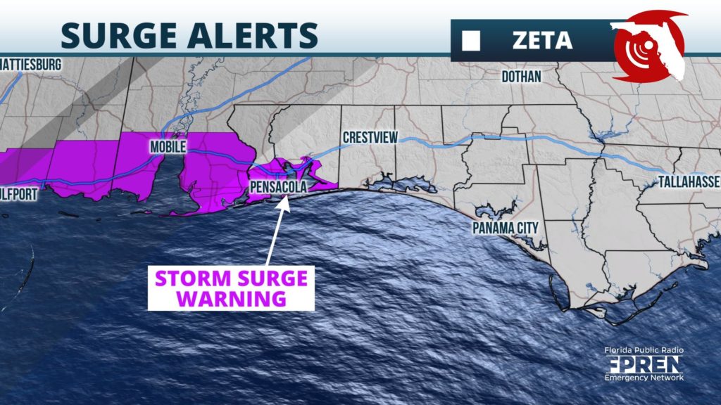
A Tropical Storm Warning and Storm Surge Warning has been issued for portions of the Florida Panhandle ahead of Hurricane Zeta.
A Tropical Storm Warning is in effect from the Mississippi/Alabama border to the Okaloosa/Walton county line in Florida. This includes the cities of Pensacola, Navarre, and Fort Walton Beach. The Storm Surge Warning is in effect for coastal areas of Florida from the Alabama state line to Navarre, including Pensacola Bay. A Hurricane Watch has also been issued from Morgan City, Louisiana to the Mississippi/Alabama border, closer to where the center of Hurricane Zeta is forecast to track.
Zeta is expected to emerge into the southern Gulf of Mexico Tuesday morning, where it is likely regain any strength that it loses over its brief time over land. Sea surface temperatures are favorable for intensification, but stronger winds aloft (often called wind shear) are likely to prevent significant strengthening over the central Gulf of Mexico. As Zeta approaches the Gulf Coast Wednesday, cooler sea surface temperatures and even stronger upper-level winds could contribute to some weakening prior to landfall. However, residents in the advised areas are being encouraged by forecasters to be prepared for hurricane impacts, including a life-threatening storm surge, wind, heavy rain and tornadoes.
Weather models continue to forecast landfall between Louisiana and the western side of the Florida Panhandle Wednesday afternoon or evening. Tropical storm force winds are most likely to arrive in the western sections of the Florida Panhandle by Wednesday evening, with worsening conditions expected overnight into early Thursday morning. A peak storm surge of 2 to 4 feet is possible from the Alabama state line to Navarre, Florida, especially near times of high tide. An inundation of water 1 to 3 feet above dry ground is possible as far east as the Nature Coast from Hurricane Zeta.
Conditions are expected to slowly improve along the northern Gulf coast Thursday as the storm quickly accelerates inland and crosses through the Southeast and the Mid Atlantic. Heavy rain, isolated tornadoes, and flooding may accompany a weakening Zeta during the day on Thursday through portions of Alabama, Georgia, and the Carolinas.
If Hurricane Zeta comes ashore in Louisiana this week it will be the fifth tropical cyclone this year, and the eleventh cyclone to impact the continental United States, both of which are records.


