Grace is moving toward Mexico's Yucatan Peninsula and Tropical Storm Henri is spinning south of Bermuda. Neither are likely to affect the Southeast United States, but a large outbreak of Saharan dust should be more noticeable later this weekend.
A large ridge of high pressure extending from coastal South Carolina into northern and central Florida is effectively blocking Grace from moving northward like Fred did. The flow around the high will push Grace into Mexico's Yucatan Peninsula on Thursday morning as a category 1 or 2 hurricane. The high pressure ridge is expected to build westward along the U.S. Gulf Coast, which will keep Grace moving toward the west and on course for a second landfall in mainland Mexico early Saturday morning.
 Meanwhile, Tropical Storm Henri (pronounced AHN-ree) has been gradually strengthening this week over the open waters of the Atlantic, south of Bermuda. A separate branch of the Bermuda high is located to the north of Henri, which will cause it to move westward through Friday. The flow between the high and a trough of low pressure over the Appalachian mountains will cause Henri to turn northward over the weekend. Henri is forecast to stay far away from the Carolina coastline; however, there is still a small chance the storm could veer toward New England late this weekend or early next week. The most probable outcome would still keep Henri offshore as a hurricane.
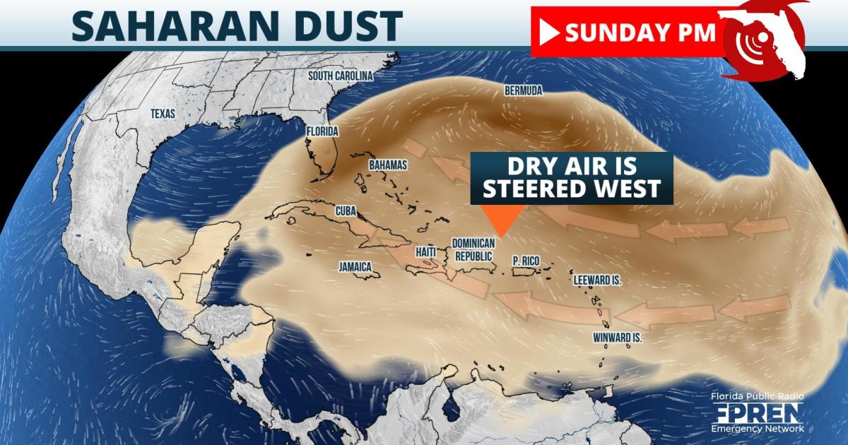
A large outbreak of Saharan dust several hundred miles east of the Lesser Antilles is well-defined on satellite imagery. The dry, dusty air is normally kicked off by the northern fringe of tropical waves moving from east to west across the African continent. The dust is often elevated 1 to 2 miles above the ground as it moves from east to west across the tropics. Oftentimes, the dust plume can cause a reduction in the number and intensity of tropical storms and hurricanes as it moves across the Atlantic.
 The latest models that simulate aerosol movements predict that the dust could reach parts of southern Florida as soon as Sunday before spreading northward over the remainder of Florida on Monday. The dust could spread northward into parts of Georgia and the Carolinas either on Monday or Tuesday of next week, but that is a bit more uncertain. The primary impact will be colorful sunrises and sunsets as the rays of the sun refract off of the dust particles in the atmosphere.
9(MDA5NDY0MjA5MDEzMzcwMjQ4MTUxZWMwMg004))


