Powered by WUFT
Temporarily change filter
Finding your station


 Confidence has increased over the past 48 hours that a tropical depression or storm will form in the southern Gulf by Monday or Tuesday. A credible forecast with regards to how strong it might become or where it will track is just not possible yet, and any social media post claiming to do so should be disregarded.
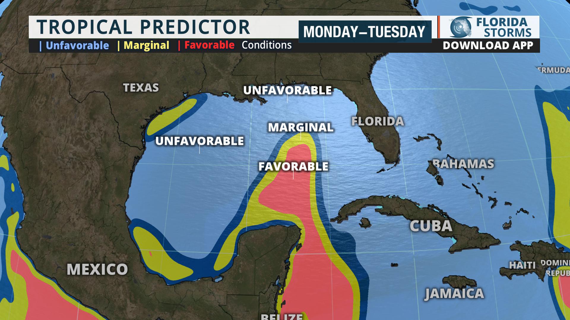
The National Hurricane Center began running forecast models on the system referred to as Invest 93 Saturday afternoon, and hurricane hunters are scheduled to fly out Sunday if necessary. A new tool we call the "Tropical Predictor" factors in future sea surface temperatures, wind shear and water vapor to determine how favorable (or unfavorable) conditions might be for development. There is credence to the idea that cyclone formation may occur just east or north of the Yucatan Peninsula, but conditions appear less favorable for strengthening over the central or northern Gulf.[/vc_column_inner][/vc_row_inner]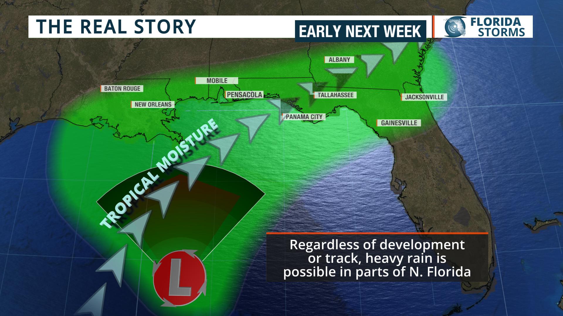 No matter how strong the system becomes or where it tracks, one thing is almost certain. Some locations in Florida, especially in the panhandle, will receive a lot of rain this week. Upper-level winds are likely to steer deep tropical moisture in the general direction of Florida as Invest 93 slowly drifts through the Gulf of Mexico. Where this moisture potentially intersects an approaching front from the north is where the rainfall amounts are likely to be the highest. At the present time, locations most prone to the heavy rain are in the panhandle and north-central sections of the state. While it's too early for specifics on amounts, flooding is a possibility this week where the rounds of heavy rain repeat themselves over the same areas.
We will keep you updated on this site or our mobile app Florida Storms.[/vc_column_inner][/vc_row_inner]
1885 Stadium Road
PO Box 118405
Gainesville, FL 32611
(352) 392-5551
A service of WUFT at the University of Florida College of Journalism and Communications


Partners of the Florida Public Radio Emergency Network include: Florida's Division of Emergency Management, WDNA (Miami), WFIT (Melbourne), WMFE (Orlando), WFSU (Tallahassee), WGCU (Fort Myers), WJCT (Jacksonville), WKGC (Panama City), WLRN (Miami), WMNF (Tampa-Sarasota), WQCS (Fort Pierce), WUFT (Gainesville-Ocala), WUSF (Tampa), WUWF (Pensacola) and Florida Public Media.
This page uses the Google Privacy Policy and UF's Privacy Policy
