English English Spanish Español
Powered by WUFT
Temporarily change filter
Finding your station

Unusual, but Brief Dry Spell on the Way

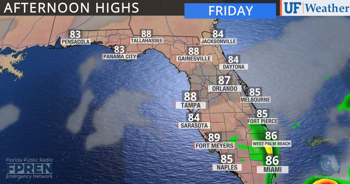
Comfortable temperatures and dry weather is not something Floridians experience very often in June.  Thanks to this week's unusual front, that's just what's in the forecast heading into the weekend.

Evidence of the air mass change was already noticeable in north Florida.

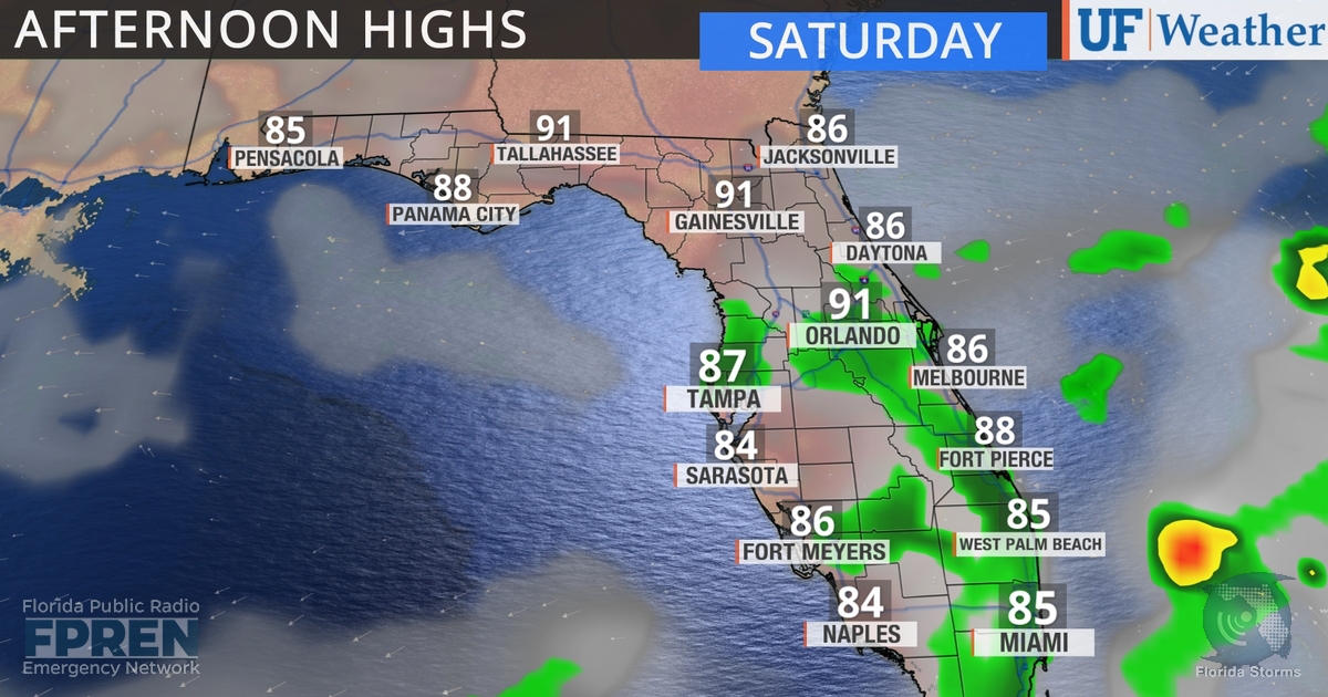
Rain chances are non-existent today across all areas of the state north of the I-4 corridor.  In South Florida, any afternoon shower activity should be confined to mainly inland areas or near the Miami metro.  Rain chances remain low Saturday, but do creep a bit further north.

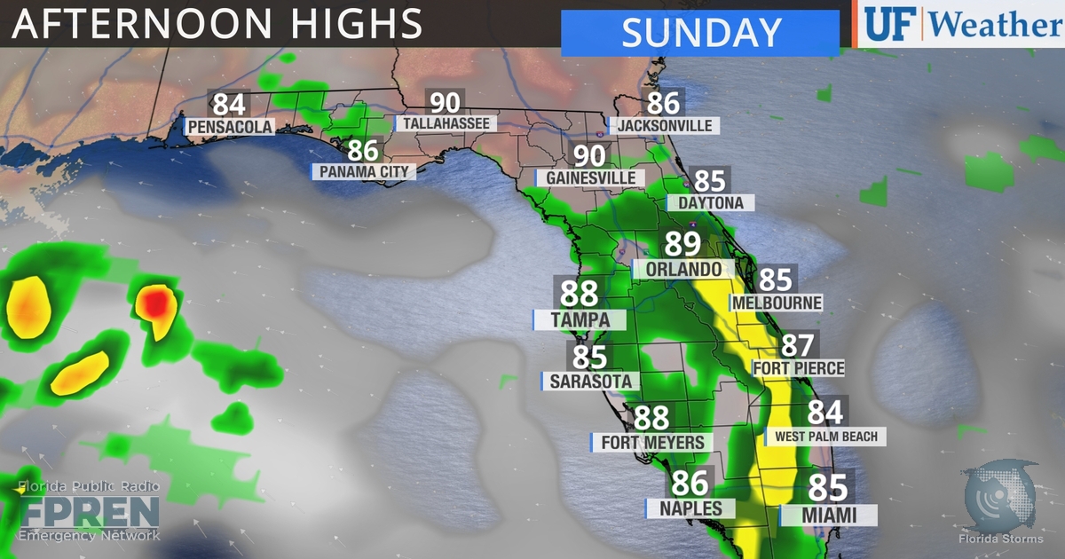
The higher humidity Floridians know so well this time of year will be quick to return. By Sunday, rain chances return to typical levels across much of the peninsula and most inland locations will see a sea breeze shower or thunderstorm.

LOCAL ALERTS
WEATHER
NEWS
TRAFFIC
Sources include nearest National Weather Service office, National Hurricane Center, and the Florida Public Radio Emergency Network (@FloridaStorms).
Sources include nearby emergency management agencies, FEMA, and your local NPR affiliate. 
Sources include the Florida Department of Transportation, Florida Highway Patrol and other nearby traffic information.

1885 Stadium Road
PO Box 118405
Gainesville, FL 32611
(352) 392-5551

A service of WUFT at the University of Florida College of Journalism and Communications 

Partners of the Florida Public Radio Emergency Network include: Florida's Division of Emergency Management, WDNA (Miami), WFIT (Melbourne), WMFE (Orlando), WFSU (Tallahassee), WGCU (Fort Myers), WJCT (Jacksonville), WKGC (Panama City), WLRN (Miami), WMNF (Tampa-Sarasota), WQCS (Fort Pierce), WUFT (Gainesville-Ocala), WUSF (Tampa), WUWF (Pensacola) and Florida Public Media.

Loading...
linkedin facebook pinterest youtube rss twitter instagram facebook-blank rss-blank linkedin-blank pinterest youtube twitter instagram