An area of low pressure is expected to form near the Yucatan Peninsula this weekend, and the National Hurricane Center says it has a "medium" chance of developing into a tropical depression early next week.

Several cluster of thunderstorms were seen on satellite data Friday morning in the western Caribbean, but there was no defined area of circulation or low pressure.
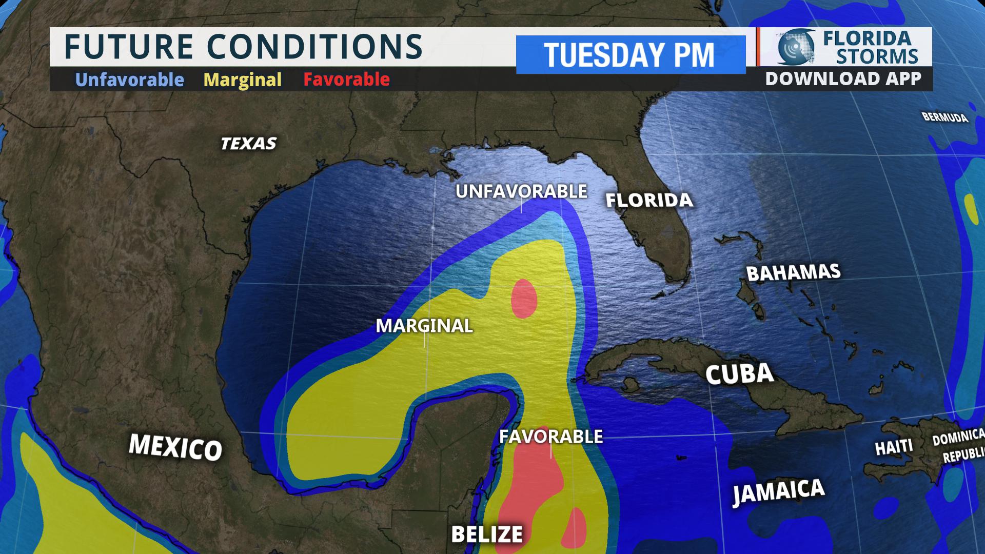
Until a low forms, reliable forecast data (such as the spaghetti models) isn't available to make credible predictions on what may form, much less where it may go. Nonetheless, an consensus of future oceanic and atmospheric data in the region suggest that marginally favorable conditions for development will be in place by Tuesday. Conditions may be UNfavorable, however, further to the north by midweek.
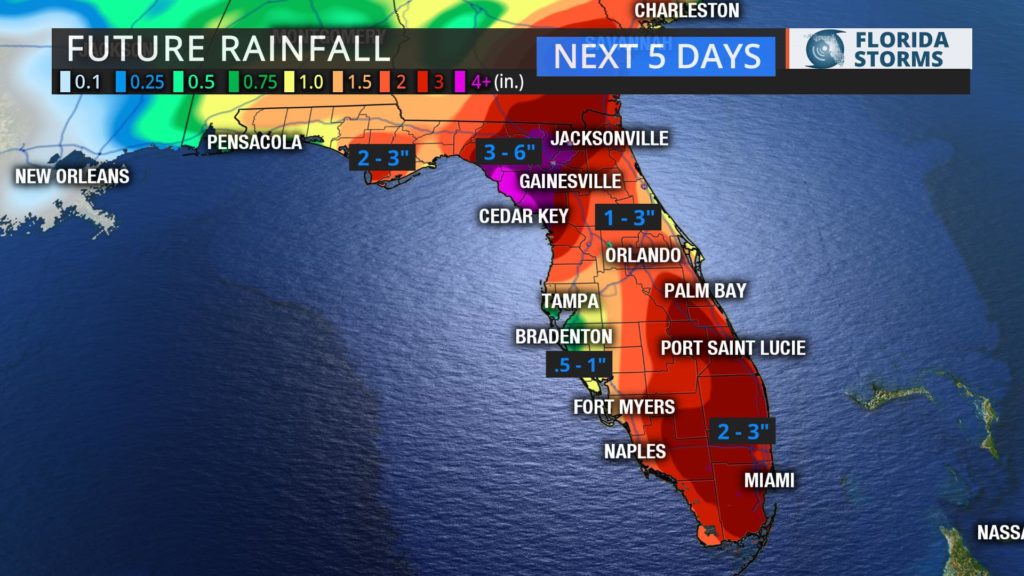
Whether this area of disturbed whether organizes into a tropical entity or not, tropical moisture is likely to return to the Sunshine State (which has been anything but that lately) next week. Keeping with June trends so far, above normal rainfall is expected to continue in most areas. The heaviest rain next week will likely fall in parts of north Florida, closer to a weak frontal boundary that is projected to drift close to the Florida-Georgia border by midweek.