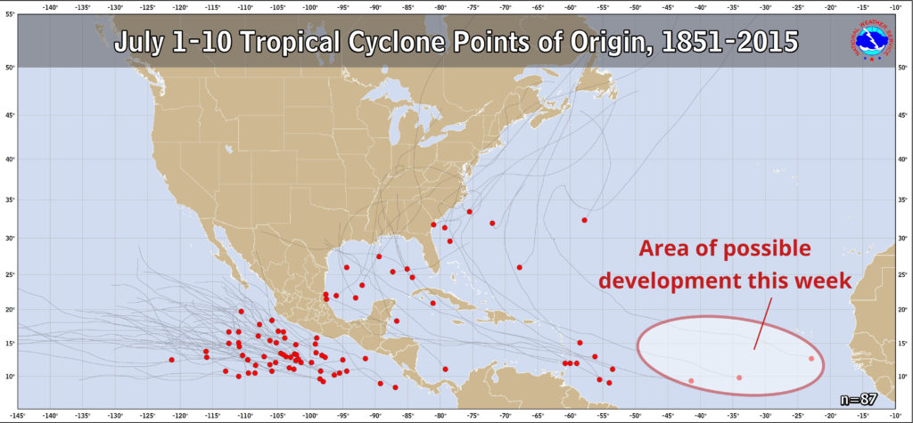
Since 1851, only three tropical cyclones have formed in the central or eastern Atlantic during the first ten days of July. The National Hurricane Center says it may happen this week.

The red dots represent where tropical cyclones have formed July 1-10 since 1851. We circled the area where potential development may occur this week.
Related: Will the Unusually Active June Lead to an Active Season?
A tropical wave 450 miles southwest of the Cabo Verde Islands has been identified as having a "medium chance" of becoming a tropical cyclone in the next five days. If it were to strengthen into a tropical storm, it would be the fourth named storm of the season and called Don.
Long range forecast data suggests the system will move west-northwest at around 10 mph through the week and potentially be located a few hundred miles northeast of the Leeward Islands by Friday. There are no tropical weather threats to the United States or Florida in the next five days.
