Future rain over the next three days.
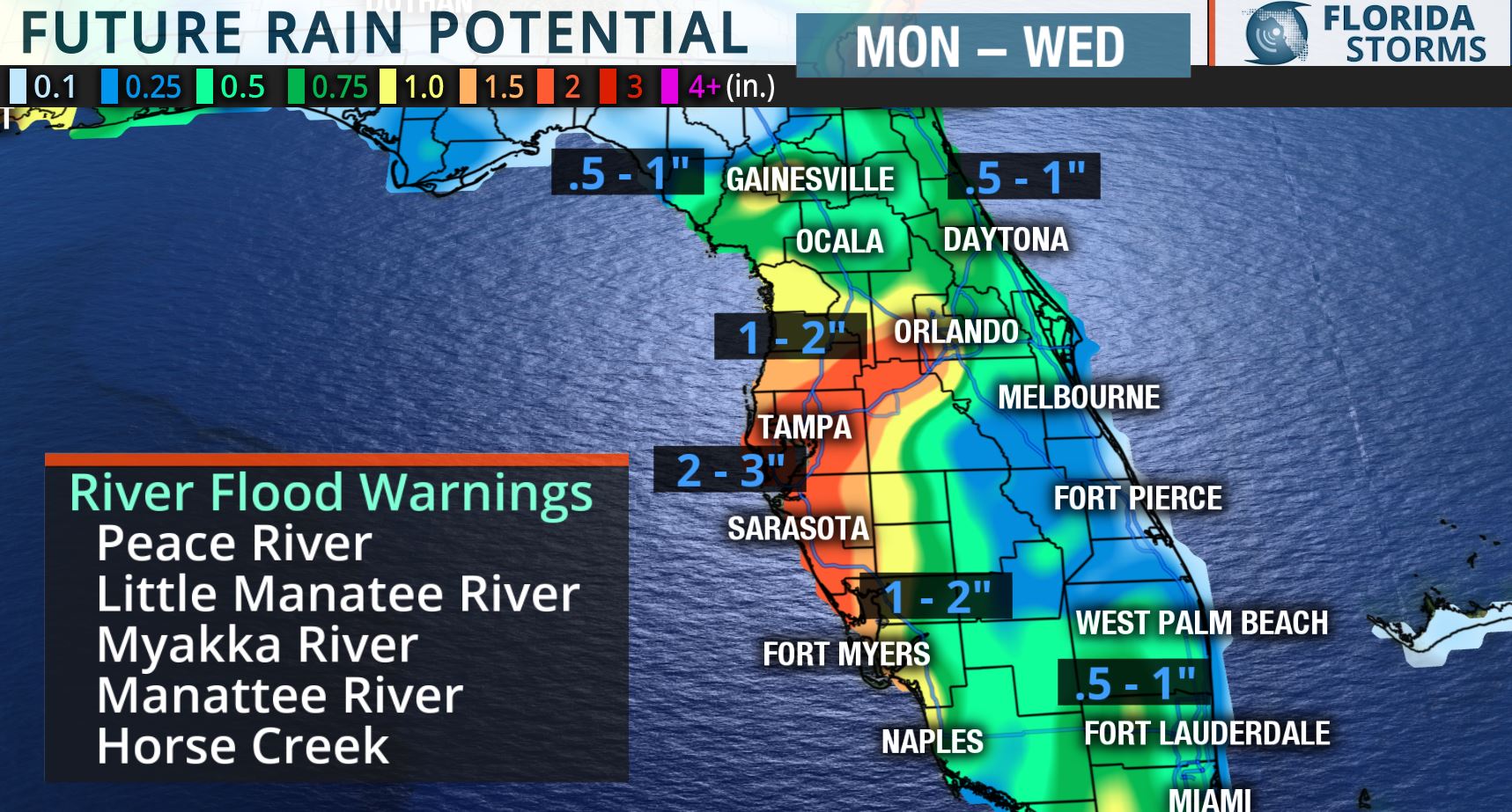
Flooding is expected along many rivers in west-central Florida over the coming days, and additional heavy rain may also cause urban and street flooding in and around the Tampa, Sarasota and Ft. Myers metro areas. Three to four inches of rain has already fallen in parts of Lee, Sarasota and Manatee counties since Friday, and another one to three inches is possible through Tuesday. The rain will become lighter and less widespread by Wednesday as higher pressure replaces the departing tropical storm system.

Gusty winds and waves of 4 to 6 feet possible along the Atlantic coast.
An onshore flow from the northeast will be persistent for a couple of days as the tropical system moves away from Florida. Sustained winds of 20 to 30 mph, with higher gusts close to 40, are expected along the First Coast on Monday. Wave heights of 5 to 7 feet are possible in near-shore waters and there will be an elevated risk of rip currents at all area beaches through Tuesday. Boaters and beach-goers are urged to use extreme caution, and only experienced swimmers are advised to enter the water through midweek.


