Summer and winter will collide tonight in Florida. Thunderstorms with a tornado potential and wet snow could occur simultaneously in the Sunshine State as a powerful early winter storm moves through.
Areas near and south of the I-4 corridor are most at risk for the severe weather, while locations in the extreme western side of the panhandle are most likely to see some flakes of snow overnight. The first freeze of the season will also be possible across the northern third of Florida over the weekend as the storm departs.As of Friday afternoon, there was more than a 40-degree temperature spread across Florida.
More than a 40-degree spread in temps this afternoon from #Pensacola to #Miami (left). Notice how also much of north-central Florida has warmed while the panhandle is getting colder (right), a sign that the front is strengthening & sharpening. #flwx pic.twitter.com/fp0U2puwI8
— Jeff Huffman (@HuffmanHeadsUp) December 8, 2017
The boundary separating the two air masses was stalled from Cedar Key to St. Augustine, where numerous thunderstorms were developing late Friday afternoon. As an area of low pressure intensifies in the Gulf of Mexico, the cold front will begin to march southeast again and trigger multiple lines of thunderstorms ahead of it.
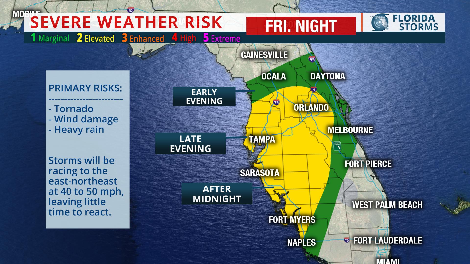
The strongest storms will be capable of producing damaging wind gusts to 60 mph and even an isolated tornado or two. The highest risk of the severe weather will be near the following metro areas at the times listed below...
Gainesville/Jacksonville - 6 pm to 10 pm
Ocala/The Villages - 8 pm to 12 am
Tampa/Orlando - 10 pm to 2 am
Sarasota/Melbourne - 12 am to 4 am
Ft. Myers/Ft. Pierce - 2 am to 6 am
Miami/West Palm - 6 am to 10 am
[vc_empty_space]


