It was a frigid week by Florida standards, but a big warm up is on the way this weekend. And it might just last until Christmas.
A big pattern change is on the way...
Huge pattern change happening this weekend. After a week of below normal temps, Florida will be “Florida” again starting Sunday. #flwx pic.twitter.com/EYR1bhz2cA
— Jeff Huffman (@HuffmanHeadsUp) December 15, 2017
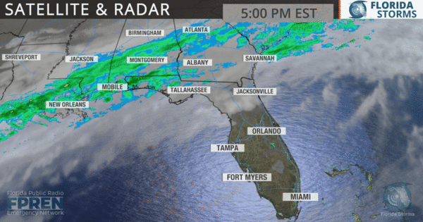
Evidence that change was about to occur could be seen Friday. The subtropical jet stream, noted by the large area of cloudiness stretching from Texas to Georgia on the satellite image below, was starting to move north. This is a sign that higher pressure from the lower latitudes is moving in.
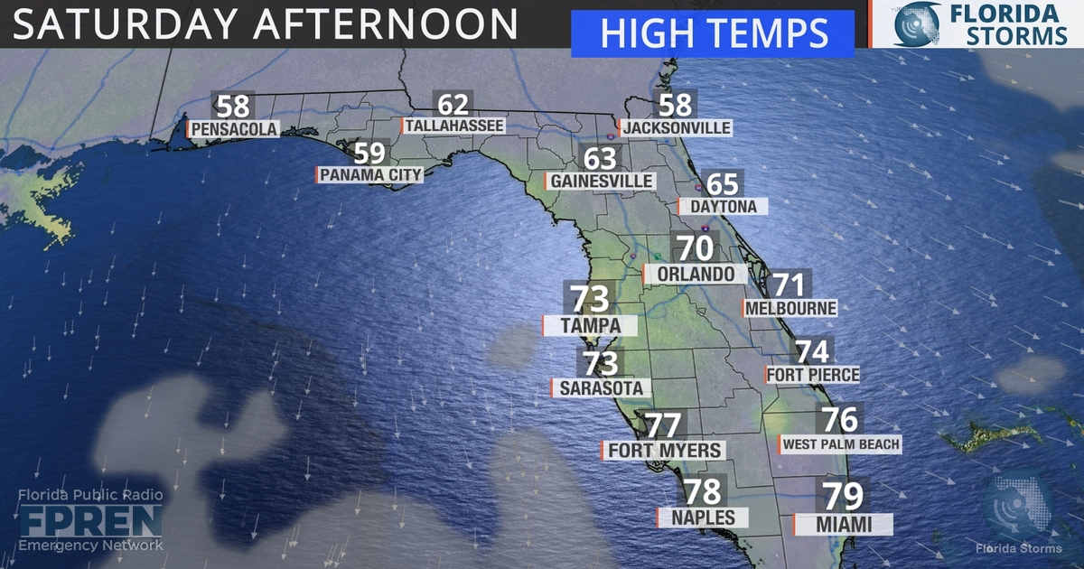
 Before the warmer weather arrives, a weak cold front will move through at least the north half of Florida early Saturday. This will be the third front in one week for many Floridians, making for a cool start to the weekend Saturday.
 Winds will turn to the south or southwest Sunday, and this will send the cold air packing.
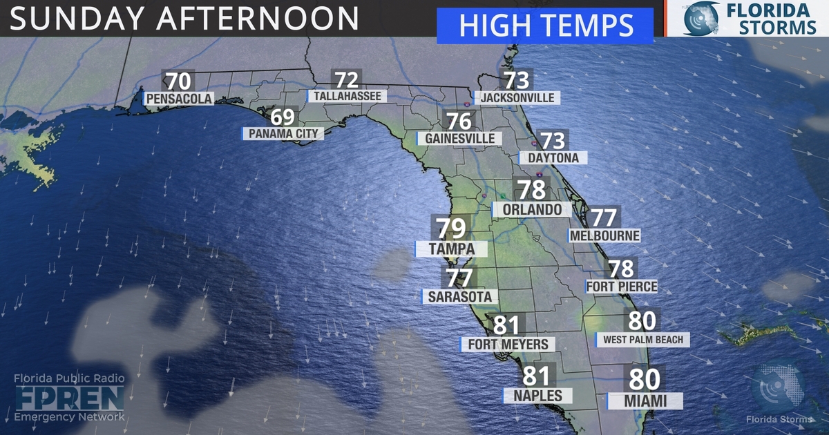
Warmer air will follow and make itself at home in Florida for several days, especially across the peninsula. The southwest flow will likely bring clouds and rain into the portions of the panhandle by late Monday or Tuesday, limiting the warmth in those areas by midweek.

Above normal temperatures are expected from Tallahassee to Miami starting Monday, with highs possibly even reaching the 80s in some spots. Even though clouds and showers may limit daytime heating in some areas by midweek, the warmer-than-normal weather is likely to last through at least the end of the week. Some long range forecast data even suggests the warm pattern will be in place across Florida through Christmas Day.


