The eastern third of the country, including the Sunshine State, is experiencing a “January thaw” this week. And yes, there is some science to it. But with another arctic air mass looming this weekend, the warm up will be brief. Subfreezing temperatures are possible again in north Florida by Sunday or Monday morning.
The history books in many cities east of the Mississippi River show a subtle, but brief rise in average temperature around the middle of January . It doesn't happen every year, but there is typically a break in the cold weather pattern this time of year thanks to the wavy nature of the jet stream. This river of air at high altitudes can deliver arctic air when it moves south, or make way for warmer subtropical air when it lifts north.
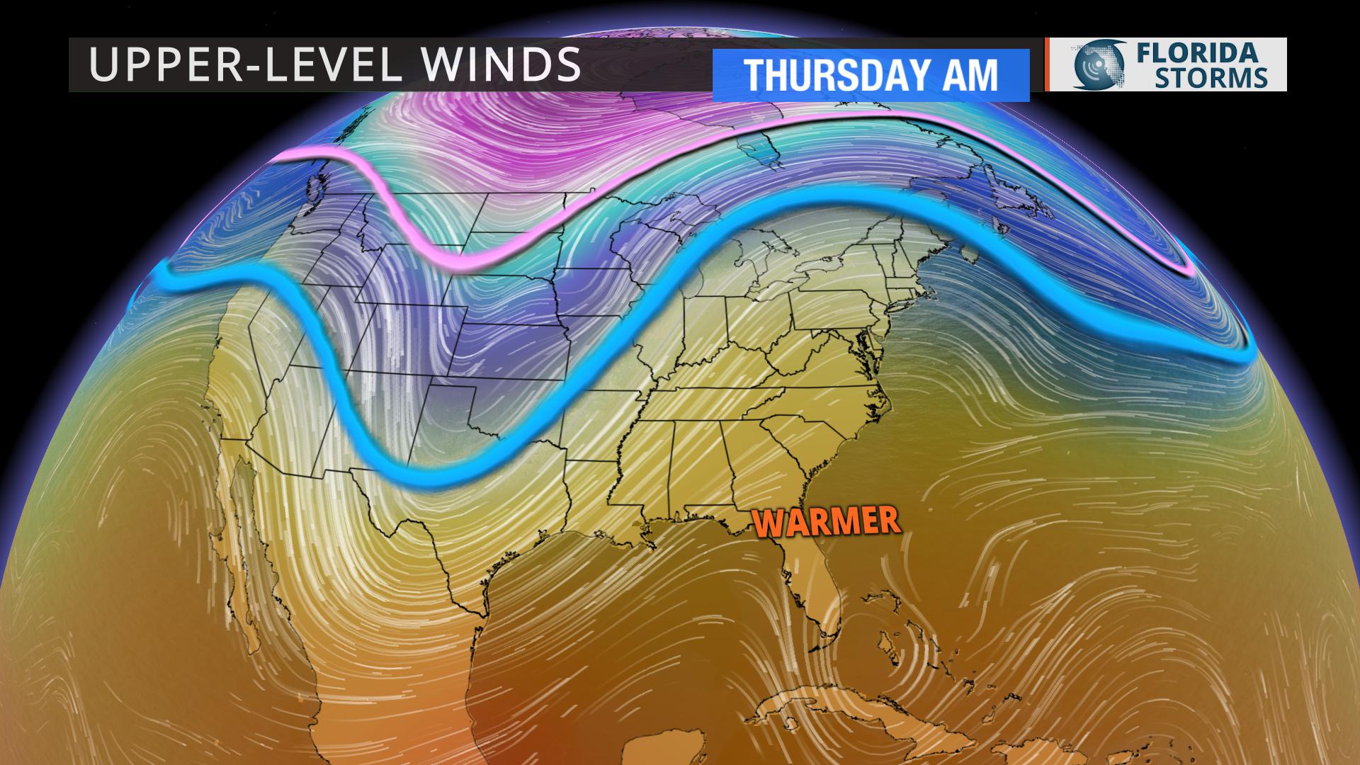
This week, an area of high pressure will create a sharp ridge in the jet stream, sending it as far north as the Ohio Valley and New England by Thursday. This will allow temperatures to warm 20 to 25 degrees above normal in several states, melting the snow and ice that has been piling up since late December in some areas. Nighttime temperatures are even likely to stay above freezing as far north as the Canadian border.
Winter weather extremes don't always affect Florida, but they certainly have this year. The first week of 2018 was one of the coldest on record. From iguanas falling out of trees in Miami to the ice-covered roads near Tallahassee, reptiles and humans alike will appreciate the warm up. Temperatures across the state will be 10-15 degrees warmer than normal January highs during the second half of the week.
Gainesville - normal 66, forecast 76
Pensacola - normal 60, forecast 71
Tallahassee - normal 64, forecast 74
Tampa - normal 70, forecast 77
Ft. Myers - normal 74, forecast 80
Daytona Beach - normal 68, forecast 76
Orlando - normal 71, forecast 81
Jacksonville - normal 66, forecast 75
Miami - normal 76, forecast 78
West Palm Beach - normal 74, forecast 77
The January thaw is a great time to enjoy a short break from the winter weather, but it usually doesn't last long. Right on cue, yet another arctic air mass is headed in this weekend, sending temperatures back below normal in most of Florida by Sunday.
Meteorologist Jeff Huffman contributed to this story.


