A few of the thunderstorms with Tuesday's front might turn severe, capable of producing damaging wind gusts. An isolated water spout or tornado is also possible immediately near the coast. Locations at greatest risk include coastal areas of the panhandle and west-central Florida, shaded in yellow on the map below.
 Some areas, especially near Tallahassee, have been in a moderate drought since November.

Drought index as of March 1st, courtesy of the National Drought Mitigation Center.
The large area of rain and thunder will move from the panhandle into much of north-central Florida early Tuesday evening. It will then slide into much of central Florida (the I-4 corridor) closer to midnight, eventually sweeping across south Florida by Wednesday morning.
[reggif type="FutureFL" caption="Most recent Futuretrack animation (also available in the Florida Storms app)"]Tuesday's rain may not completely erase the drought, but it should help in the areas that need it the most.
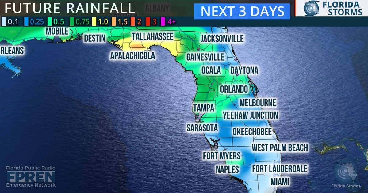
Rainfall forecast over next 3 days, with much of it likely to fall Tuesday and Tuesday night.
At this time last year, a drought was prevalent across central and south Florida, where it turned severe by late spring. Similar global weather patterns, namely the current La Nina cycle in the equatorial Pacific Ocean, often lead to dry and warm winters and a corresponding elevated fire season across Florida.
As of Monday evening, the Florida Forest Service reported that there were 50 active wildfires across the state, burning nearly 6000 acres. These numbers are slightly down from this time last year, when 54 fires were scorching more than 7,000 acres. The long range outlook from the Climate Prediction Center is for a drier and warmer than normal conditions to persist through late spring.


