The two most reliable forecast models were in general agreement Thursday that Invest 90 would move north into the central Gulf of Mexico by Sunday, then slow down and turn northwest toward central portions of U.S. Gulf Coast on Monday. They were also surprisingly in agreement on the system strengthening into a formidable tropical storm before landfall. It should be noted, however, that before a tropical cyclone develops a closed center of circulation - and this won't likely happen until at least Saturday - forecast data is often not scientifically credible.
An Air Force Reconnaissance plane is scheduled to investigate the disturbance Friday, and special (pre-season) updates will be issued by the National Hurricane Center at least every 12 hours until the system develops.Regardless of development, we have been advising that heavy rain and potential flooding are the primary hazards with this system. That is still the case statewide. But in addition to those risks, residents and vacationers along the Gulf coast should also prepare for the potential of other tropical-related hazards, such as coastal flooding, rip currents, water spouts, and even damaging wind.
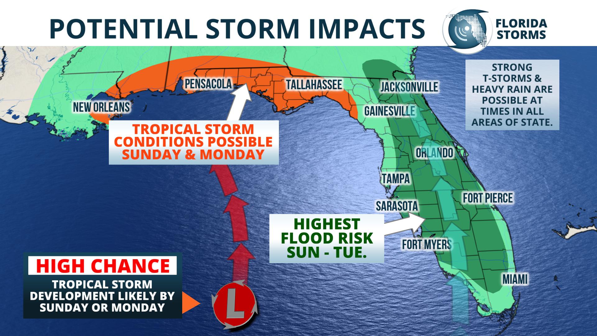
We've broken down the most likely timing of such hazards across the state in the section below.[vc_empty_space]The Florida Public Radio Emergency Network will provide frequent updates on this developing weather story all holiday weekend, both on the Florida Storms social media accounts and in the app Florida Storms.
UF Forecaster Bryan Boggiano contributed to this story.


