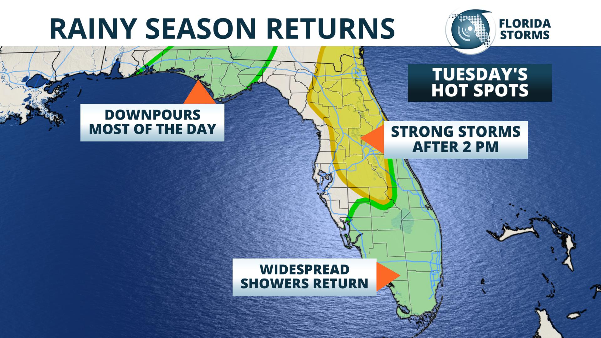
 Tuesday's most widespread and heaviest rain will fall across portions of north and northeast Florida. Although Subtropical Depression Alberto is moving farther away to the north, heavy rain bands will trail the system from the Tennessee Valley to the Gulf of Mexico, which includes a large portion of the panhandle. Locally heavy rain is expected at times throughout the day near cities such as Pensacola, Panama City and Tallahassee.
Further east and south, sea breeze thunderstorms will be enhanced by Alberto's leftover moisture across northeast, north-central and central Florida Tuesday afternoon and evening. A strong Gulf sea breeze is expected to move inland and merge with the Atlantic sea breeze. Strong thunderstorms will locally heavy rain and wind gusts will develop this afternoon from Orlando to Jacksonville, then move northeast from the First Coast to the Space Coast.
In South Florida, deep tropical moisture will lead to showers and storms with locally heavy rain and lightning. A few waterspouts are possible today in Biscayne Bay and along the Atlantic beaches.


