The state has already seen its fair share of tropical weather this spring. Subtropical Storm Alberto drenched most of state over the Memorial Day Weekend, coming ashore near Laguna Beach Monday. And this followed two very wet weeks in a row for most locations, due to a seemingly never-ending barrage of downpours. In fact, May 2018 was among the 10 rainiest on record for most of Florida.
[table id=3 /]
Several cities received near-record amounts of rainfall this past month. Ft. Myers received its wettest May with over a foot of rain, which is 10.1 inches more than they normally receive. Daytona Beach, Ft. Lauderdale, and Miami also collected more than a foot of rain this past May. Daytona Bach experienced its second rainiest May with a total of 12.89 inches. Ft. Lauderdale, Ft. Pierce, and Gainesville had their third rainiest May. Most of this rain fell all within the past two weeks.
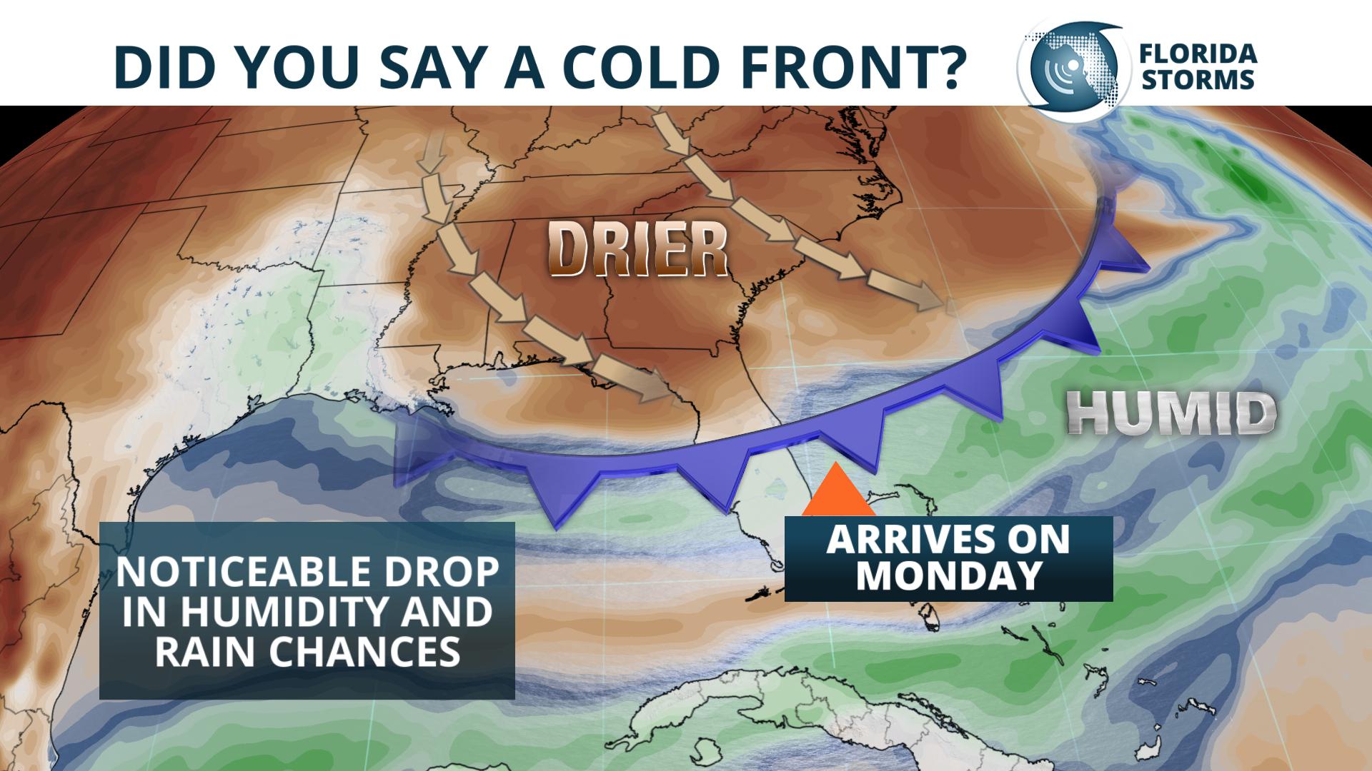
The all-day rain events, such as what was experienced by many on Wednesday, will be taking a break. Any showers or thunderstorms that pop up Saturday and Sunday will form mostly along the sea breezes. The exception to this idea will be in the Florida Panhandle Sunday afternoon. A rare, late-season front is expected to move in from the Mid-South, and thunderstorms may be more numerous in these areas by early evening. Some of the storms may even be strong, potentially producing hail and damaging wind gusts near cities like Pensacola, Panama City or Tallahassee.
This same front is then likely to sweep across the northern two-thirds of the state Monday and Tuesday, effectively bringing an end to the rainier-than-normal pattern for most of Florida during the first full week of June. Across the Atlantic Basin, the tropics are likely to stay quiet for the first week of the season, with no new developments expected.


