Summer began at 6:07 am EDT this morning. Considering sweltering heat and afternoon storms have been occurring for over a month now, it’s a rather anticlimactic event in Florida. And of course, the same pattern is likely to continue for several months.
The U.S. recognizes the start of summer on the summer solstice. At this moment, the sun is directly aobve the Tropic of Cancer in the northern hemisphere, which is at 23.5 N. This is the longest day of the year and the day that the sun’s UV rays are at their strongest in the United States. Each day will start to gradually shorten as the winter solstice nears in December.
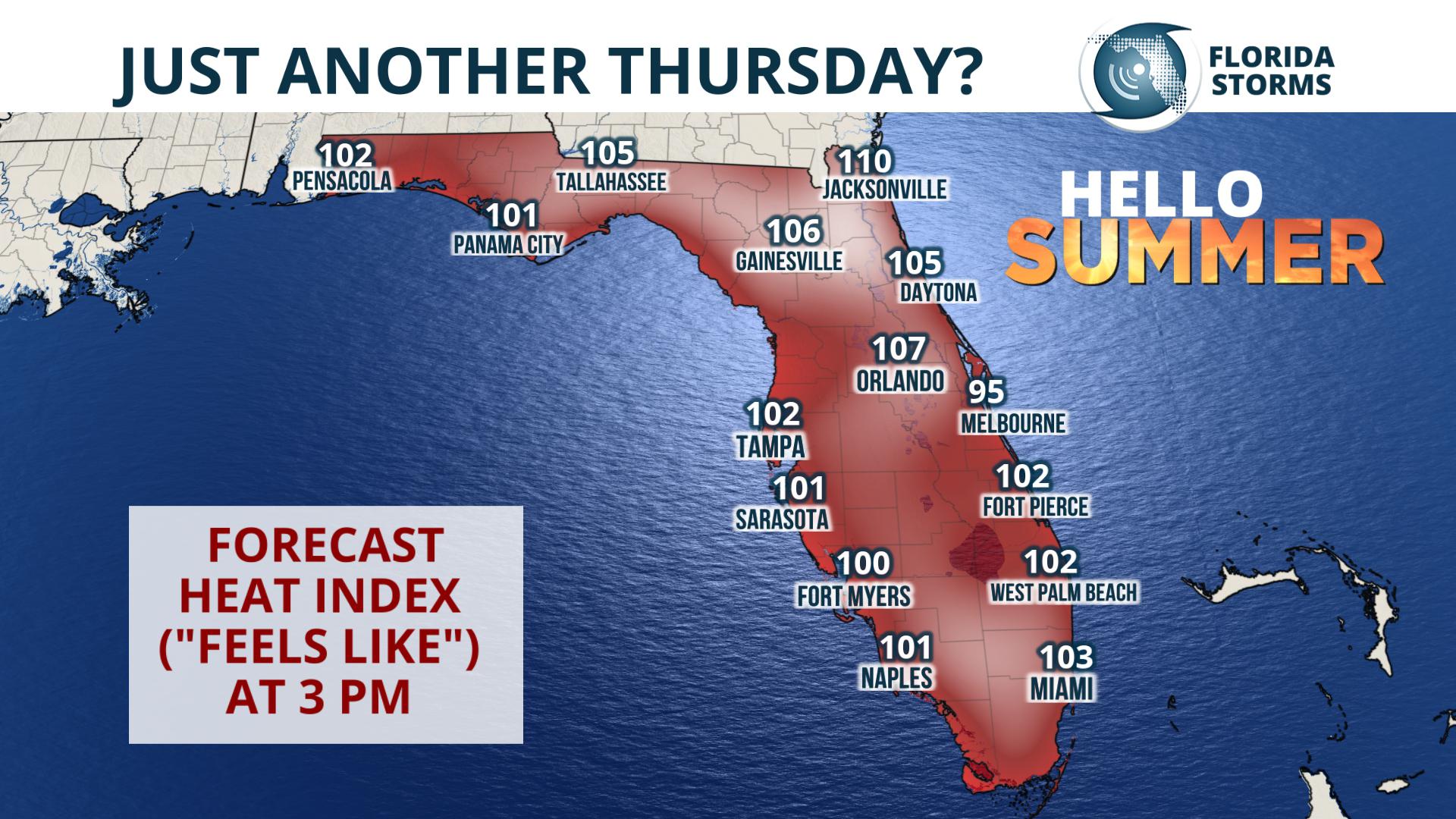 The heat index forecast valid Thursday afternoon around 3 pm.
Since June 1st, which is considered the meteorological start of summer, temperatures have been trending above normal in many areas, but only by a small amount. According to the Southeast Regional Climate Center, 9 of the 14 reporting stations have recorded mean temperatures above the 30-year average since June 1st. Gainesville, Bradenton, and Melbourne have been about two degrees above the mark, and locations trending about one degree above normal include Fort Myers, Tampa, Sanford (Orlando area), Jacksonville, Tallahassee, and Pensacola. The only city coming in cooler than normal in June (so far) is West Palm Beach.
Temperatures in Florida are often directly related to the timing and coverage of the daily thunderstorm cycles. That will be no different over the coming days. Higher rain chances reside across central portions of the state Thursday and Friday, and as a result temperatures will be slightly cooler. Further north and south, along the I-10 corridor and in much of South Florida, the absence of widespread thunderstorm activity will likely send the thermometer soaring into the middle 90’s. And when you add the humidity factor, often referred to as a “feels like” temp, the heat index will spend several hours in the triple digits.


