A tropical wave will move across the peninsula this weekend, enhancing rainfall and potentially washing out holiday plans for many Floridians. The disturbance could even develop into a tropical storm over the Gulf of Mexico the following week.
The system of interest was located just north of Hispaniola Friday morning, producing a large disorganized area of showers and thunderstorms from Cuba to The Bahamas. In their 2 pm tropical outlook, the National Hurricane Center placed odds for tropical development at only ten percent over the next five days. Upper-level winds were noted to be too strong for development until the middle part of next week, when conditions could become “less hostile” as the wave moves into the eastern Gulf of Mexico.If the system becomes a tropical depression or storm, it most likely won't do so until it moves west of Florida. Regardless of development though, heavy rain will be possible from this weather system across a large portion of Florida. The enhancements to the typical diurnal thunderstorm cycle will be most noticeable on Sunday across south and central Florida, spreading into portions of the Florida Panhandle and north Florida on Monday. The heavy rain potential will continue across the panhandle through at least Tuesday, as the system continues to drift west.
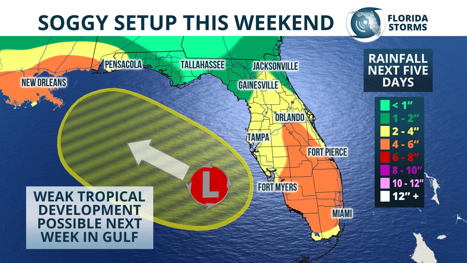
Potential rainfall through Tuesday from a tropical wave crossing the state.
Total rainfall amounts over the next five days will range from 4 to 6 inches across South Florida, 2 to 4 inches across portions of central and north Florida, tapering to 1 to 2 inches across far sections of north and northeast Florida.


