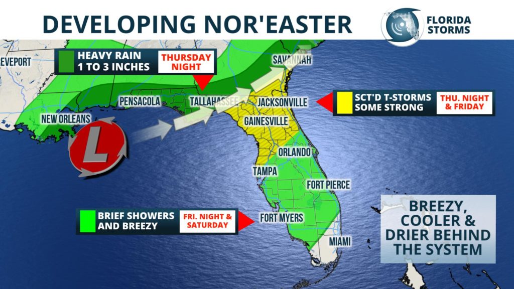
Remnant moisture from a former hurricane will team up with an area of low pressure to soak the northern third of Florida over the next two days. A few strong thunderstorms will also be possible in some areas Thursday night and Friday as a cold front sweeps through the state. The storm system is then forecast to strengthen into a Nor'Easter as it passes over Florida and moves up the East Coast over the weekend.
 The heaviest rain will fall along a slow-moving, northward-advancing warm front Thursday and Thursday night. Showers will begin overspreading portions of the Florida Panhandle Thursday morning, stretching as far east as north-central Florida by late afternoon. A steadier and heavier batch of rain, with a few thunderstorms embedded in, will develop near Pensacola by mid-afternoon and spread east along the Emerald Coast by early evening. This complex of rain and thunder will then likely move toward the Nature Coast and much of north and northeast Florida in the overnight and early morning hours Friday.
The heaviest rain will end by midday Friday across the northern third of the state, but scattered showers and thunderstorms may redevelop in these areas later in the day as a cold front approaches. Further south, along the I-4 corridor across Central Florida, only brief fast-moving showers are expected with the front Friday evening. This same front might also trigger a few showers across South Florida Saturday, but the rain will not be widespread, long-lasting or heavy in these areas.
