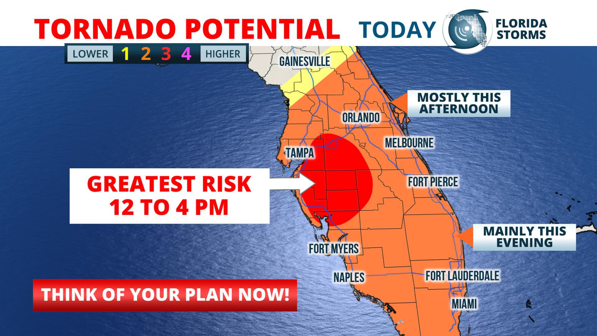
A Tornado Watch has been issued for much of central and southwest Florida until 4 pm Thursday. The watch includes the cities of Tampa, Saint Petersburg, Lakeland, Orlando, Daytona Beach, Melbourne, Sarasota, Fort Myers and Naples.
In addition to the chance of tornadoes, severe thunderstorms could also produce damaging wind gusts up to 70 mph and small hail in the advised area.
As of 9 am Thursday, several Tornado Warnings had already been issued by the National Weather Service across portions of central Florida with the first complex of storms. A tornado was reported by emergency managers to have caused damage 9 miles northwest of Myakka City, FL at 7:40 am. This first round of cells are expected to move northeast along the I-4 corridor toward the Space Coast by late morning.
The Tornado Watch was issued primarily in anticipation of the next round of thunderstorms likely to move in from the Gulf of Mexico ahead of a strong front. The leading edge of this squall line will be capable of producing destructive winds and isolated tornadoes. Rotating super cells, the kind that often produce strong tornadoes, are also possible in advance of the squall line across sections of southwest and central Florida.
Based on the most recent forecast data, the most likely arrival times of the next round of severe weather are listed below...


