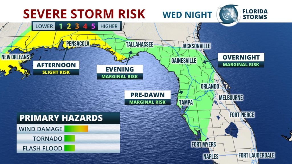
A few strong thunderstorms are possible across the Florida Panhandle Wednesday evening, then across portions of the peninsula early Thursday morning.
 A fast-moving cold front is expected to sweep through the state over the next 24 hours, triggering a line of showers and thunderstorms ahead of it. The primary hazard from the strongest cells will be damaging wind gusts up to 60 mph, although an isolated tornado can not be ruled out. Periods of heavy rain are also possible for a two to four-hour period of time before the front arrives in much of north and central Florida overnight. The front is then expected to weaken before it clears South Florida Thursday afternoon and evening.
Rainfall amounts of over an inch are possible are possible in most areas along and north of the I-4 corridor. The heavy rainfall rates could cause some brief, localized flooding in some spots. Low-lying areas and locations who have received heavy rain recently are most prone to the spotty flooding.
A strong onshore wind is expected to develop ahead of the front, which will kick up the seas and send large waves crashing ashore along portions of Florida's Gulf Coast. A Coastal Flood Advisory has been issued for the Big Bend Region from Apalachicola to the Dixie-Levy county line, and High Surf Advisories are in effect for the Emerald Coast and Sun Coast. Gale Warnings are in effect
