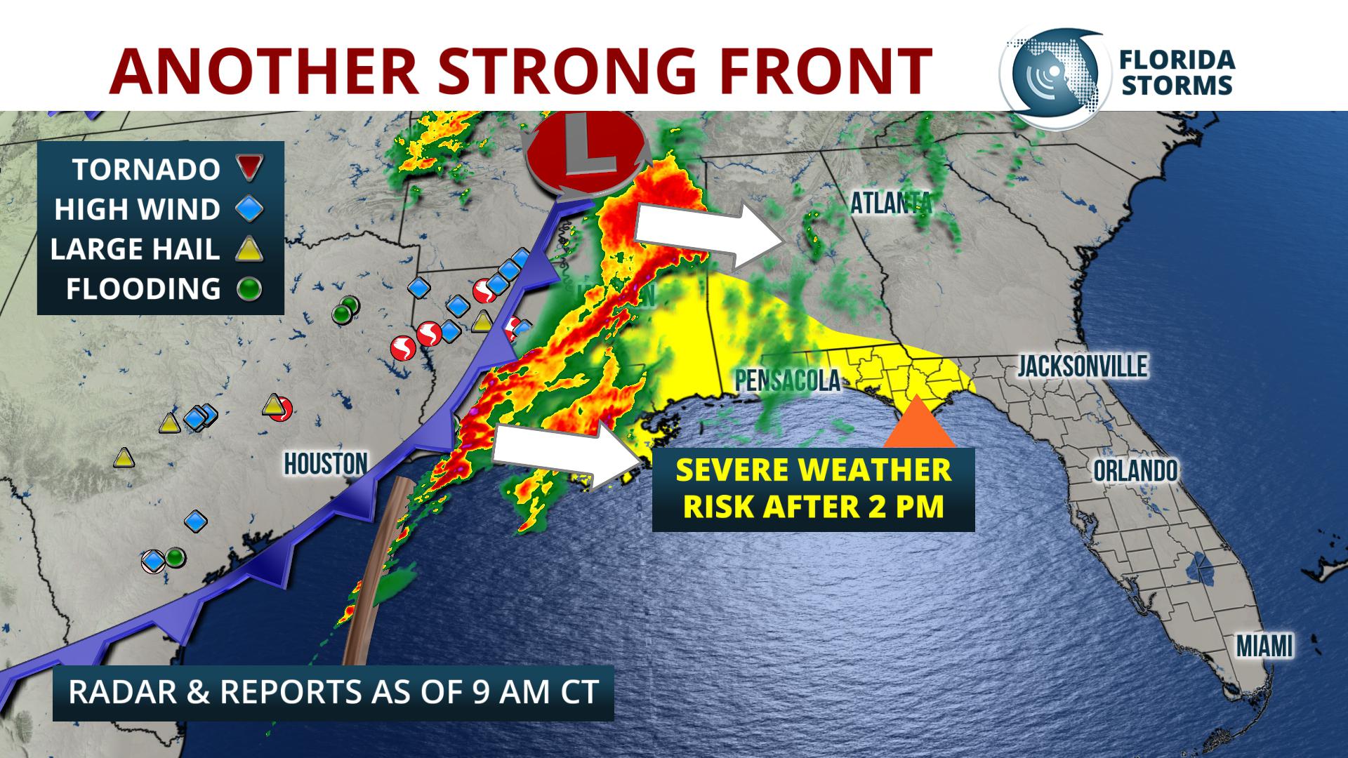
Wind damage or a tornado is possible in the Florida Panhandle Thursday evening, thanks to another strong cold front moving in.
The front had already produced a reported five tornadoes and 23 instances of wind damage across Texas and Louisiana Wednesday night.
The Storm Prediction Center has placed the Florida Panhandle from Pensacola to Panama City under a “slight risk” for severe thunderstorms Thursday afternoon and evening. A more marginal risk exists overnight near Tallahassee and Florida's Big Bend.
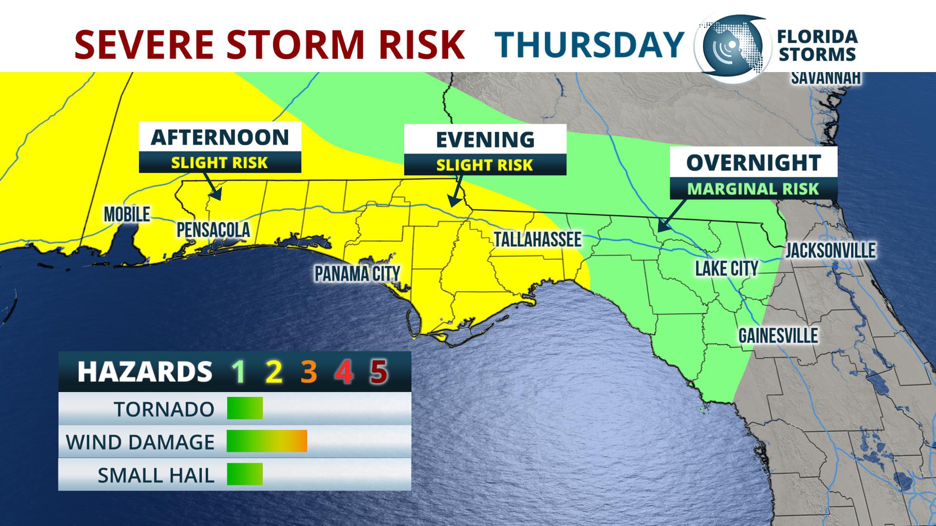
The line of storms will approach Pensacola after 3 pm CDT, and then move east towards Panama City between 6 and 10 pm CDT. Later in the night, likely after 9 pm ET, the storms will approach areas near Tallahassee and Florida's Big Bend.
Pensacola - 3 to 6 pm CDT
Panama City - 6 to 10 pm CDT
Tallahassee - 9 pm to 3 am EDT
The threat for severe weather shifts to the Nature Coast, Sun Coast, and portions of north and central Florida on Friday, including the greater Tampa Bay metro area. Strengthening winds in the mid levels of the atmosphere will support the potential for damaging wind gusts with the same line of cells that moves through the panhandle Thursday. This could heavily impact the morning commute in cities like Gainesville, Ocala, and Tampa.
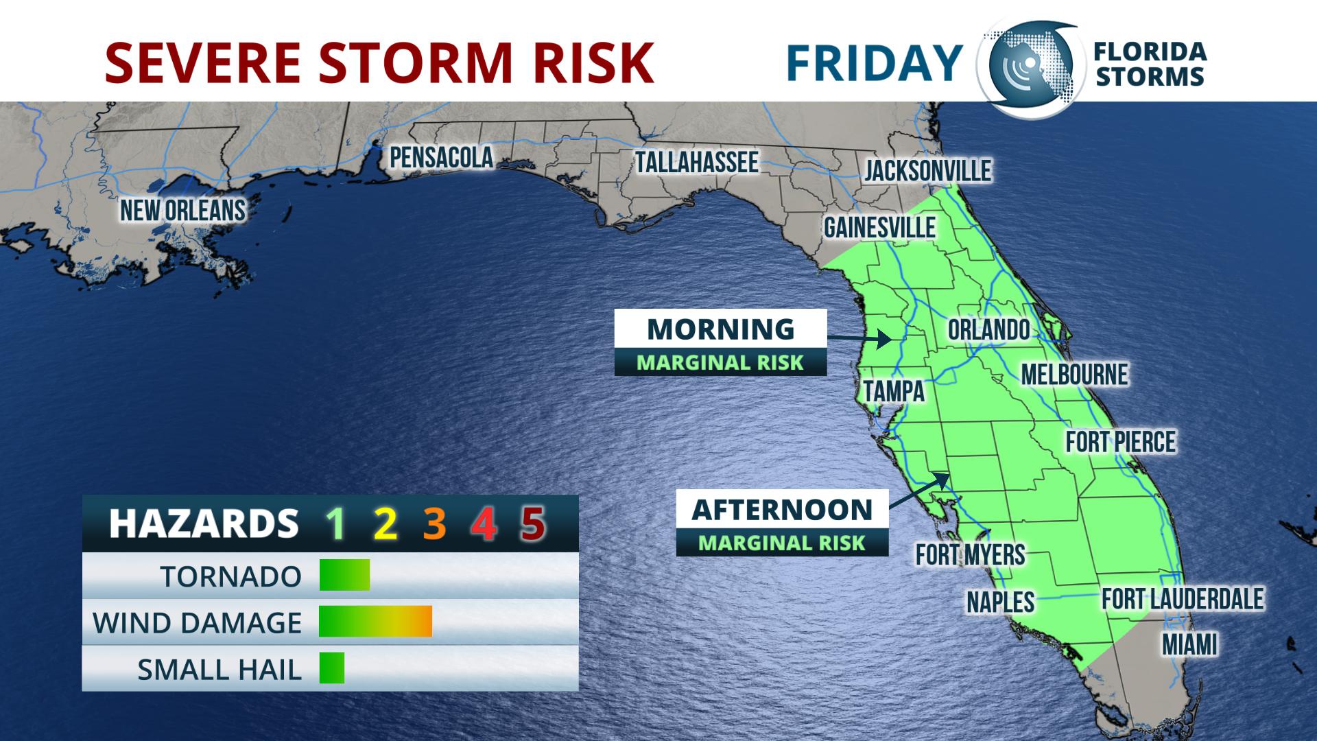
Approximate arrival times of the heavy rain and gusty winds are listed below.
Gainesville/Ocala - 4 to 8 am.
Tampa - 6 to 10 am
Sarasota - 7 to 11 am
Orlando - 8 am to Noon
Ft. Myers - Noon to 4 pm
Naples - 2 to 6 pm
The front responsible for the unsettled weather is expected to weaken as it approaches areas of South Florida, lessening or evening eliminating the risk of damaging thunderstorms altogether for cities like Miami and West Palm Beach. A much quieter weekend is in the forecast for the entire state of Florida, thanks to a ridge of higher pressure building in on Saturday.


