Florida's skies are usually filled with darkening clouds and flashes of lightning this time of year. Instead, the smell of smoke and a milky haze have been observed in many areas. A historic heat wave and abnormally dry weather pattern have contributed to an environment favorable for the spread of fires, and conditions are not expected to improve much through early next week.
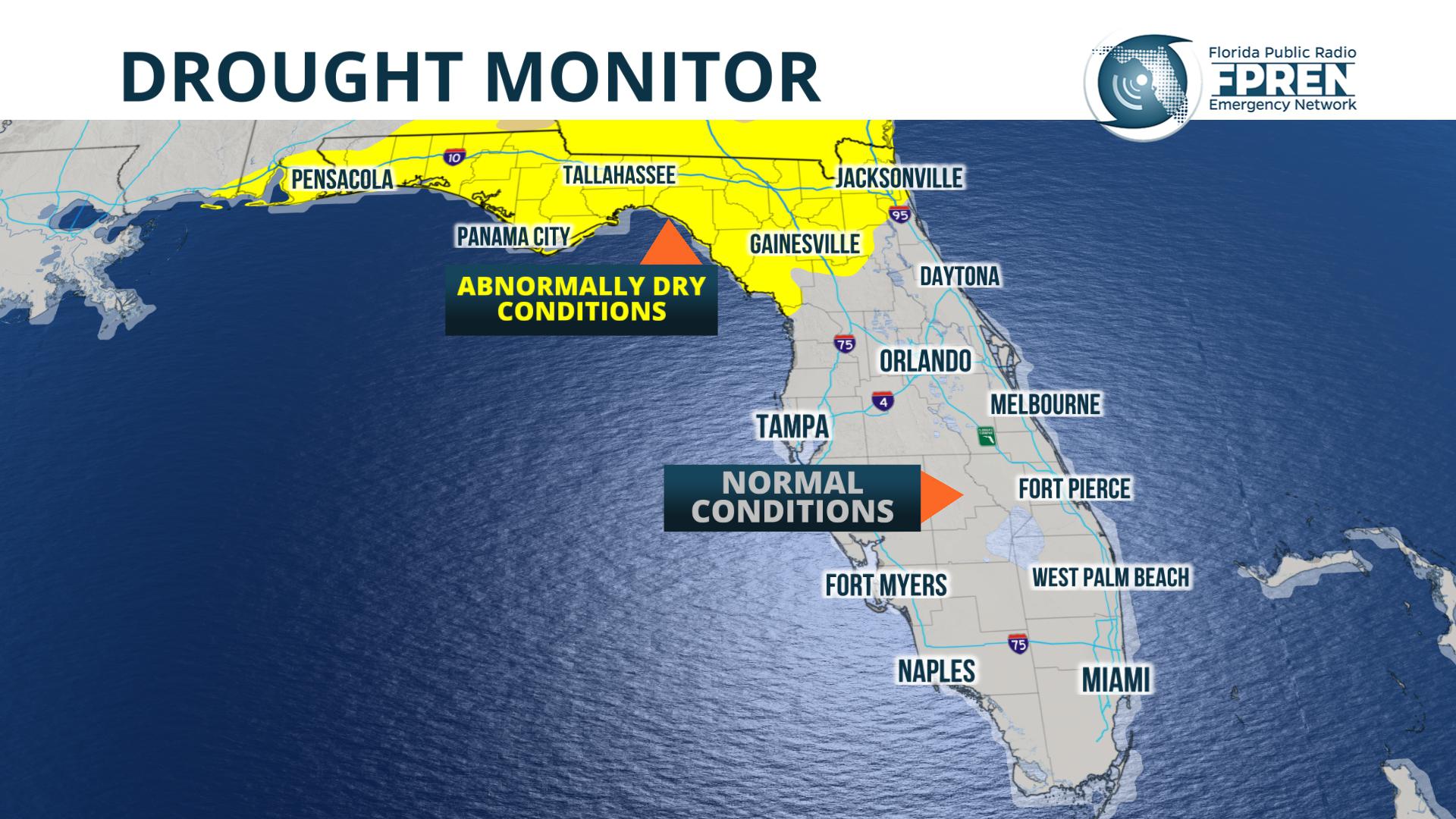
The US Department of Agriculture says much of the Florida Panhandle and North Florida have had abnormally dry conditions over the past few months, with moderate drought conditions possibly developing in the next couple of weeks. 30-day rainfall deficits in much of north and northeast Florida are between 2 to 4 inches, and according to NOAA's Climate Prediction Center, below normal rainfall is in the forecast for the next 6 to 10 days.
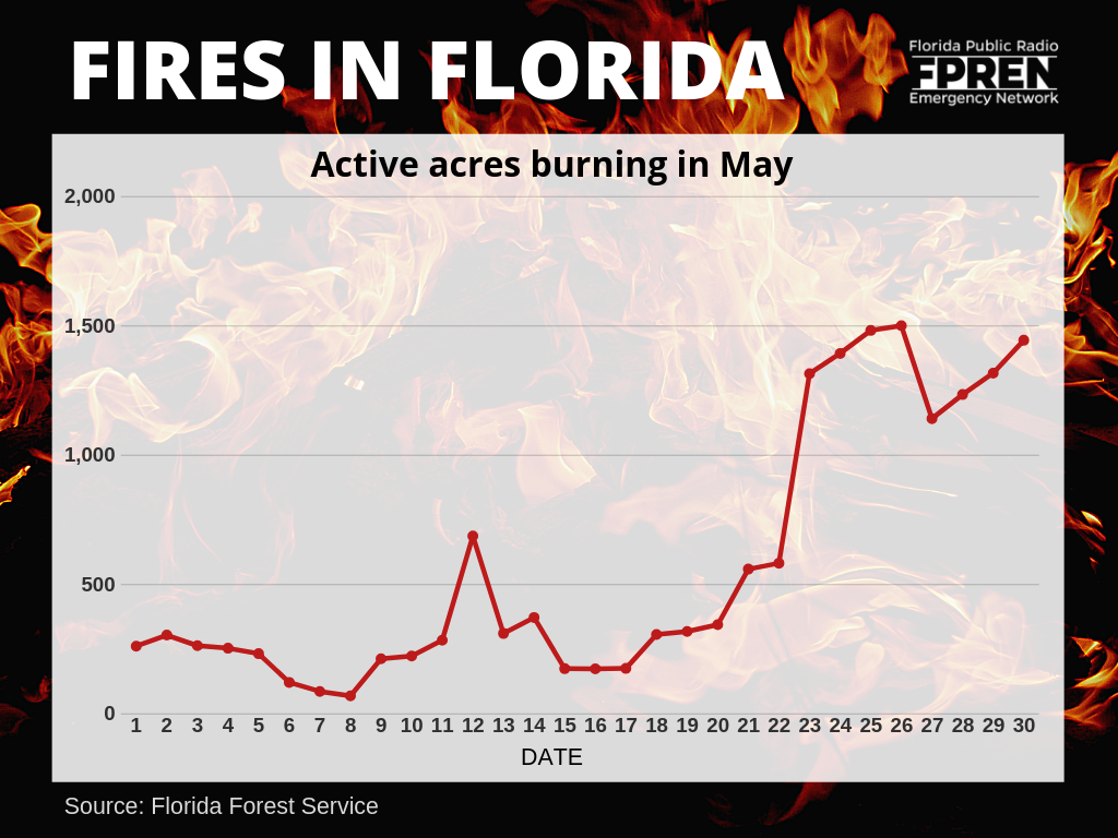
More than 60 fires were actively burning upwards of 1500 acres across the state, according to a report from the Florida Forest Service on May 30. Two of them have been particularly large and disruptive in the past week. The Yellow Bluff fire grew to over 600 acres, forcing the temporary closure of I-95 north of Jacksonville just before the Memorial Day weekend. A fire in the Ocala National Forest Wednesday prompted the evacuation of 200 homes near Ocklawaha. Both blazes have since been extinguished, although seven others were not yet considered “contained” as of Friday morning.
A weak cold front approaching the state this weekend may trigger a few showers and thunderstorms, but they will only be widely scattered in nature. If the rainfall is not widespread and long lasting, a thunderstorm can actually exacerbate the wildfire problem. Of the state's 138 wildfires this month, 39 of them have been started by a lightning strike. 24 were started by non-authorized burns, 15 were ignited by an incendiary device, and 5 began as campfires that spread out of control.
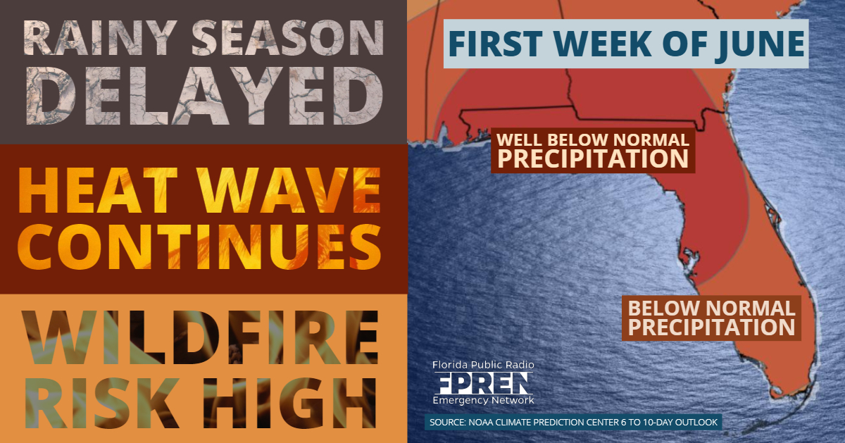
Longer range forecast data suggests a change in the wind pattern will take place next week, which will allow deeper moisture to move in from the south or southwest. This will likely lead to more coverage of daily thunderstorm activity, which should begin to reduce the risk of wildfires. The state's rainy season normally begins in late May, but this year's wet pattern is more likely to gradually develop during the first two weeks of June.


