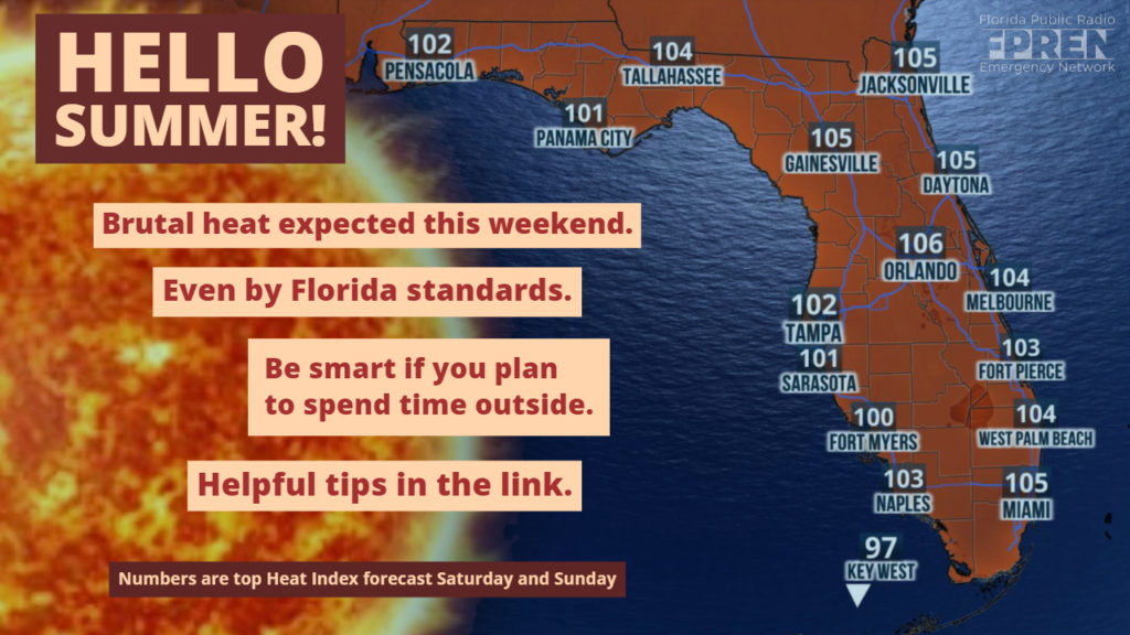
The summer solstice arrived Friday, which usually means nothing in Florida. It’s been hot for weeks. However, this weekend’s heat reaches a new level. Sweltering!

The persistent feed of moisture that dumped a foot of rain over parts of the Peninsula the past two weeks is shutting down. Replacing it will be an upper-level area of higher pressure. The air mass at this altitude is much drier, and with the sinking air will come fewer thunderstorms.
The drier, hotter trend began Friday.
With fewer storms, the strong June sun angle will boost temperatures into the middle 90s for areas away from the beaches. Unlike the heatwave experienced in May, the air closer to the ground is far more humid from recent rain. The combination of higher humidity and hot temperatures will boost heat index (or “feels like”) values to 105 degrees or more across the entire state this weekend.
As a member of the Weather Ready Nation, the Florida Public Radio Emergency Network wants to remind you of some heat safety tips.
The heat is something most Floridians have become accustomed to. However, Centers for Disease Control and Prevention say heat-related illnesses become more likely to occur when the temperature or heat index breaches 100 for two or more days in row. For this reason, forecasters at the National Weather Service will be monitoring conditions closely this weekend, and Heat Advisories could be issued.
This latest heatwave is expected to last through the weekend and ease Tuesday or Wednesday of next week. At that time, several model simulations show the area of high pressure breaking down, which should mark a return to more clouds, greater rain chances, and average late June temperatures.
