Widespread thunderstorms have returned to the Sunshine State this weekend, and some of them will be a bit stronger than normal.
This was certainly the case Friday afternoon in Southwest Florida. The photos below were shared by Meteorologist Jason Dunning on Twitter.
Three different angles from the Forum in Fort Myers of the rope funnel cloud and possible tornado touchdown just after 4 o’clock today. Photos from NBC2 News viewers Cedric Hall, Bobby Sarivannara, and Angie Trueblood. pic.twitter.com/wwlFeaporC
— Jason Dunning (@JasonDunning) June 28, 2019
The storm in Fort Myers was one of at least four severe thunderstorms that our team of meteorologists covered on Friday afternoon.
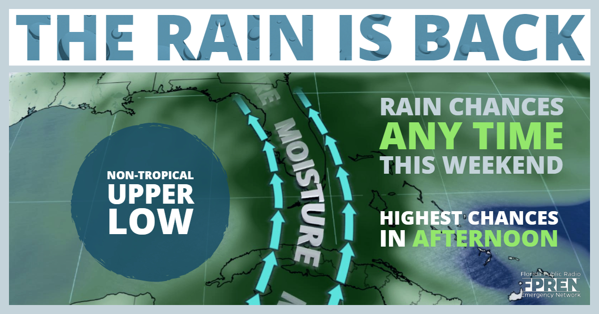
The rain and thunder will follow a different pattern than what is typical from just the sea breezes this time of year. A meteorological feature called a “TUTT” (which stands for tropical upper tropospheric trough) is moving westward from the Bahamas and on track to reach the Gulf of Mexico by Saturday . As the “TUTT” passes Florida, southerly winds will transport copious tropical moisture northward from the Caribbean. Added energy and spin from the TUTT could also contribute to an environment favorable for pockets of stronger thunderstorm activity, such as what occurred near Fort Myers on Friday.
Prior to the approach of the TUTT, a strong area of high pressure had suppressed thunderstorms across the state earlier in the week. Data from rain gauges and Doppler radar indicate that nearly the entire state of Florida has experienced below average rain between June 21 and June 28. In some cases, there has been no rain at all near Gainesville, Ocala, Lakeland, and along the east coast in parts of Brevard and Indian River counties. Parts of Collier and mainland Monroe counties in Southwest Florida and Wakulla County in the Big Bend have been some of the few areas to deviate from the otherwise dry period.
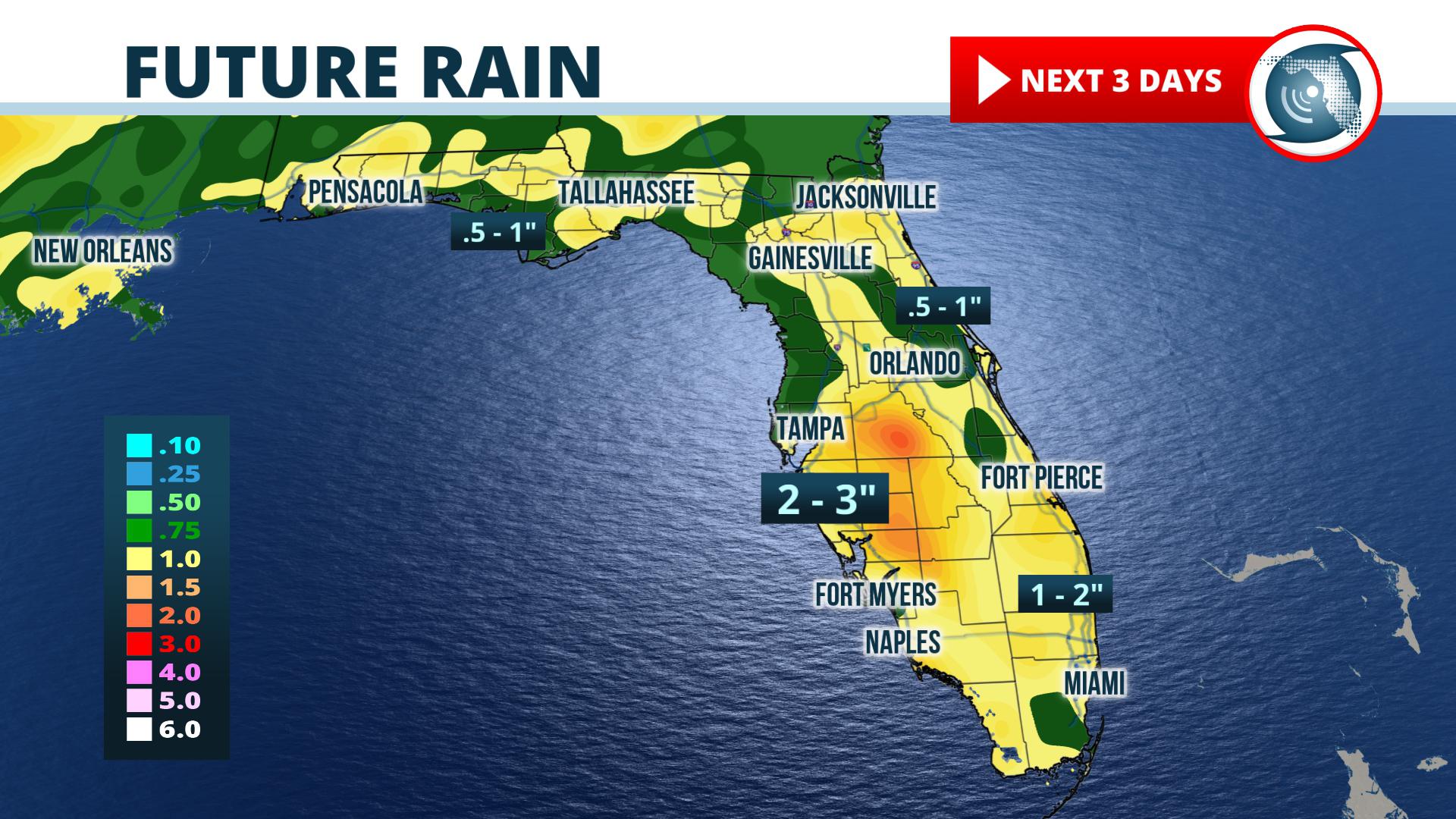
The greatest effects from the passage of the “TUTT” are expected over the Florida Peninsula. NOAA’s Weather Prediction Center forecasts widespread 1 to 3“ rainfall totals between Friday afternoon and Monday morning. Scattered thunderstorms are also forecast for the Big Bend and Panhandle, where rainfall totals of one-quarter to one-half inch are expected. As is often the case, localized heavier downpours may drop more rain in a few neighborhoods.
The weather pattern across Florida is forecast to change again early next week. The “TUTT” is expected to move westward into Texas. In its place, another strong area of high pressure is forecast to strengthen in the eastern Gulf of Mexico and Florida. If this pattern develops as forecast, the number of thunderstorms over the state will decrease again headed around the 4th of July holiday and temperatures will once again trend above average.
Meteorologist Jeff Huffman and Forecaster Kyle Kipple contributed to this report.


