The Tropical Atlantic Ocean has been quiet, and there are no signs of significant trouble anytime soon.
Meteorologists from the Florida Public Radio Emergency Network will publish an update on the state of the hurricane season on or around the 1st and 15th of each month. This will include scientific explanations on current oceanic and atmospheric conditions, and how they may play a role in the forecast for tropical cyclone activity over the subsequent two weeks. These stories are not meant to replace any forecasts for ongoing tropical activity or potential hazardous weather that may affect Florida in the near future.
Water temperatures might be favorable for tropical development in some areas, but other conditions such as wind shear and dry, dusty air are likely to prevent tropical storms or hurricanes from developing during the first two weeks of July. In this “State of the Season” update, we will provide an overview of those conditions and trends we are watching that could influence the long range forecast in the tropics.
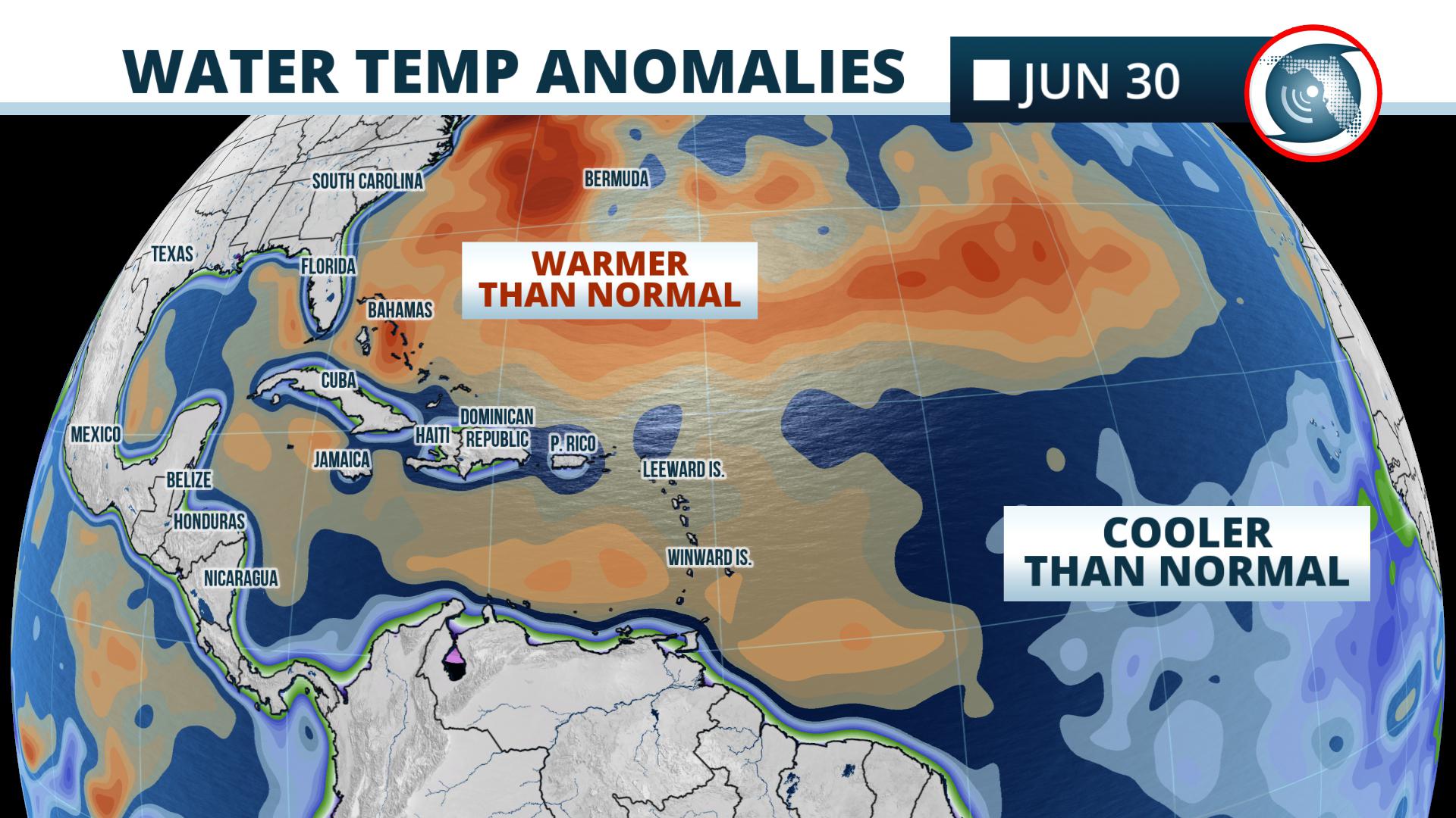
The waters are still too cool in locations where hurricanes commonly form later in the season, such as the central Atlantic Ocean and Caribbean Sea. However, above normal sea surface temperatures continue across the eastern Gulf of Mexico and nearby waters of the western Atlantic.
This would make tropical cyclone development possible close to the mainland United States if the other ingredients were present. But they are not.
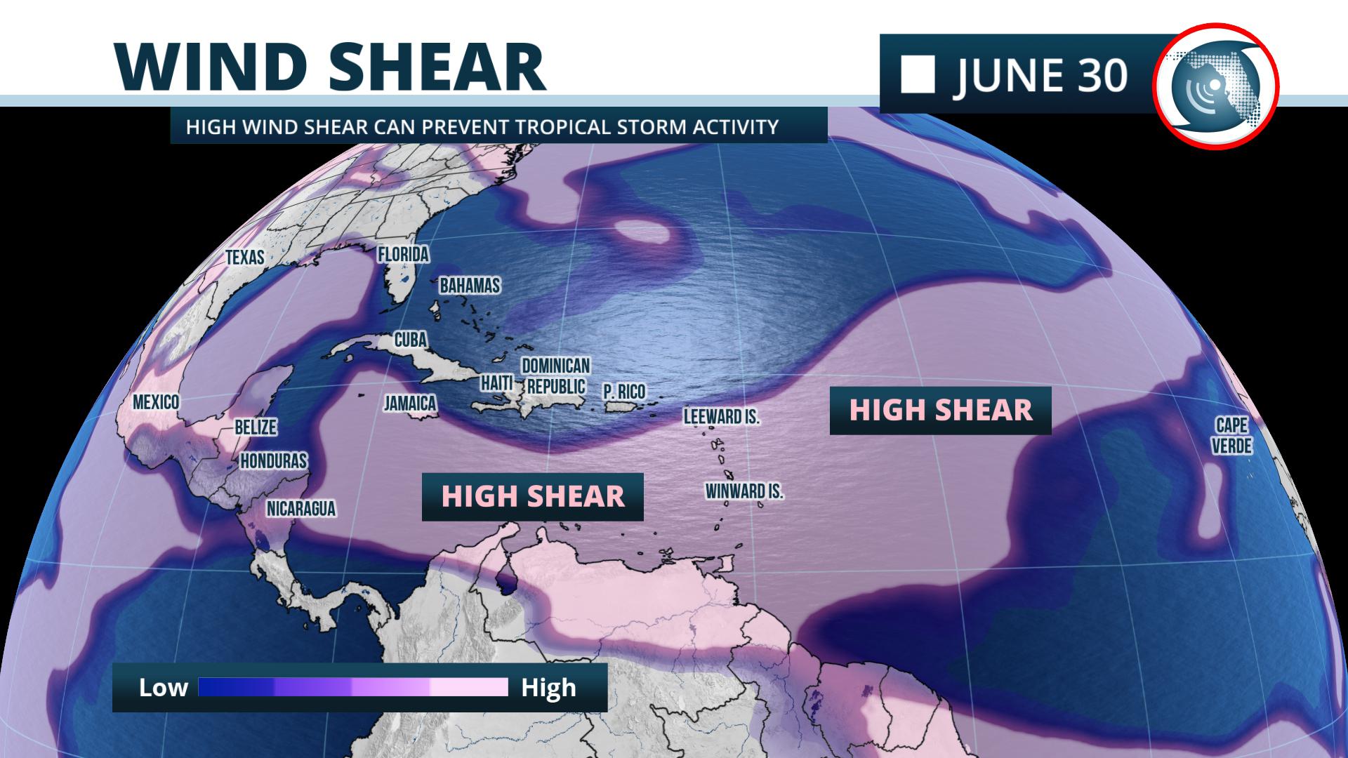
Upper-level westerly winds are strong across a large swath of the Atlantic Basin, which creates high wind shear and makes it nearly impossible for a tropical entity to develop. This is not uncommon in July.
On occasion, the leftover energy and moisture from weather systems in the mid-latitude westerlies can produce thunderstorms that lead to the formation of tropical storms in the Gulf of Mexico or western Atlantic Ocean in July. However, that is not currently expected based on available short-term forecast data.
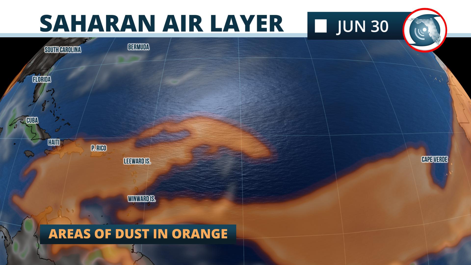
A phenomenon known as the “SAL” (Saharan Air Layer) is dust that forms on the African continent that is lofted into the middle parts of the atmosphere and is pushed westward across the Atlantic Ocean. According to NOAA, “the SAL can have a significant negative impact on tropical cyclone intensity and formation.”
A plume of dust moved across the Atlantic into Florida and the Gulf of Mexico during the last week of June. Satellite data from the University of Wisconsin’s Cooperative Institute for Meteorological Satellite Studies (CIMSS) is showing another large plume of Saharan dust moving off of west Africa. Global models forecast this dust plume to move into the Caribbean and possibly the Gulf of Mexico during the first week of July. Should the models verify, tropical storm activity would not be favored in this dry, dusty air.
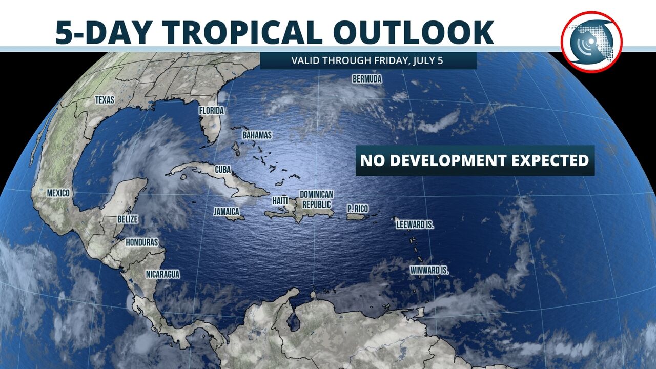
Forecasters at the National Hurricane Center do not expect tropical storm formation over the next five days, and NOAA's global outlook indicates no tropical cyclone formation is likely over the next two weeks.
Larger-scale climatological factors can play a role in tropical cyclone activity over longer periods of time, and these data can offer clues as to how active the next few weeks may (or may not) be.
NOAA's Climate Prediction Center says a weak El Niño is likely to persist this summer, but there is uncertainty on how long it may last. An El Niño is a natural warming of water in the equatorial Pacific Ocean, and it normally produces wind shear that reduces the number of tropical storms in the Atlantic Ocean.
Another climate factor, known as the Madden-Julian Oscillation (MJO, for short), modulates rainfall and thunderstorms in the tropics across the globe. The MJO signal is currently weak and the global models are suggesting its future state is uncertain. Odds are slightly favoring a stronger MJO signal over Africa or the Indian Ocean in early July. Sometimes, this signal can enhance tropical disturbances over the Deep Tropical Atlantic, but the water temperatures there are below average. The longer-range global models are not currently forecasting tropical cyclone activity in the Atlantic Ocean. All of these factors are stacked against tropical storm and hurricane development in the coming weeks.
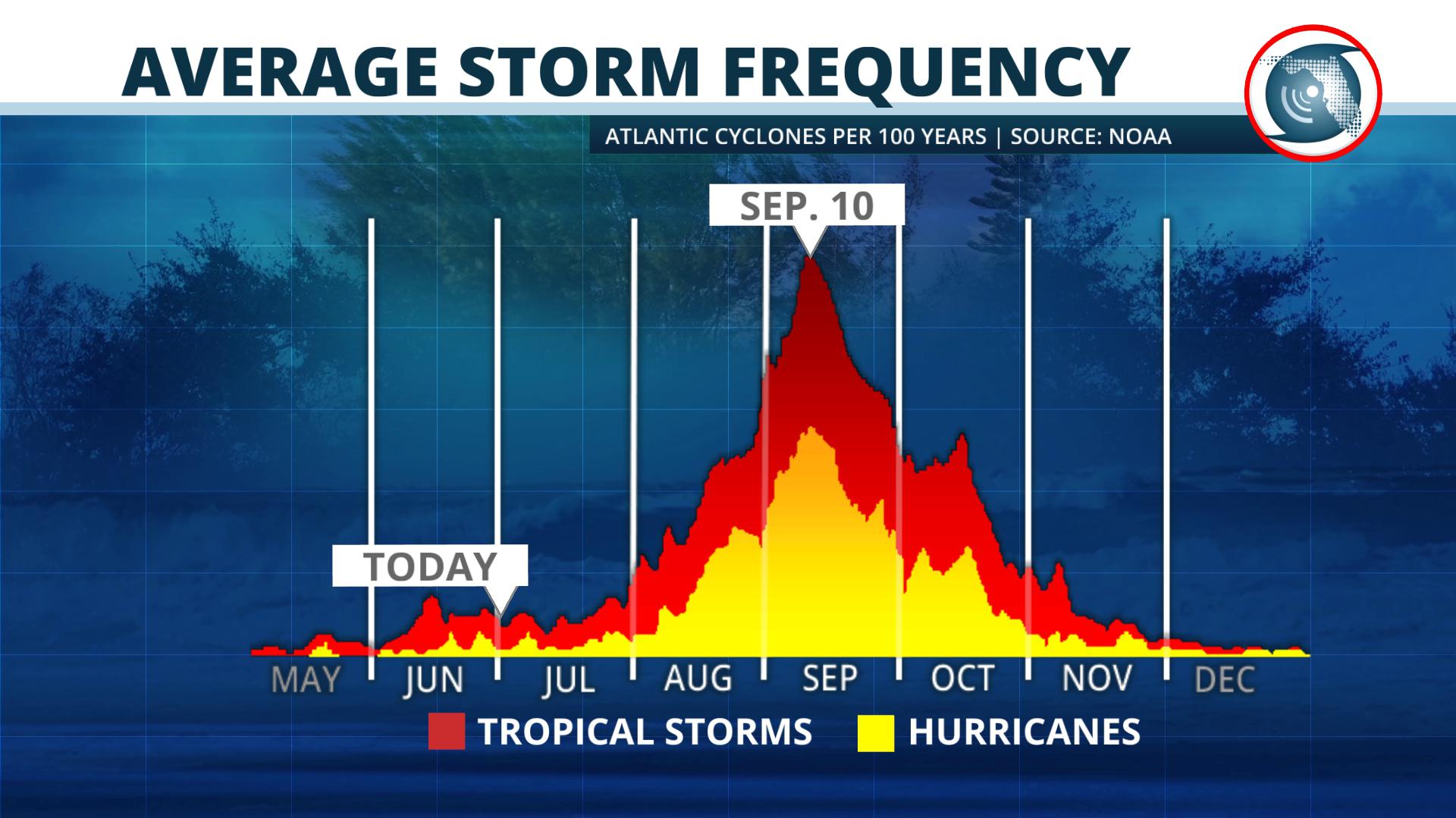
As the peak of the season approaches in August, September and October, the Climate Prediction Center says there are reduced chances of the El Niño lasting into the fall. What happens with El Niño, the MJO, and other factors like the West African Monsoon (where many tropical disturbances are born) will ultimately have a say on how active the hurricane season becomes.
It's too early to tell for sure how each of these factors will contribute, but climatology alone suggests more tropical activity is likely into the fall months of August, September and October.
Meteorologist Jeff Huffman contributed to this report.


