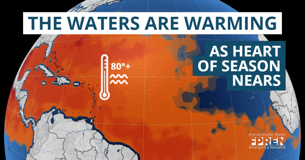
The heart of hurricane season is approaching, and the atmosphere is signaling that the Atlantic Basin could soon become more active.
No development is expected over the next week to ten days. However, later this summer and fall, global-scale climate factors are changing. And this could make conditions more favorable for tropical storm or hurricane development.
Forecasters examine many features when forecasting for the tropics. They include: wind shear, water temperatures, atmospheric dust concentrations, moisture in the air, and global atmospheric circulations.
El Niño Fading
Cooler sea surface temperature anomalies in the Pacific, especially toward the eastern Pacific, have signaled that the El Niño is weakening. According to the Climate Prediction Center, model guidance suggests this trend will continue and El Niño could be in a neutral state as early as mid-August.
Typically, an El Niño in the eastern Pacific causes an increase in vertical wind shear in the western Atlantic Ocean and Caribbean Sea. The shear serves as an atmospheric “shredder” and keeps thunderstorm development unorganized, making it harder for hurricanes to form.
As the El Niño weakens, the vertical wind shear may also decrease. This makes it more likely for thunderstorms to organize into tropical storms or hurricanes.
Saharan Air Layer
In order for a hurricane to organize, clusters of showers and thunderstorms must first be able to develop, and this is often called convection. The extent of these thunderstorms can be greatly impacted by the intensity of the Saharan Air Layer (SAL). The SAL is a mid-atmosphere of dusty air originating in Africa that blows west over the Atlantic Ocean. If the SAL is deep and expansive, it can impede convection. A thinner and less dense layer can have less of an impact on thunderstorm development.
Current forecast data suggests that areas of dense SAL layers will move across the Atlantic in the coming days, suggesting that convection may be limited at times.

Water Temperatures Vary
Convection necessary for hurricane development is not solely limited by the presence of dust : Warm sea surface temperatures (SST) must be present to facilitate upward motion and transfer of energy into the atmosphere. As a general rule, SSTs must be 80°F or higher to support thunderstorm organization and tropical cyclone intensification.
As of Tuesday, SSTs were in the middle 80s across the western Atlantic, but only in the upper 70s to the east (closer to Africa) in the area known as the Main Development Region (MDR). The MDR is where the majority of tropical cyclone activity develops during the months of August and September of a traditional hurricane season.
Current projections from the climate models suggest the cooler waters in the deep tropics will warm to near or above average levels in the coming weeks. The warmer trend is common this time of year, but confidence on the degree to which it may occur has been low.
State of the Season Summary
The above data, in aggregate, indicate tropical activity may become more prominent in August. Climatology itself argues for more tropical storm and hurricane activity in the Atlantic Basin between August and October. The global signals mentioned above lend further credence to an uptick in activity during the typical peak months of the season. Just how active the peak months will be relative to normal will depend on factors that are difficult to predict more than a few weeks in advance.
Meteorologist Ray Hawthorne contributed to this report.
