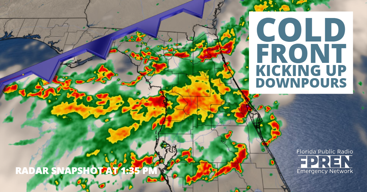
 Wednesday 1 pm Update: As of 1 pm the cold front extended through southeast Georgia into North Florida near Apalachicola. Highest rainfall totals are still expected along the Nature Coast, just south of the front.
A small pocket of drier air is expected to move in tonight, giving the region a brief break from the wet weather. More rounds of heavy rain are expected during the day on Thursday, especially toward North Central Florida. Widespread cloud cover and rain will limit the chance for severe weather, however localized flooding is a potential threat.
The National Hurricane Center continues to watch a broad area of clouds and showers over the northwest Gulf of Mexico near the frontal boundary. An area of low pressure is expected to form along the boundary with a 20% chance of tropical development in the next five days.
The same front that denied Tropical Depression Three access to South Florida could be a bit of a trouble-maker further north.
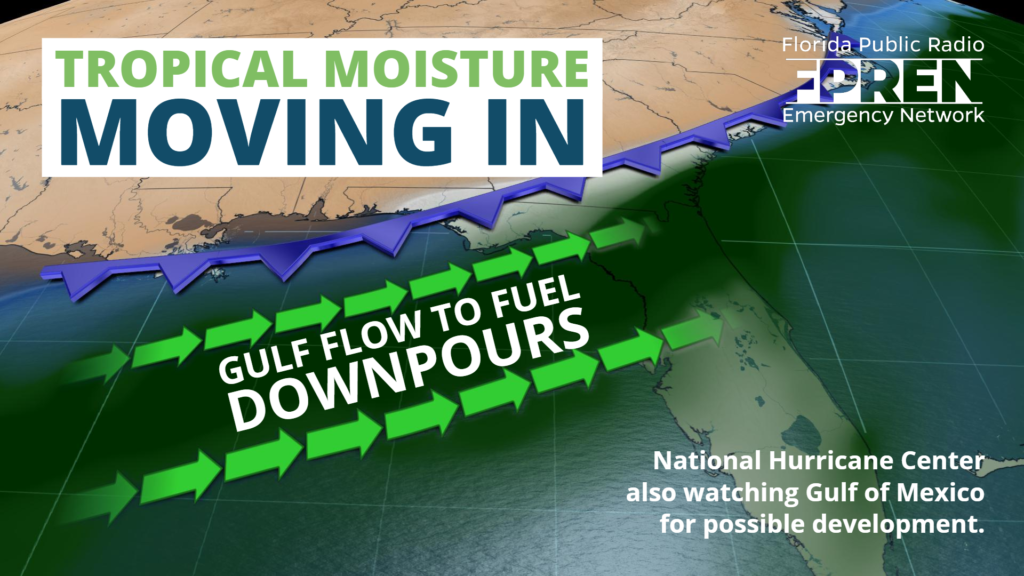
The front is expected to stall over the northern Gulf of Mexico, where an an area of low pressure may form along it. This will likely produce multiple rounds of rain - some of it heavy - across portions of the Florida Panhandle and North Florida over the next three days.
Occasionally, a stalled front in July can spur tropical development. The National Hurricane Center says a non-tropical low could form late Wednesday or Thursday along the front, and that it would have a “low chance” of becoming tropical or subtropical this weekend. At this time, reliable global forecast models do not lead us to believe significant tropical development will occur, but residents near the Gulf Coast should be aware that sometimes tropical systems can form in these situations.
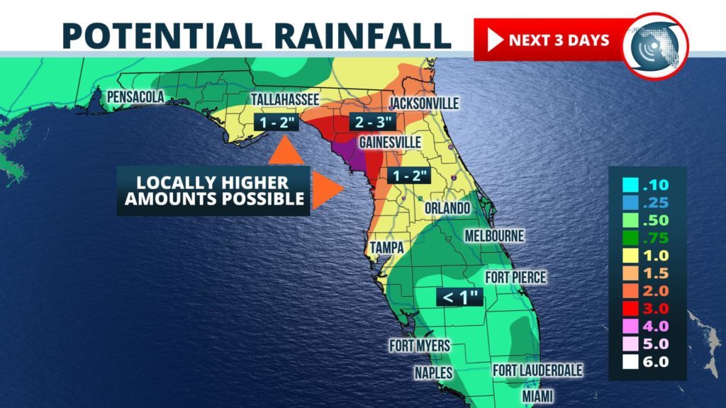
While chances are slim that a tropical storm will develop from this weather system, the probability of heavy rain is high regardless. Forecasters at NOAA’s Weather Prediction Center say there is even a risk of “excessive rainfall” across the region, where pockets of flash flooding are possible, but with uncertainty in the exact location of occurrence. The risk area covers the Jacksonville and Gainesville metropolitan areas and extends to near Tallahassee on the western edge.
Widespread rainfall amounts of 1 to 3 inches are possible in the areas mentioned at risk, with the potential of up to four inches to fall by Friday in a few locations near the Nature coast. Farther west, near cities such as Tallahassee and Panama City, 1 to 2 inches of rain is expected from this system. Similar numbers may also be realized in Central Florida, from Tampa to Orlando.
Southeast and east-central sections of Florida, including the cities of Miami, West Palm and Fort Pierce, are not expected to receive heavy rainfall associated with this system. The typical afternoon scattered thunderstorms may develop, but near-normal amounts of rain are expected in these areas through the weekend.


