Meteorologists at the Florida Public Radio Emergency Network are closely watching a tropical wave in the southeastern Caribbean Sea that, according to the National Hurricane Center, has a low chance of developing into a tropical depression or storm over the next five days.
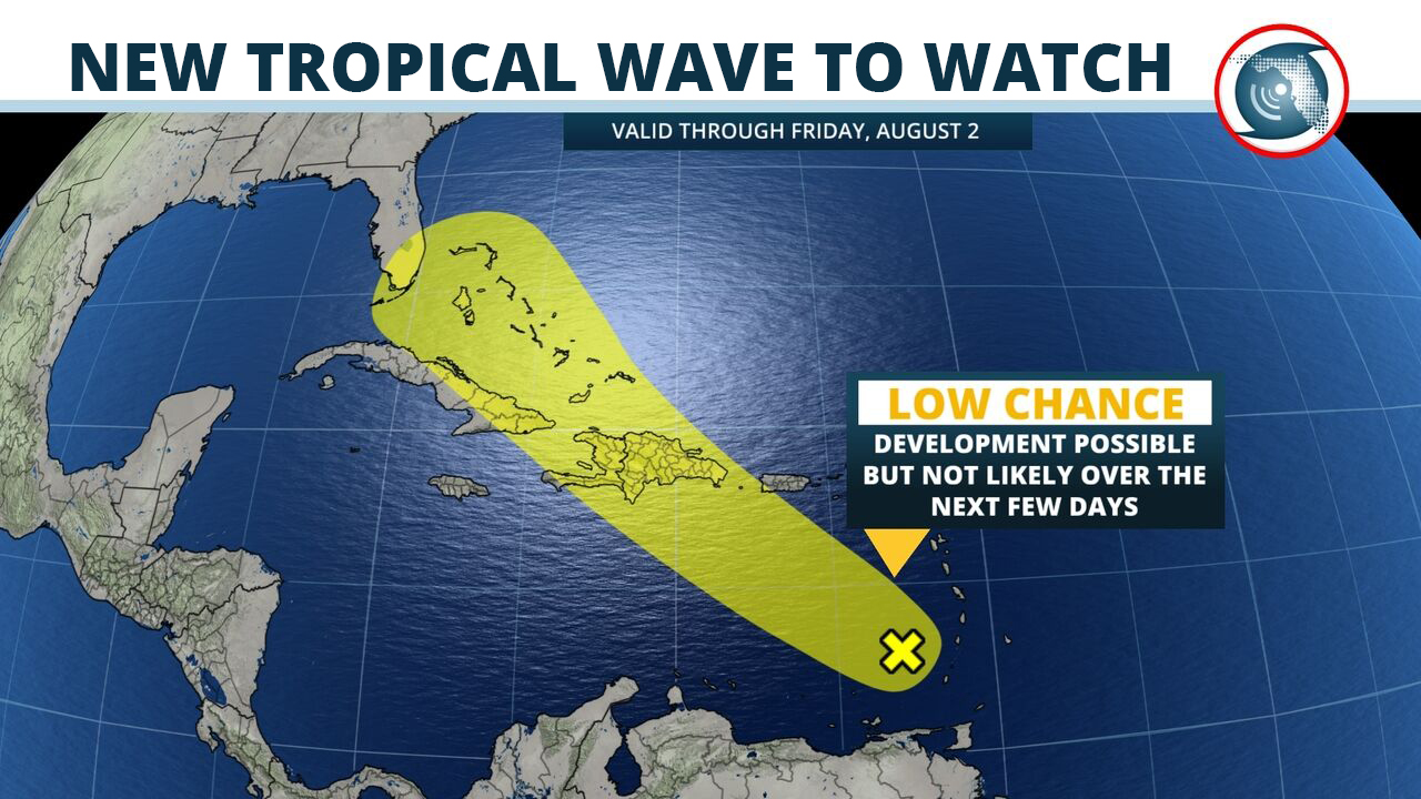
An area of disorganized thunderstorms near the disturbance were noted on satellite data west of the Lesser Antilles Sunday afternoon, moving west-northwestward at 15 mph. The system is expected to turn northwest and move toward Puerto Rico, the Dominican Republic, and Haiti by midweek, where it then has the potential to become better organized. At the present time, it is unclear whether the tropical wave would move close enough to Florida to produce unsettled or hazardous weather in the Sunshine State. Forecast data presently suggests the chances of this happening are very low.
In the near term, however, normal late-summer weather is expected across most of Florida. An area of high pressure and drier air is expected to nose in from the northeast Monday, resulting in fewer afternoon showers and thunderstorms across the northern half of the state through Wednesday. Winds are then expected to turn out of the southwest, coming from the Gulf of Mexico, which will send rain chances back up Thursday and Friday. Over the southern half of the peninsula, the typical afternoon sea breeze thunderstorms are expected each day this week across mostly inland areas.
Meteorologist Megan Borowski contributed to this story.


